Mountain wave clouds over Alberta and Montana
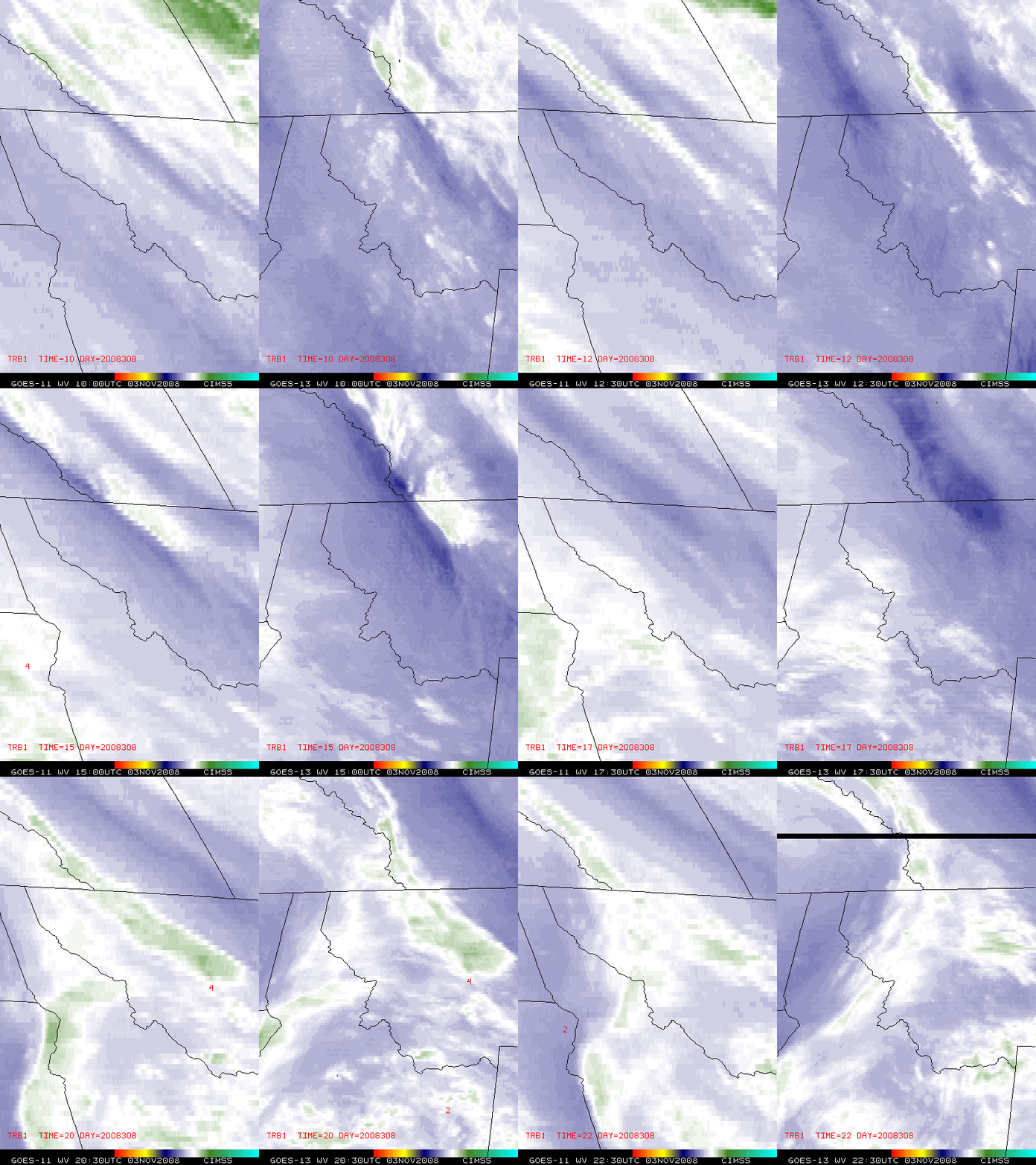
GOES-11 6.7 µm and GOES-13 6.5 µm “water vapor channel” images (above) showed the formation of mountain wave clouds over parts of southern Alberta and western Montana on 03 November 2008. Note how the mountain wave clouds — which formed immediately downwind of the highest terrain of the Rocky Mountains – dissipated as pockets of drier air aloft (darker blue enhanced areas) passed through the region. Not long after the initial area of mountain wave clouds disappeared, a second patch of mountain wave clouds formed very quickly over western Montana around 18:00 UTC (11 am local time); there were 3 reports of moderate (intensity level 4) turbulence in the general vicinity of that mountain wave cloud. While these features could certainly be followed adequately using the 8-km resolution GOES-11 water vapor imagery, they appeared much clearer on the 4-km resolution GOES-13 water vapor imagery (also aided by the more direct satellite viewing angle of GOES-13, which was positioned at 105º W longitude).
AWIPS images of the MODIS visible channel, 11.0 µm IR window channel, 3.7 µm shortwave IR channel, Cloud Top Temperature product, and Cloud Phase product (below) were useful to further characterize the mountain wave cloud shortly after its formation over western Montana. The cloud top temperatures appeared to be quite low (as cold as -52º C on the IR window channel data, and as cold as -52.8º C on the Cloud Top Temperature product), and the Cloud Phase product classified the feature as an ice cloud (salmon-colored enhancement). However, note the rather warm brightness temperatures on the 3.7 µm shortwave IR image: cloud top temperatures were in the +5 to +10º C range. These warmer brightness temperatures were due to reflection of solar radiation by the rather small ice crystals (having diameters which were likely in the 50-60 micrometer range) that made up the mountain wave cloud. The larger patch of cirrus clouds located farther to the west (over the Idaho/Montana border region) exhibited significantly colder 3.7 µm brightness temperatures (close to -20º C), since the typical larger (around 100 micrometers or greater in diameter) cirrus ice crystals are not efficient scatterers of light.
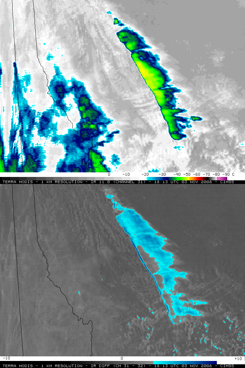
Further confirmation of the small ice crystal particle sizes within the mountain wave cloud is seen by examining the MODIS 11.0-12.0 µm (channel 31-32) IR difference product (below). IR difference values were in the 3-5º K range (cyan to blue color enhancement) over a good deal of the mountain wave cloud feature — but IR difference values over the cirrus clouds found farther to the west and southwest were negligible. Of particular interest was the thin filament of even higher IR difference values (7-8º K, darker blue color enhancement) seen along the leading (western) edge of the mountain wave cloud.
A MODIS IR window image about 90 minutes later (below) indicated that the mountain wave cloud had grown in size somewhat, with the coldest cloud top brightness temperature at -53º C (placing the cloud top at about the 32,300 foot level, not far below the tropopause according to the Great Falls, Montana rawinsonde report). There was one aircraft report of moderate turbulence (intensity level 4) at an altitude of 33,000 feet (close to the southern portion of the mountain wave cloud) near the time of the 19:56 MODIS IR image.


