Severe weather outbreak across the Southeast US
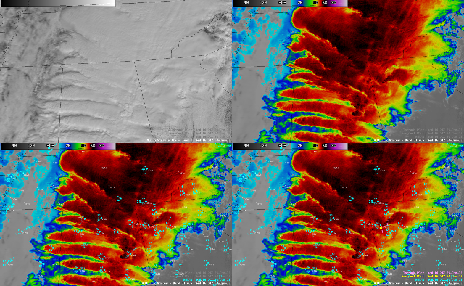
MODIS 0.65 µm visible channel and 11.0 µm IR channel images, with METAR surface reports and SPC storm reports
AWIPS images of 1-km resolution MODIS 0.65 µm visible channel and 11.0 µm InfraRed (IR) channel images with an overlay of METAR surface reports and SPC storm reports (above) displayed a number of distinct banded convective features across parts of the Southeast US at 16:04 UTC or 11:04 AM local time on 30 January 2013. This banded structure could also be seen on a sequence of 1-km resolution POES AVHRR visible and IR images. In northwestern Georgia, note the isolated convective feature that produced a cluster of tornado and damaging wind reports — one of these tornadoes (rated EF-3) was responsible for a fatality in Adairsville, Georgia (NWS Peachtree City GA event summary), which ended a record 220-day streak with no tornado fatalities in the US.
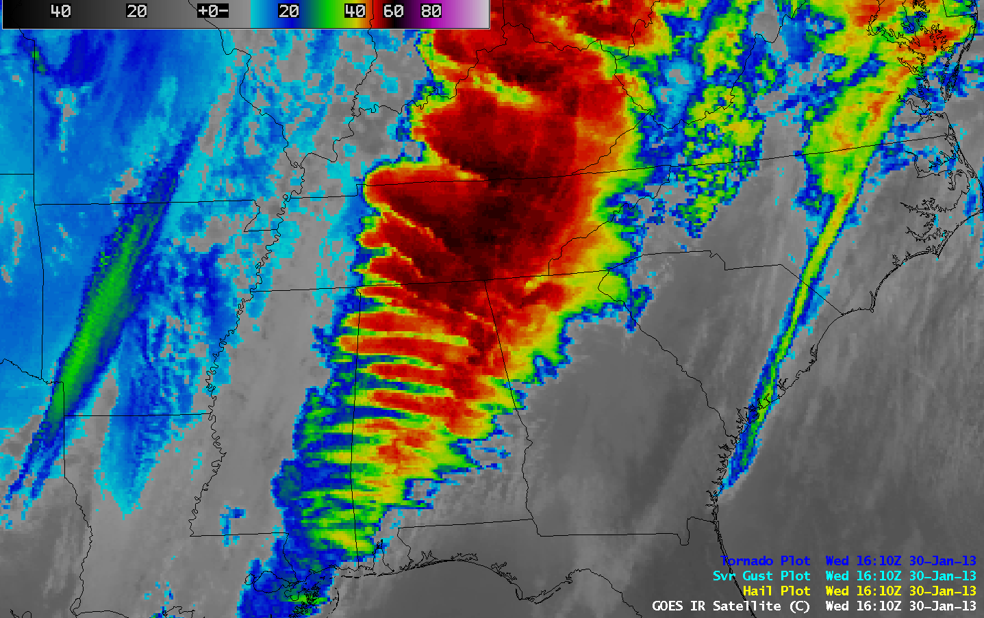
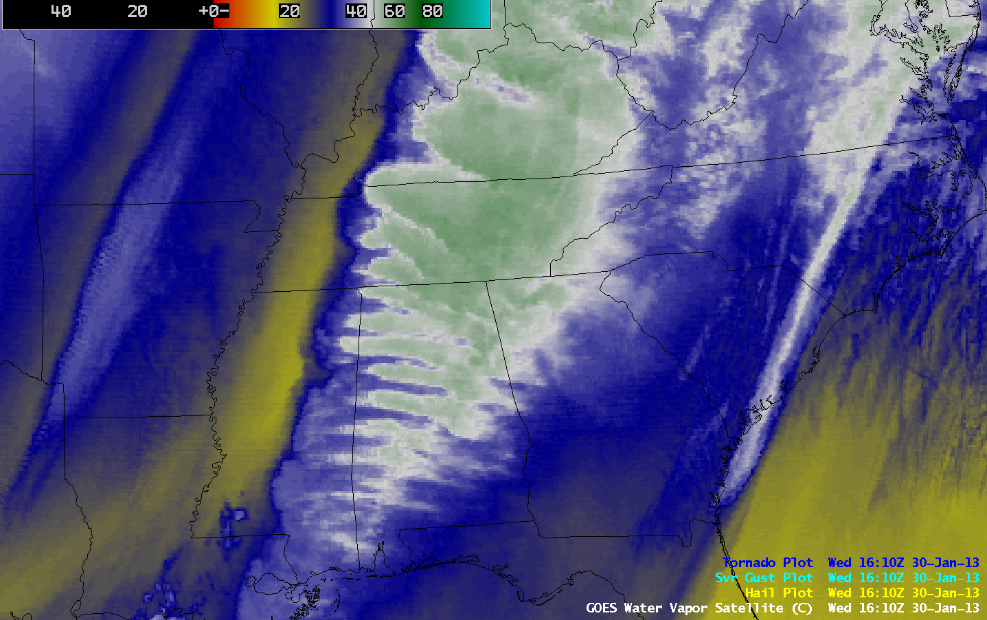
On 4-km resolution GOES-13 10.7 µm IR channel images (above; click image to play animation) and 6.5 µm water vapor channel images (below; click image to play animation) this banded structure was quite evient throughout the morning and afternoon hours within the warm conveyor belt of moisture that was helping to fuel the pre-frontal squall line that was producing widespred severe weather across the region.
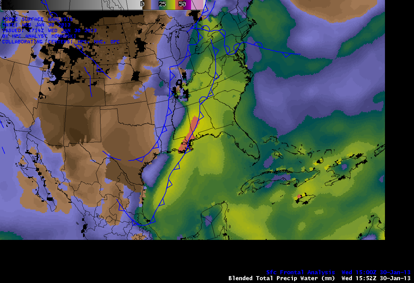
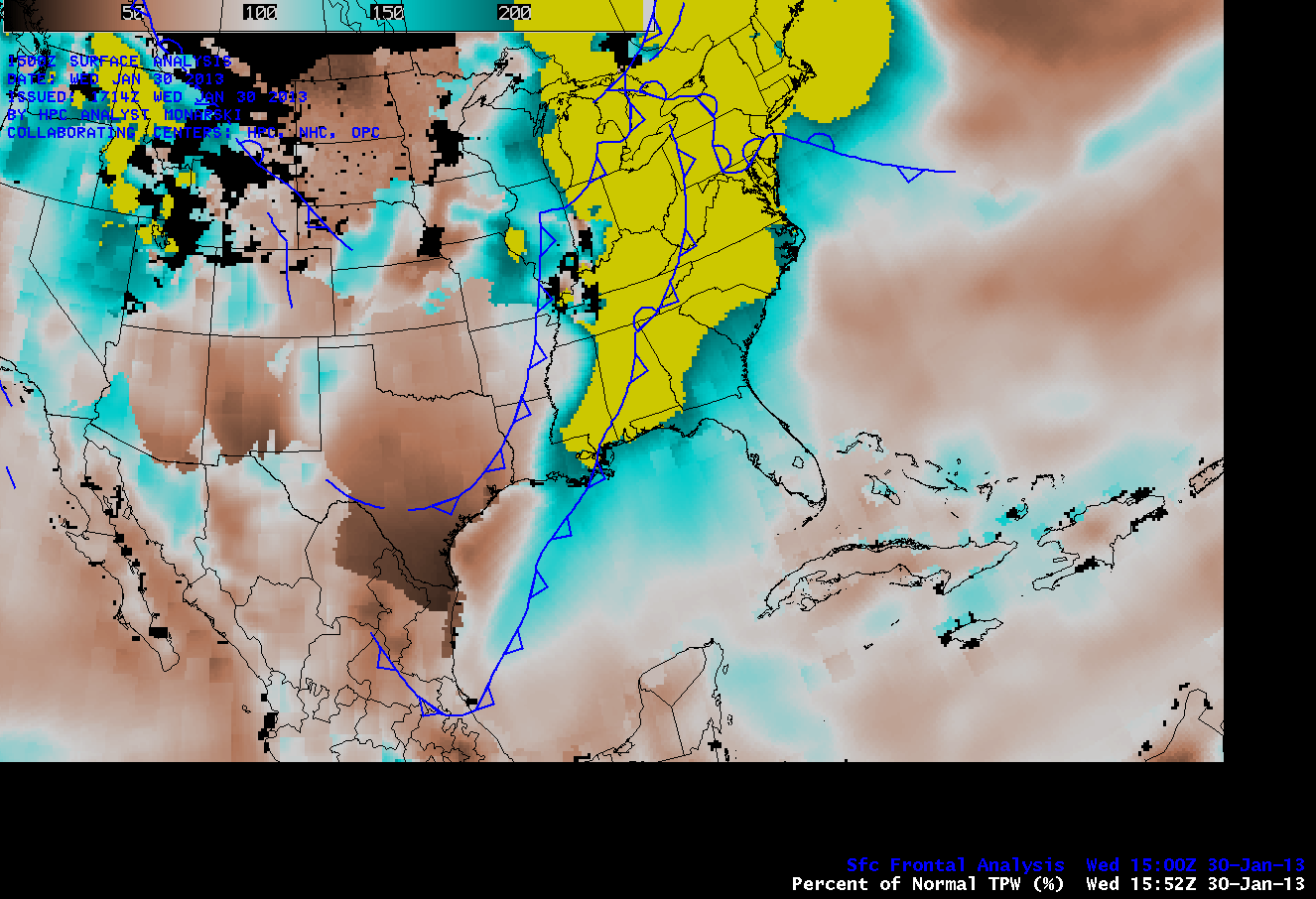
Large amounts of moisture were being transported northward from the Gulf of Mexico ahead of the advancing cold frontal boundary — Blended Total Precipitable Water (TPW) values were in the 30-40 mm or 1.2-1.6 inch range (above; animation), and these TPW values were in excess of 200% of normal for this region and this time of the year (below; animation).


