Bay-Effect Snow Showers over Virginia and North Carolina
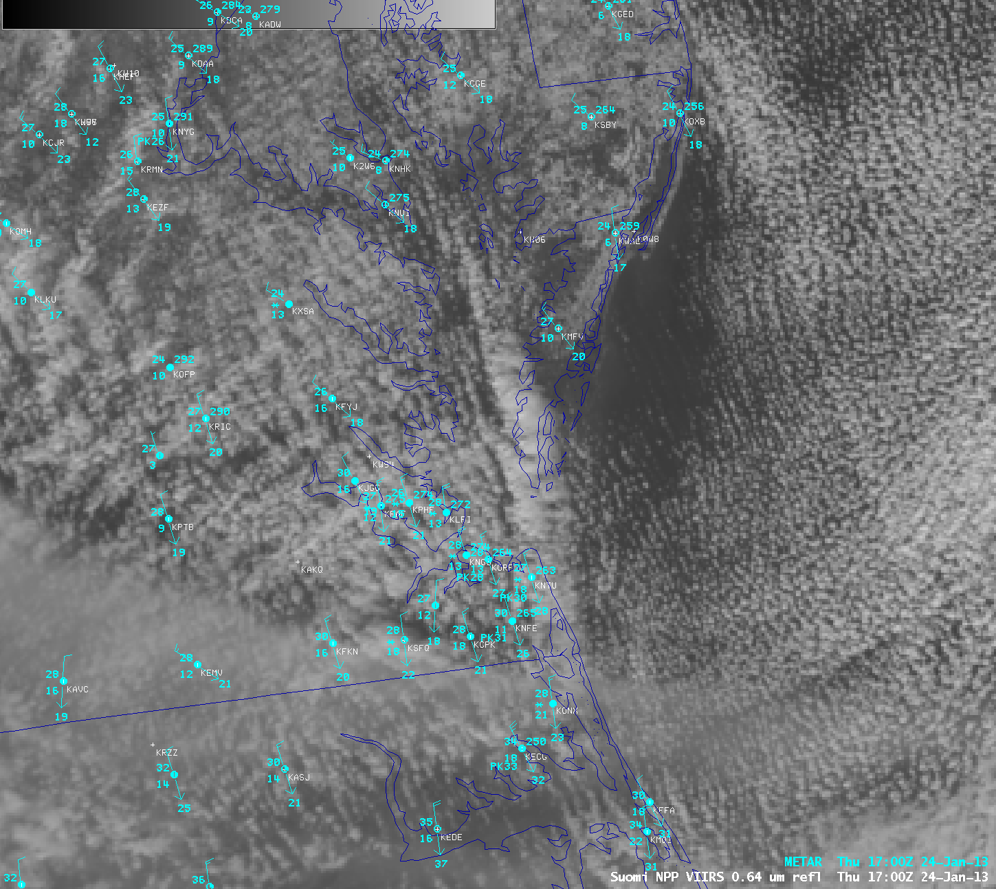
The Arctic airmass that has overspread the eastern two-thirds of the United States is cold enough that sustained northerly winds down the length of Chesapeake Bay yielded snow showers over extreme southeastern Virginia and northeastern North Carolina. The Suomi/NPP Visible image, above, shows a distinct cloud band over the eastern side of Chesapeake Bay that stretches southwards towards the Outer Banks of North Carolina. Snow was being reported at a number of stations across the Hampton Roads area in southeastern Virginia, with visibility being restricted to 2 miles at Oceana Naval Air Station (KNTU) — and snow was reported as far south as Currituck, North Carolina (KONX).
Bay-effect (or Lake-effect) snows typically occur when the temperature difference between the water surface and lower tropopshere (for example, 850 mb) exceeds about 13 to 15 C. The sounding from Roanoke, VA, from 1200 UTC on 24 January shows temperatures near -12 C at 850 mb. Sea-surface temperatures over the lower Bay are around 5 C. This animation of two MODIS visible images, from 1506 UTC and from 1640 UTC, shows the snow band shifting from the western shore to the eastern shore of the Bay. This event was also caught on radar.
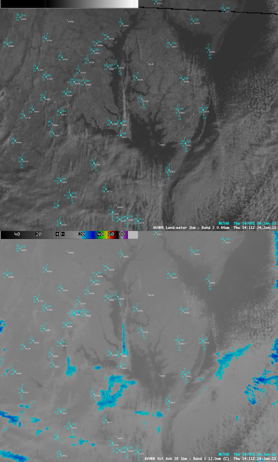
A comparison of 1-km resolution POES AVHRR 0.86 µm visible channel and 12.0 µm IR channel images at 14:11 UTC or 9:11 AM local time on the morning of 24 January 2013 (above) showed a prominent bay-effect cloud band as it was becoming well-organized over the northern portion of Chesapeake Bay. Cloud top IR brightness temperatures were as cold as -25.5 C (darker blue color enhancement), indicating that the cloud band was almost certainly glaciated. Note the observation of blowing snow (reducing visibility to 2 miles) at Patuxent River Naval Air Station (station identifier KHNK) near the southern end of the cloud band.
The development and movement of the bay-effect snow bands could be seen on 1-km resolution GOES-13 0.63 µm visible channel images (below; click image to play animation).
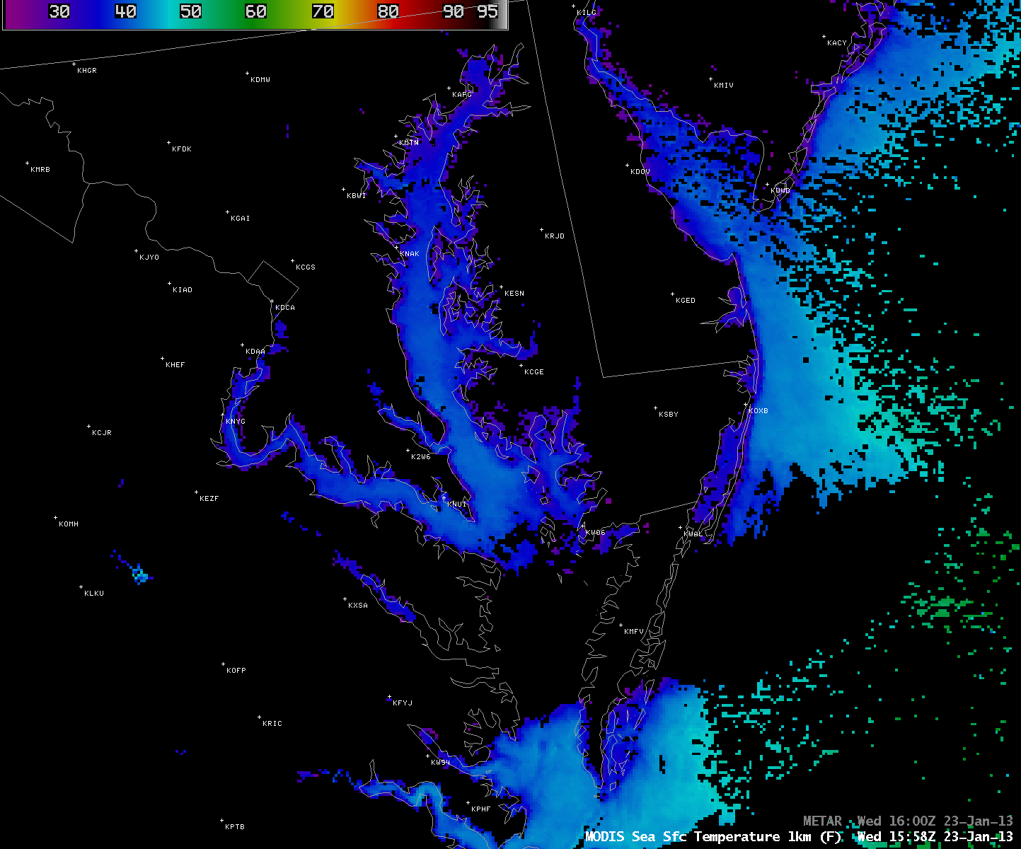
On the previous day, the 1-km resolution MODIS Sea Surface Temperature (SST) product (below) revealed SST values greater than 40 F or 4.4 C (lighter blue color enhancement) over the central and southern portions of Chesapeake Bay.


