Unusual pattern of cloud edge clearing
Hat tip to Chad Gravelle (CIMSS), who asked about the curious pattern of trailing edge cloud clearing across South Carolina on the morning of 28 November 2012. Given that the etiology of these elongated cloud clearing line features is unknown at this point, this case is a perfect candidate for the “What the heck is this?” blog category. An animation of GOES-13 0.63 µm visible channel images (above; click image to play animation) shows the unusual cloud edge clearing pattern moving southwestward across South Carolina.
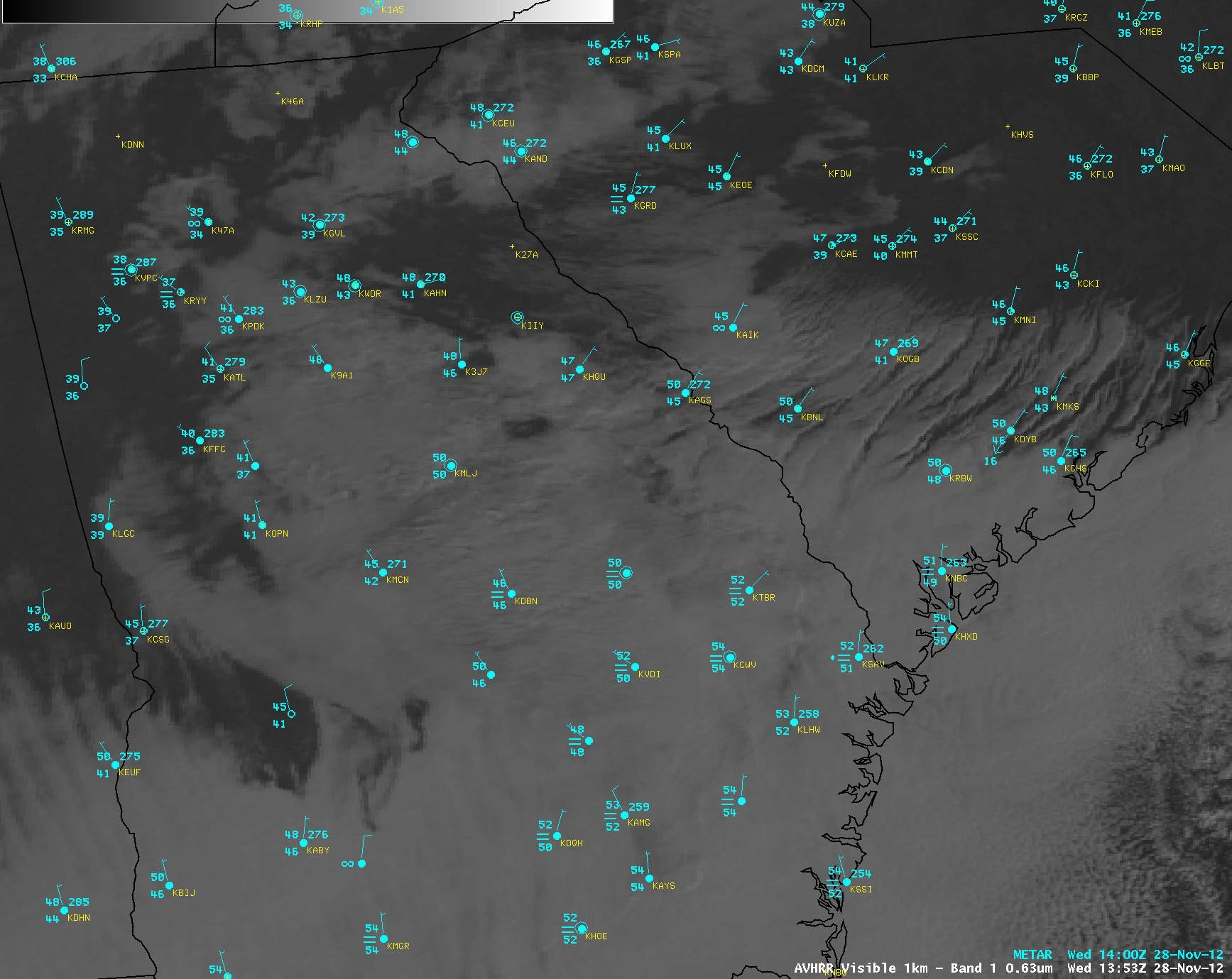
These cloud features were also seen on an AWIPS image of POES AVHRR 0.63 µm visible channel data at 13:53 UTC (below). Surface observations showed that air with drier dew point values was being advected southwestward into the trailing cloud edge, but the wind speeds were generally light at most reporting sites — so the cause of the elongated “clear slot” features is unclear.
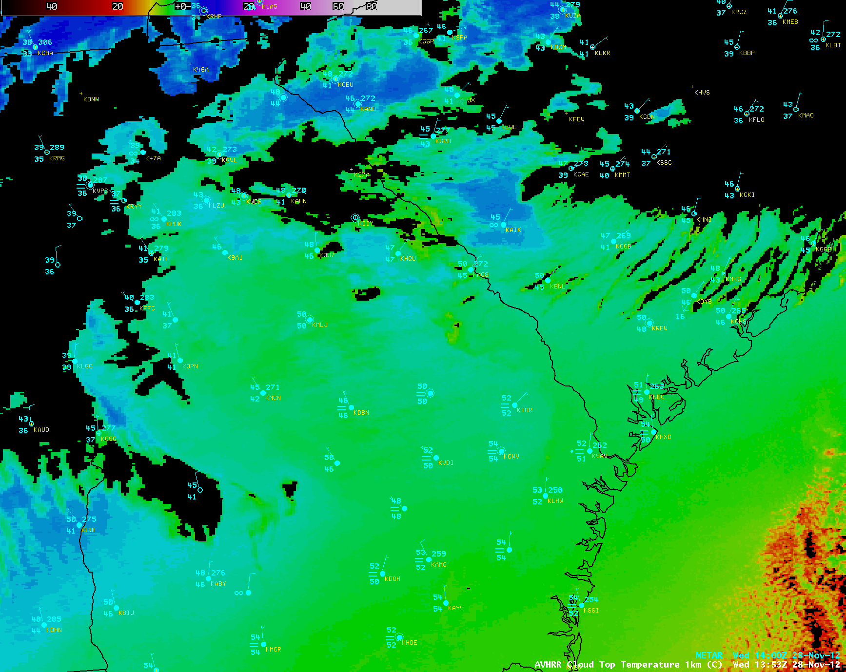
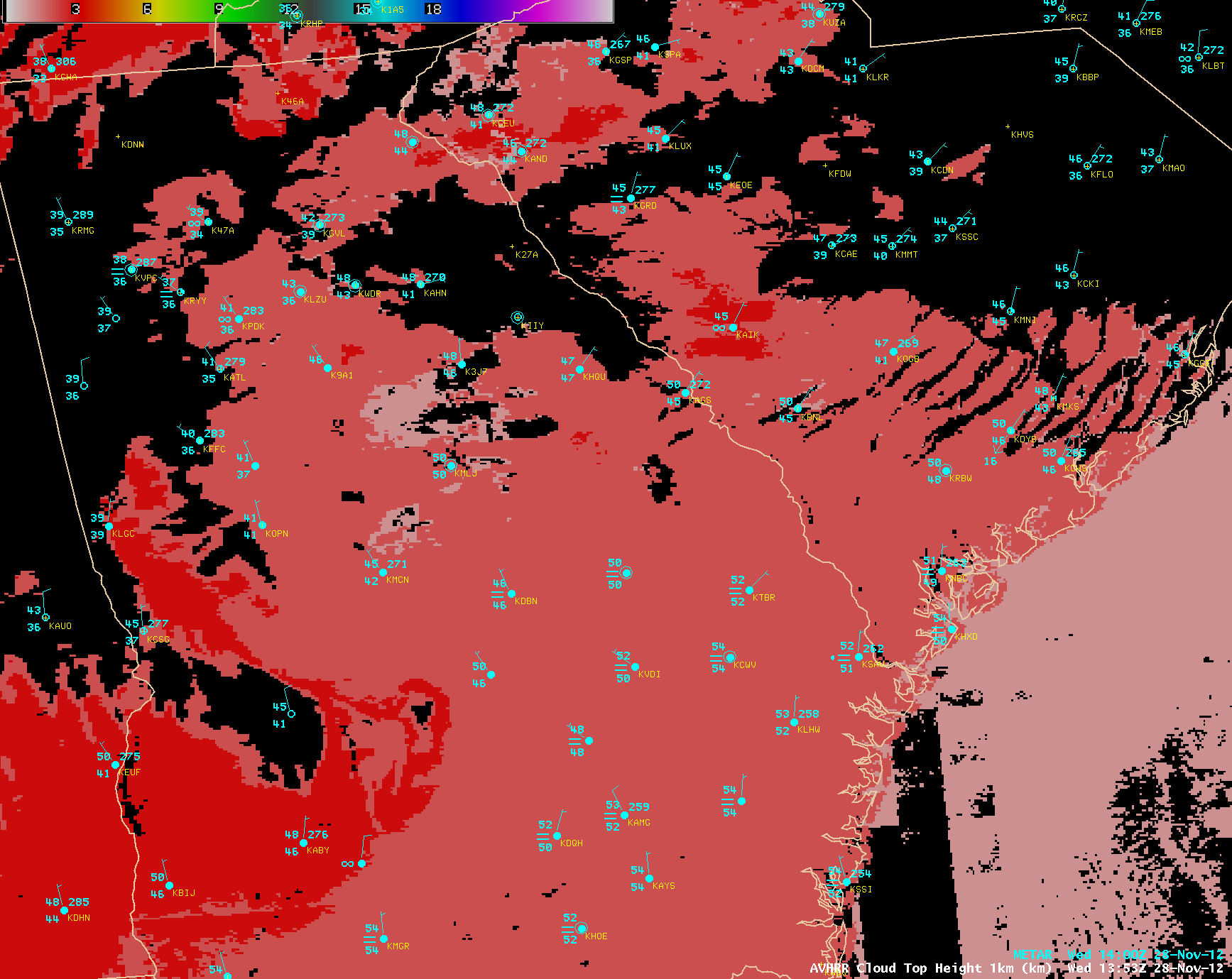
The three POES AVHRR products shown below indicated that these trailing edge cloud features were liquid water clouds, which exhibited cloud top temperature values of +1 to +3º C, with a cloud top height value of 2 km.
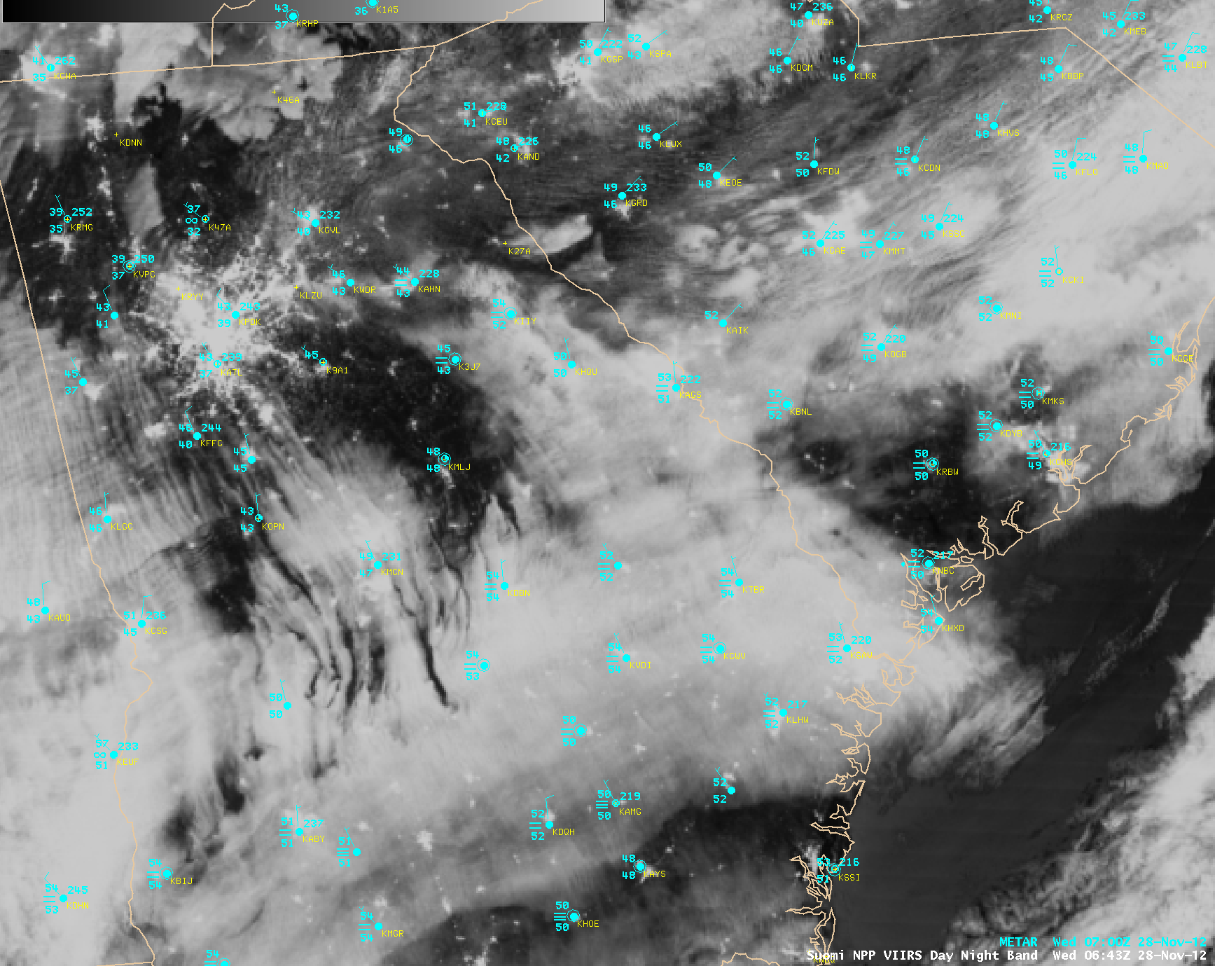
On the GOES-13 and POES AVHRR images, you can see some evidence of similar cloud edge clearing lines over the Alabama/Georgia border region. During the previous overnight hours, this cloud signature was very well-defined over Georgia, as seen on a Suomi NPP VIIRS 0.7 µm Day/Night Band “night-time visible image” at 06:43 UTC or 1:43 AM local time (below).


