Mountain waves in Colorado and New Mexico
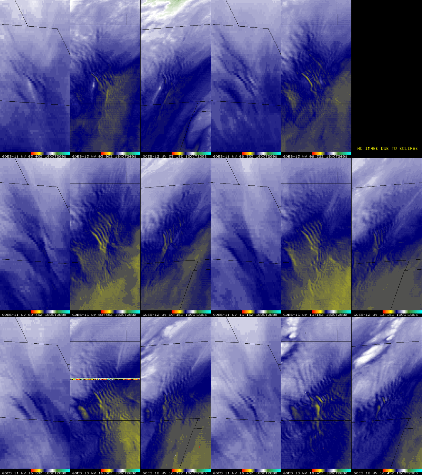
Strong southwesterly winds over the southern and central Rocky Mountains led to the development of mountain waves downwind of the higher terrain in Colorado and New Mexico on 10 October 2008. A distinct mountain wave signature was seen on 6.7 µm water vapor channel imagery from GOES-11 and 6.5 µm water vapor channel imagery from GOES-13 and GOES-12 (above). Note the improved appearance of the mountain waves on the 4-km resolution GOES-13 and GOES-12 imagery (compared to the 8-km resolution GOES-11 imagery). These mountain waves were also easier to identify and track using GOES-13, due to the more direct viewing angle of GOES-13 (positioned at 105º W longitude) and also the fact that GOES-13 was able to operate and supply imagery through the eclipse period (when the satellite was in the Earth’s shadow, and the solar panels could not supply power to the spacecraft).
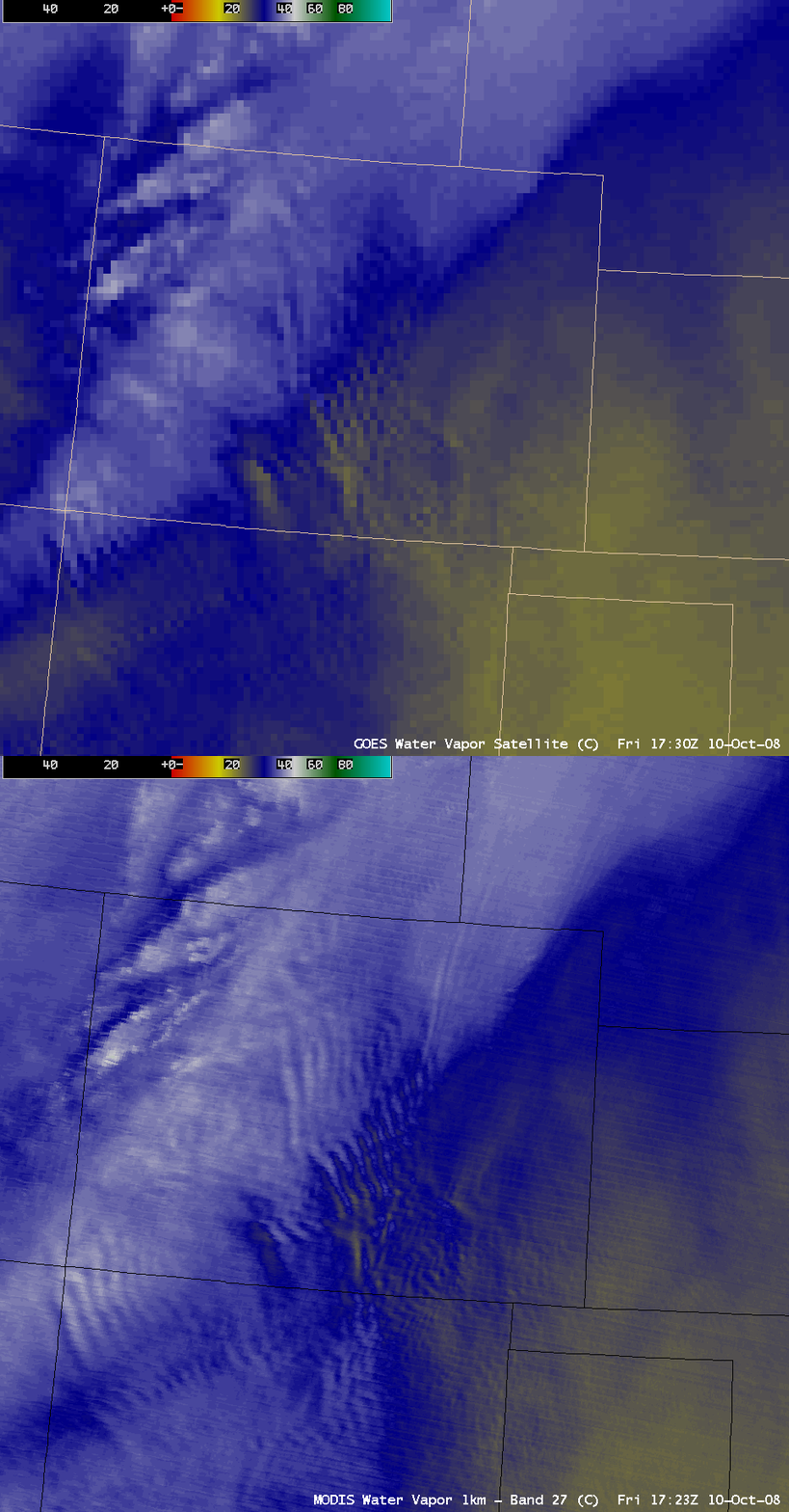
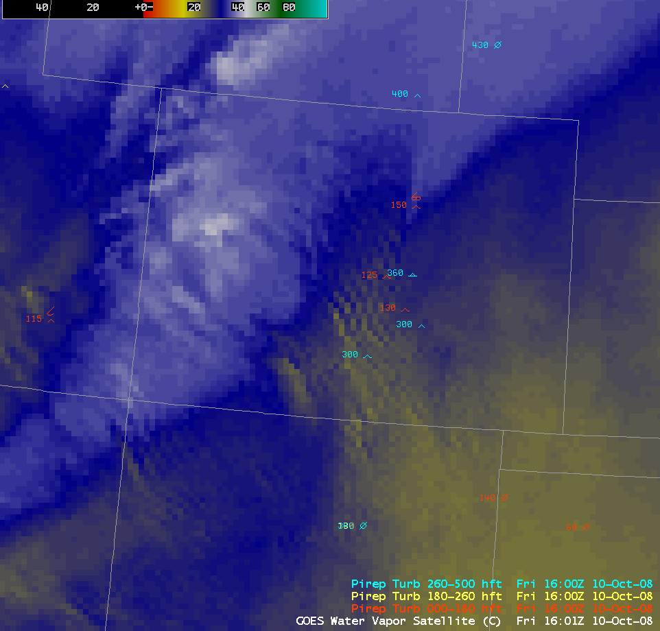
AWIPS images of the GOES-12 and MODIS water vapor channel data (above) showed further improvement in mountain wave identification using 1-km resolution data from MODIS. Mountain waves on water vapor imagery have long been recognized as a signature of potential clear air turbulence, and there were indeed a few pilot reports of light to moderate turbulence over eastern Colorado and New Mexico (below).


