River valley fog in the Northeast US
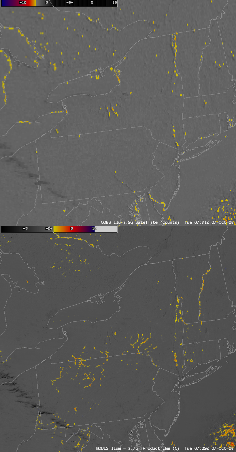
AWIPS images of the GOES-12 and MODIS fog/stratus product around 07:30 UTC or 3:30 AM local time  (above) told two very different stories regarding the formation of river valley fog across parts of the Northeast US on 07 October 2008. In general, there was a surprising amount of disagreement between to two images: the 4-km resolution GOES-12 fog/stratus product suggested that fog was forming over places like the Finger Lakes region of New York and the Lake Champlain region along the Vermont/New York border, while the 1-km resolution MODIS fog/stratus product indicated significant areas of river valley fog across parts of northern Pennsylvania into southern New York.
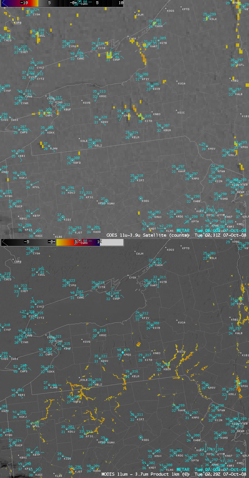
A closer view (below) helps to illustrate the problem of fog/stratus product verification — there was a lack of reporting stations in the actual areas where river valley fog was forming.
A 1-km resolution NOAA-15 AVHRR fog/stratus product (below) from a few hours later (11:10 UTC or 7:10 AM local time) indicated that the fingers of river valley fog across northern Pennsylvania and southern New York had increased in the hours leading up to sunrise.
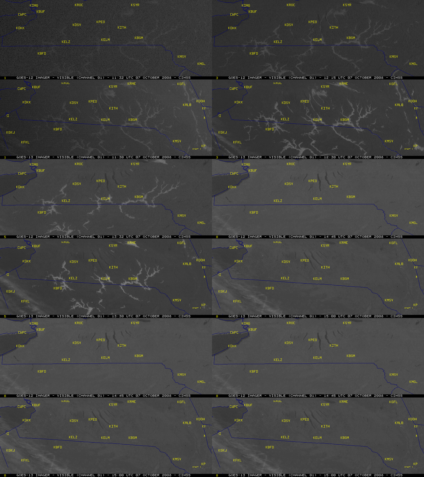
Post-sunrise GOES-12 and GOES-13 visible images (below) revealed the widespread coverage of river valley fog across the Pennsylvania/New York border region, which dissipated rather quickly by 15:00 UTC or 11 AM local time.


