GOES-15 Super Rapid Scan Operations (SRSO) imagery
The GOES-15 satellite was placed into Super Rapid Scan Operations (SRSO) mode on 17 May 2012, in support of the Deep Convective Clouds and Chemistry (DC3) field experiment. SRSO provides bursts of imagery at 1-minute intervals (compared to the standard operational 15-minute interval). McIDAS images of 1-km resolution GOES-15 0.63 µm visible channel data (above; click image to play animation) showed the development of widespread deep convection over Colorado and the adjacent states during the afternoon hours.
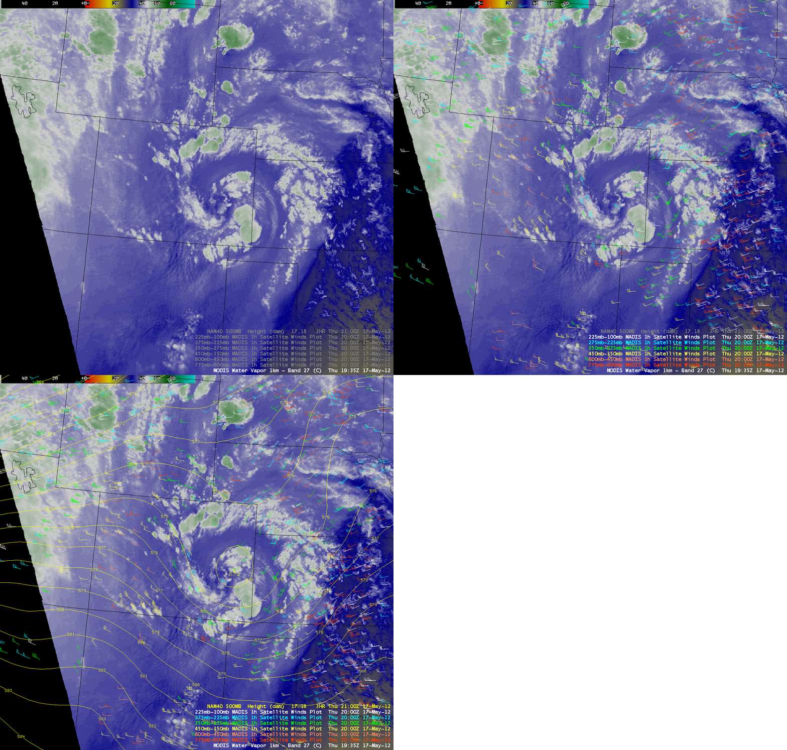
The cloud motions revealed the presence of a strong cyclonic circulation aloft over the region, which was verified by satellite-derived atmospheric motion vectors and NAM model 500 hPa heights plotted on an AWIPS image of MODIS 6.7 µm water vapor channel data at 19:35 UTC (below).
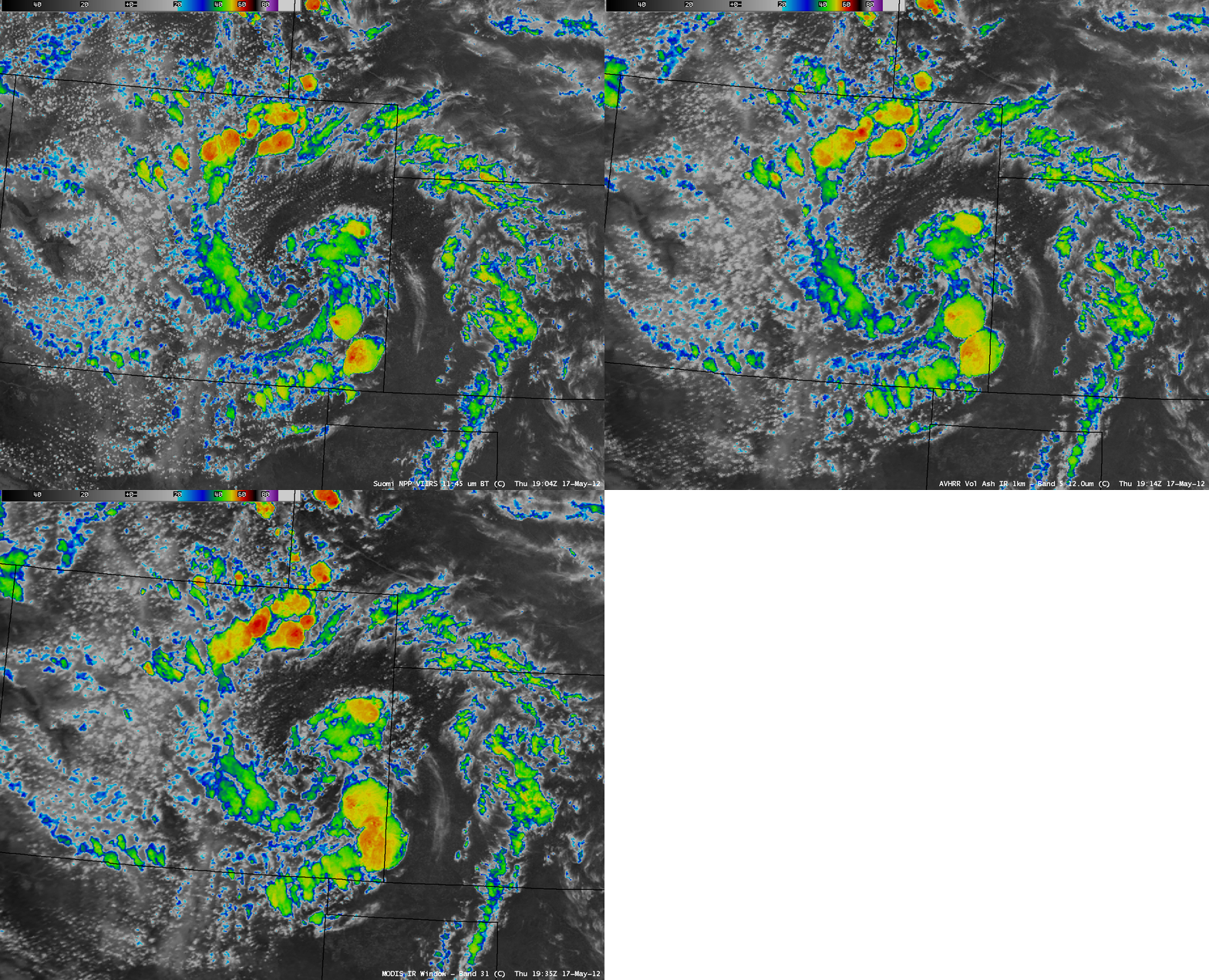
AWIPS images of 1-km resolution Suomi NPP VIIRS 11.45 µm, POES AVHRR 12.0 µm, and MODIS 11.0 µm IR channel data at 19:04, 19:14, and 19:35 UTC (below) revealed that cloud top IR brightness temperatures were as cold as -60 to -62 C (darker red color enhancement) with many of the stronger areas of convection.


