Undular bore over northeastern North Dakota and northwestern Minnesota
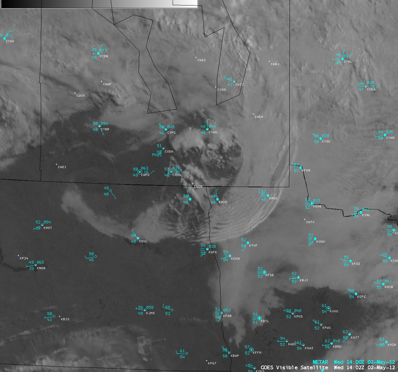
Surface outflow from dissipating convection over southern Manitoba, Canada during the pre-dawn hours on 02 May 2012 created an undular bore, which then propagated southeastward across northeastern North Dakota and northwestern Minnesota. AWIPS images of 4-km resolution GOES-13 10.7 µm IR channel data followed by 1-km resolution GOES-13 0.63 µm visible channel data after sunrise (above) showed the undular bore wave clouds. Surface winds associated with this convective outflow gusted to 30 knots in southern Manitoba at 12 UTC and 27 knots in northwestern Minnesota at 13 UTC.
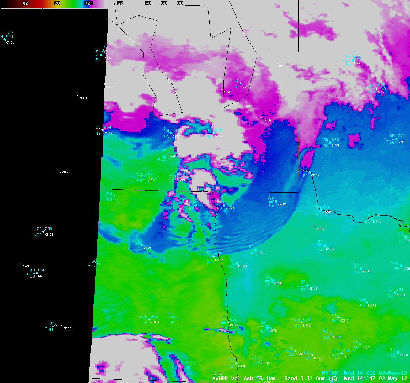
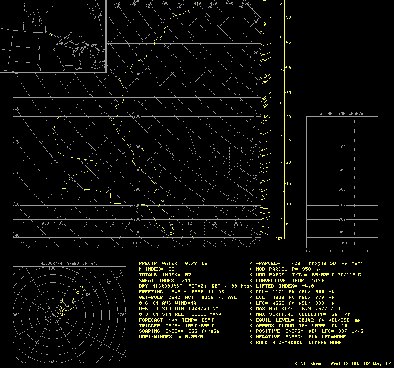
An AWIPS image of 1-km resolution POES AVHRR 12.0 µm data (above) indicated that the wave cloud top IR brightness temperature was in the +2 to +3 C range. According to the 12 UTC rawinsonde data from International Falls, Minnesota (below), a temperature inversion located between 683 hPa and 693 hPa was likely acting to duct the undular bore as it moved southeastward.


