Aircraft encounters extreme turbulence near the Louisiana coast
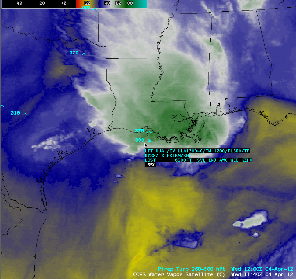
United Airlines flight 1727 from Tampa, Florida to Houston, Texas (aircraft flight path | plot of aircraft altitude/speed, from FlightAware.com) encountered extreme turbulence near the coast of Louisiana just before 12:00 UTC on 04 April 2012, which resulted in injures to 12 passengers. An AWIPS image of 4-km resolution GOES-13 6.5 µm water vapor channel data at 11:40 UTC with the text of the pilot report is shown above — note that there was also a pilot report of moderate turbulence at 37,000 feet just to the north.
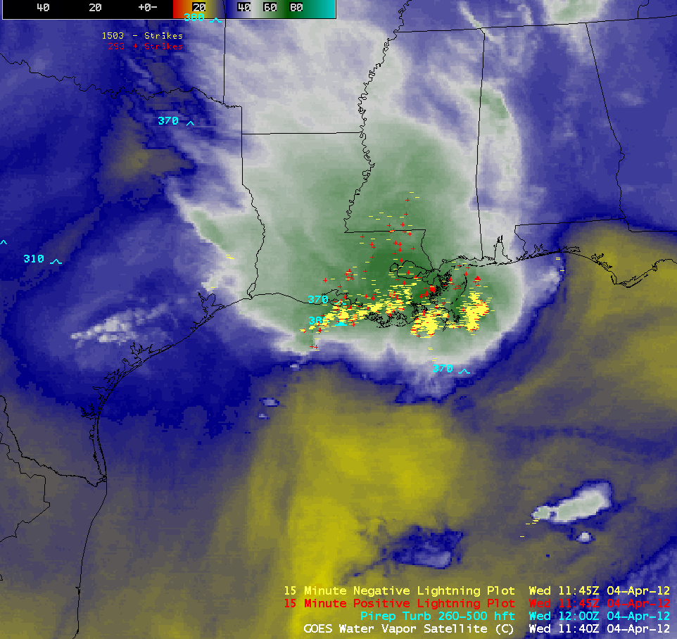
A southward-propagating squall line was intensifying during the morning hours as it crossed the Gulf Coast — the leading edge of the squall line was evident from the numerous cloud-to-ground lightning strikes (below; click image to play animation).
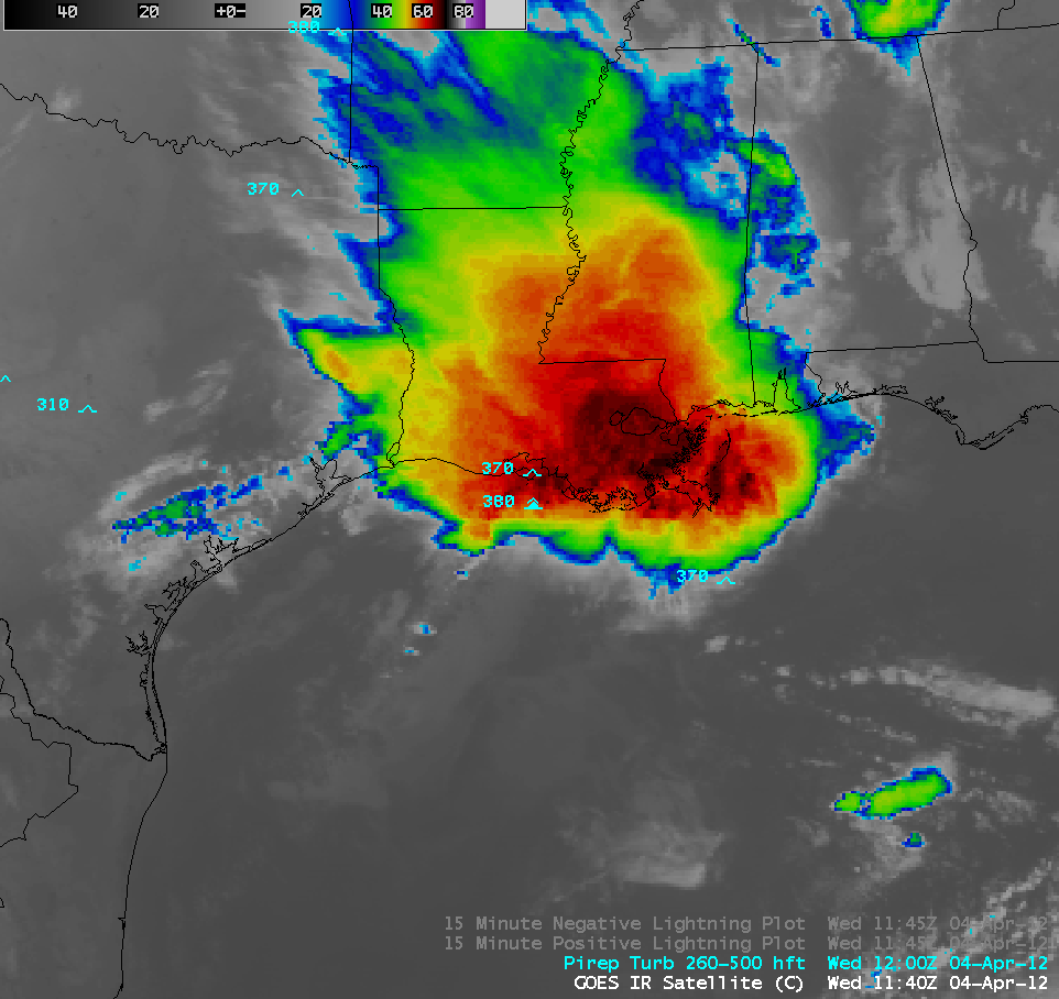
4-km resolution GOES-13 10.7 µm IR channel images (below; click image to play animation) showed a few cold overshooting cloud tops, with an IR brightness temperature as cold as -70 C at 11:01 UTC and -67 C at 11:40 UTC.
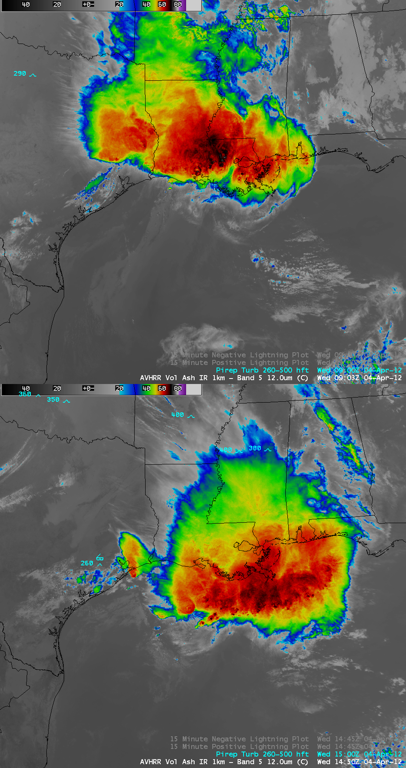
1-km resolution POES AVHRR 12.0 µm IR channel images before and after the turbulence encounter (below) revealed cloud top IR brightness temperatures as cold as -77 C over Louisiana at 09:03 UTC.
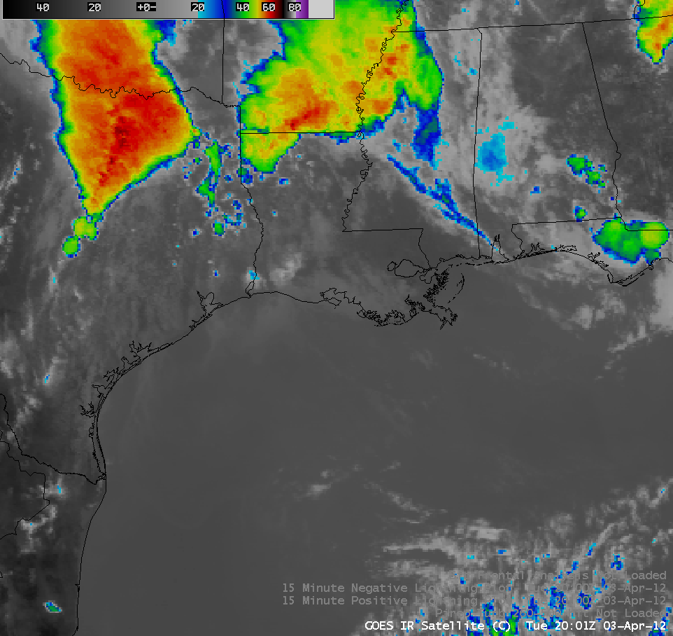
One interesting question to ask is: was this southward-propagating squall line initiated by outflow boundaries from the large mesoscale convective system that produced the widespread large hail and tornado event across northeastern Texas during the afternoon and evening hours on 03 April? A long sequence of GOES-13 10.7 µm IR channel images (below; click image to play animation) does suggest a possible connection.


