Ice eddies in the Gulf of Saint Lawrence
We received the following in an email from John Goff, lead forecaster at the Burlington, Vermont National Weather Service office:
“Couldn’t help but notice the apparent large ice eddies up in the Gulf of Saint Lawrence this afternoon (3/6) per the TERRA MODIS noon overpass (250m res). I thought that initially these were eddy/small-scale cloud vortices we sometimes see up there, but upon looping the GOES visible imagery on my AWIPS workstation it’s fairly obvious these are not clouds, but ice structures.”
Thanks John for the heads-up on this very interesting example! McIDAS images of 1-km resolution GOES-13 0.63 µm visible channel data (above; click image to play animation) showed the development and motion of the ice eddies on 06 March 2012. Note how many of the ice floe structures began to move toward the northeast by the end of the day, due to increasing southwesterly surface winds across the region.
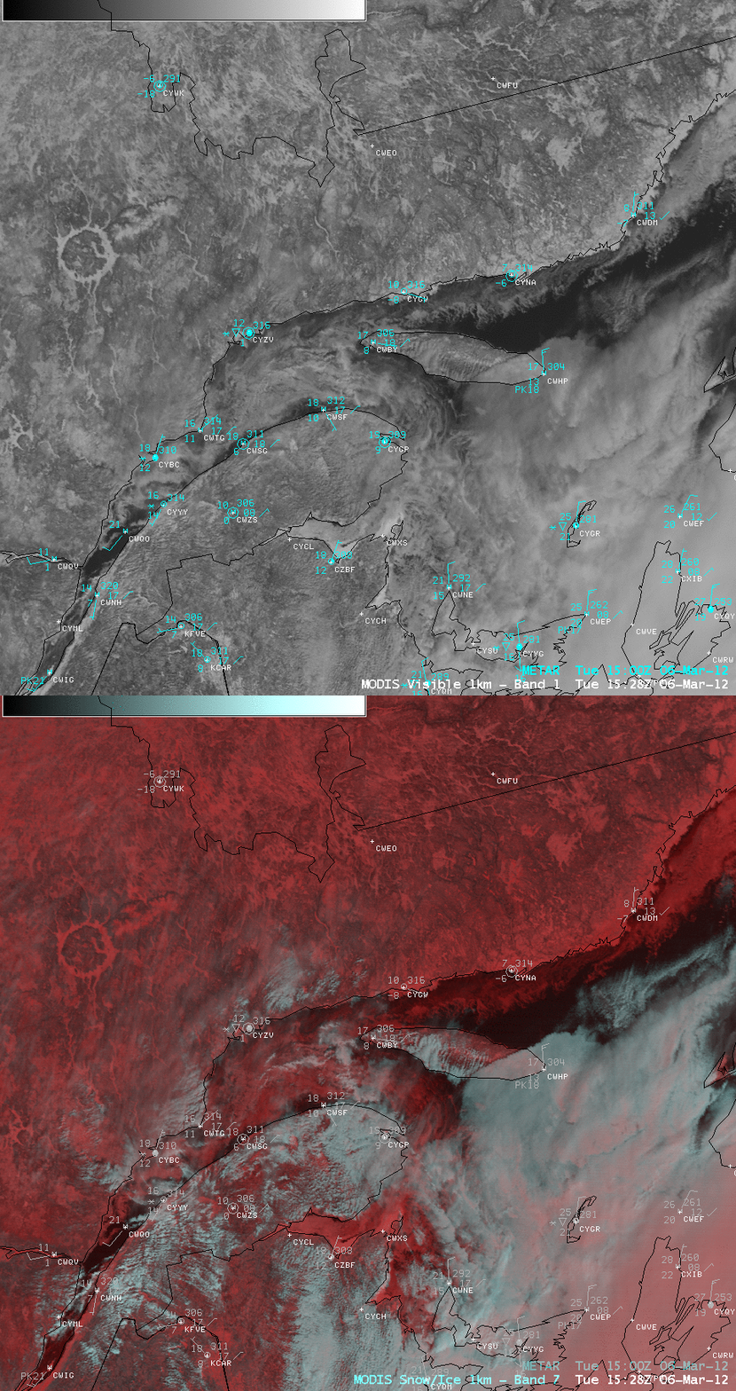
A comparison of AWIPS images of 1-km resolution MODIS 0.65 µm visible channel data and the corresponding MODIS false-color Red/Green/Blue (RGB) image (below) demonstrated the value of using RGB imagery to aid in the discrimination between snow/ice (which appeared as varying shades of red in the false-color RGB image) and supercooled water droplet clouds (which appeared as the brighter white to cyan features on the RGB image).
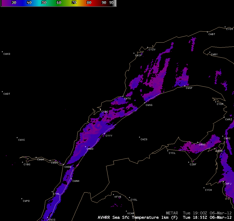
An AWIPS image of the 1-km resolution POES AVHRR Sea Surface Temperature (SST) product at 18:55 UTC (below) indicated that SST values over the open waters were in the 30-31º F range (blue color enhancement), while the ice features exhibited colder values in the 23-25º F range (violet color enhancement).
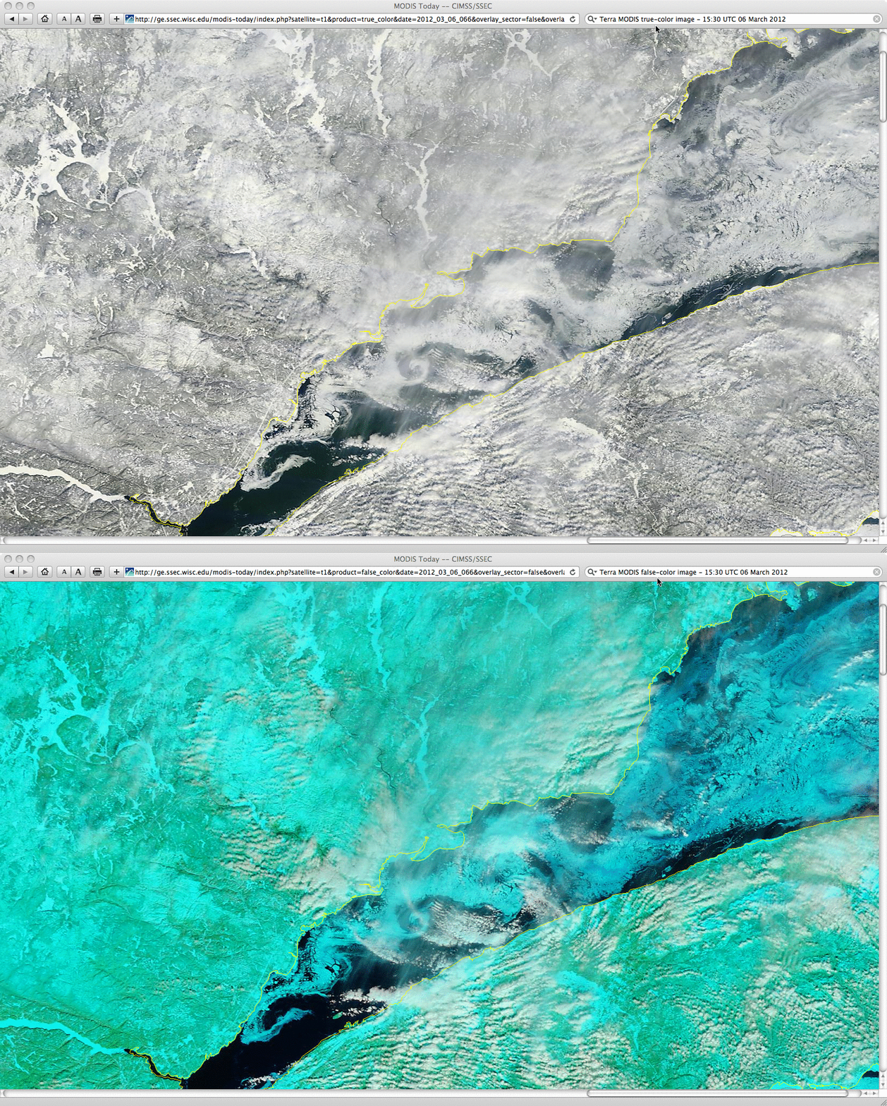
Finally, a comparison of 250-meter resolution MODIS true color and false color Red/Green/Blue (RGB) images from the SSEC MODIS Today site (below) showed a closer view of the ice eddies, and again demonstrated the value of using various RGB image combinations to discriminate between snow/ice (cyan in the false-color image) and supercooled water droplet low cloud features (white on the true-color image).
CIMSS participation in GOES-R Proving Ground activities includes making a variety of POES AVHRR and MODIS images and products available for National Weather Service forecast offices to add to their local AWIPS workstations. Currently there are 51 NWS offices receiving MODIS imagery and products from CIMSS.


