Large central US storm: record snowfall in Colorado, heavy rain in Texas and Kansas
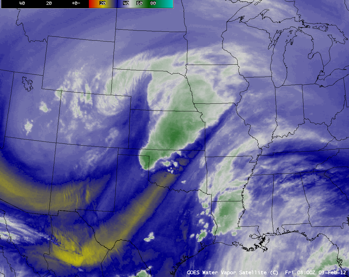
AWIPS images of 4-km resolution GOES-13 6.5 µm water vapor channel data (above; click image to play animation) showed the middle-tropospheric circulation and cloud features associated with the large storm system which brought heavy snow, heavy rainfall, and severe thunderstorms to much of the central US on 03 February – 04 February 2012. Snowfall amounts included 51.1 inches at Pinecliffe, Colorado, 26.0 inches at Laramie, Wyoming, 17.0 inches at Tyron, Nebraska, and 11.5 inches at Cumberland, Iowa.
Denver received 15.9 inches of snow during 02/03/04 February, setting a new 3-day record accumulation for the month of February. Boulder also set a new single-storm snowfall record, with 22.7 inches of snowfall (NWS Denver/Boulder CO storm summary).
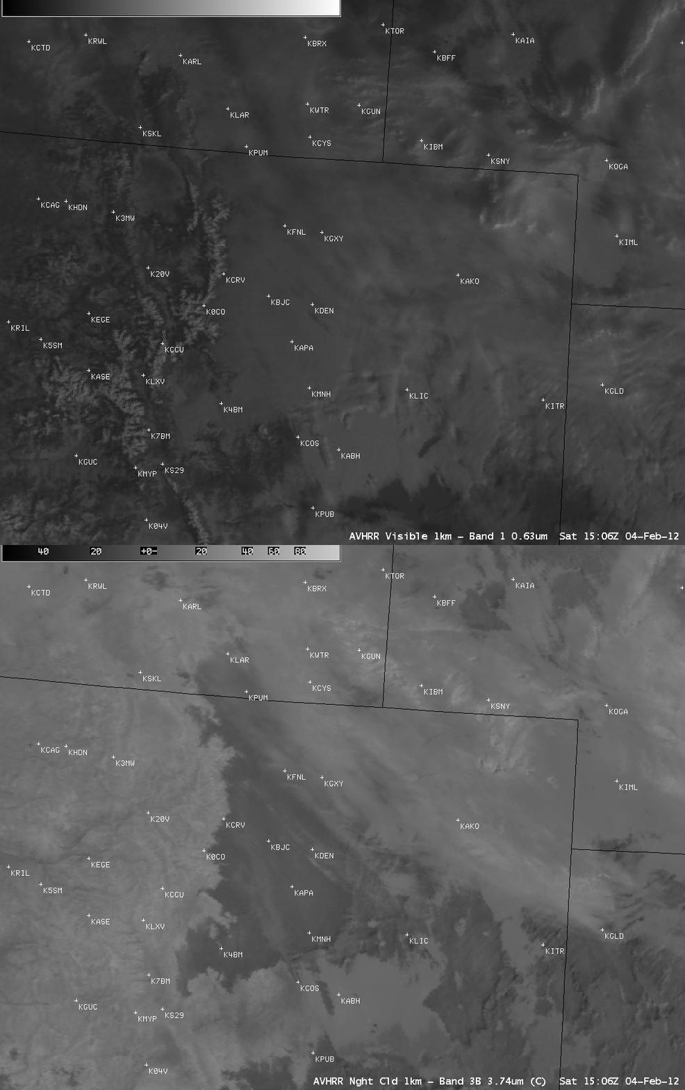
As the storm departed, a comparison of AWIPS images of 1-km resolution POES AVHRR 0.63 µm visible channel and 3.74 µm shortwave IR data (above) at 15:06 UTC (8:06 am local time) on 04 February showed that some low clouds persisted across much of northeastern Colorado, backed up against the highest terrain of the Continental Divide in some places. The low clouds showed up as darker gray features on the shortwave IR image, due to the sensitivity of reflection of solar radiation off of cloud top supercooled water droplets at the 3.74 µm wavelength.
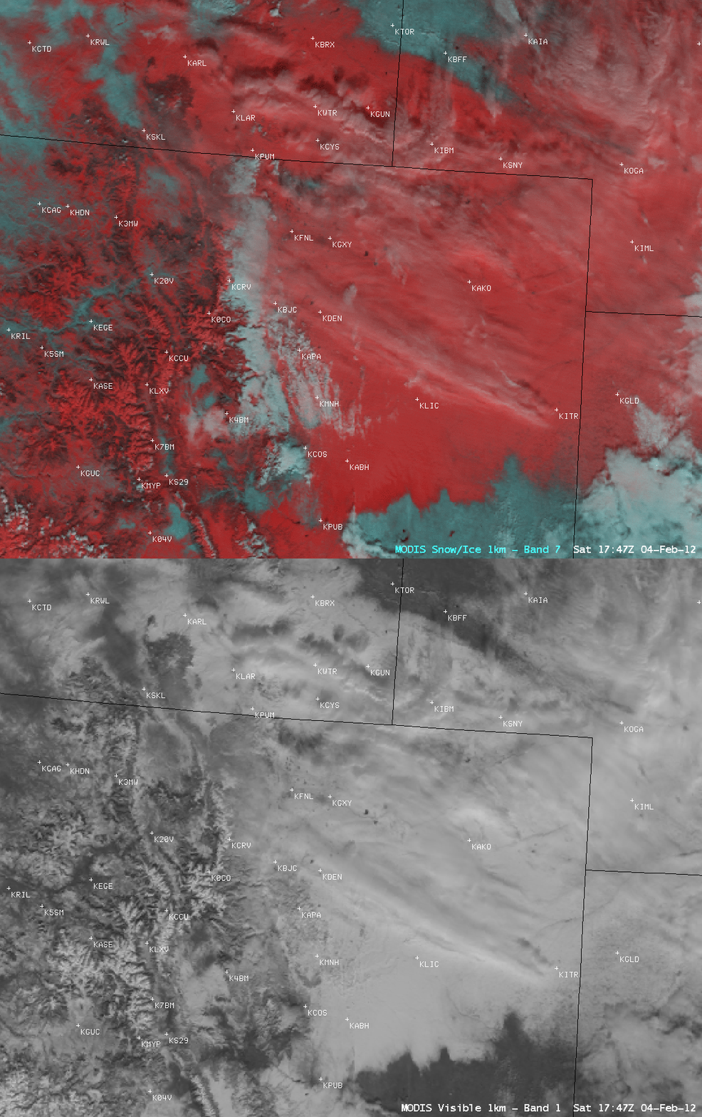
At 17:47 UTC (10:47 am local time), a comparison of AWIPS images of 1-km resolution MODIS 0.65 µm visible channel data with the corresponding MODIS false-color Red/Green/Blue (RGB) image (created using MODIS channel 01/07/07 as the red/green/blue components of the image) indicated that most of the low clouds (which appeared as varying shades of white on the false-color image) had dissipated, revealing a good deal of the snow cover (which appeared as darker shades of red on the false-color image). A few streaks of high-level cirrus clouds could also be seen over the snow cover. Bare ground appeared cyan on the false-color image.
About 2 hours later, a more detailed example of using false color images to discriminate between snow cover and supercooled water droplet clouds can be seen with a 375-meter resolution Suomi NPP VIIRS Red/Green/Blue (RGB) image (below), created using Band I1 (0.64 micrometer visible) as the red component and Band I3 (1.61 micrometer near-IR) as the green and blue components of the image.
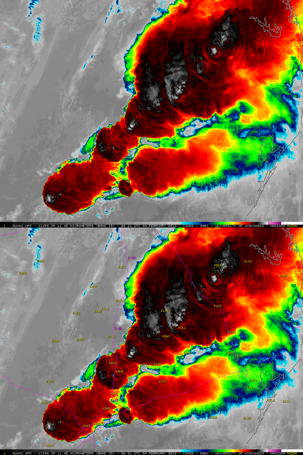
Farther to the east and south, heavy rainfall amounts included 9.30 inches at Romayer, Texas, 5.69 inches at Alexandria, Louisiana, and 4.34 inches at Medicine Lodge, Kansas. Wichita, Kansas received 2.86 inches of rain — the wettest February day on record at that location. Severe thunderstorms produced one tornado and hail up to 2.0 inches in diameter in Texas (SPC storm reports). A McIDAS image of 375-meter resolution Suomi NPP VIIRS 11.45 µm IR channel data (below) showed very intricate detail to the cloud top IR brightess temperature structure associated with strong thunderstorms producing heavy rainfall and flash flooding across the Interstate 35 corridor in the Austin/San Antonio, Texas region during the pre-dawn hours on 04 February. VIIRS IR brightness temperatures were as cold as -81º C with the far southwestern storm — and rare “warm trench” signatures (a ring of warmer cloud top temperatures surrounding a well-defined cold overshootng top) were seen associated with the 2 storms located near Austin-Bergstrom International airport (KAUS) and Houston County Airport (KDKR).
===== 05 February Update =====
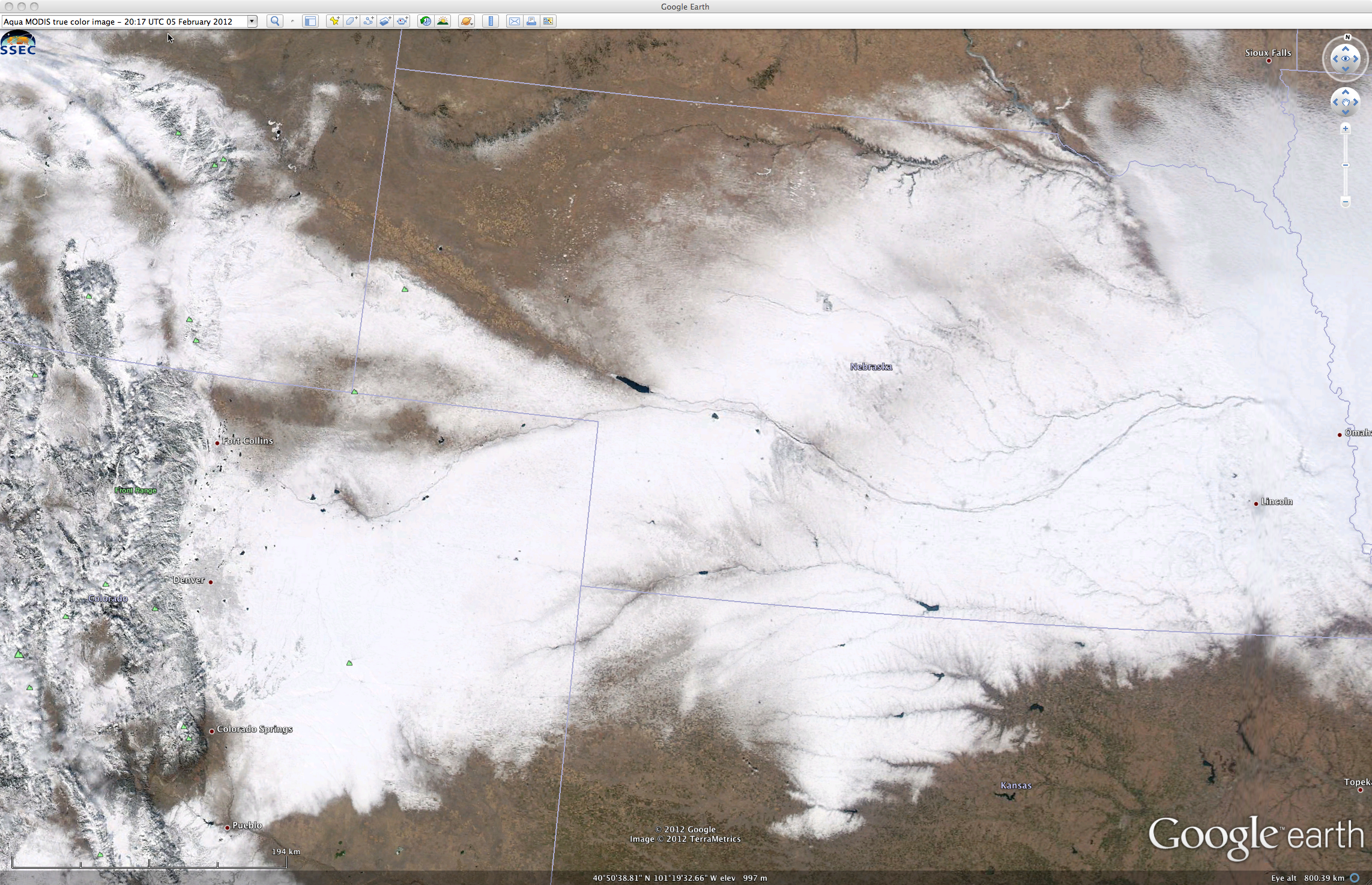
A large portion of the resulting swath of snow on the ground across parts of Wyoming, Colorado, Nebraska, and Kansas could be seen on a 250-meter resolution MODIS true color RGB image from the SSEC MODIS Today site (below, viewed using Google Earth) at 20:17 UTC on 05 February 2012.


