River valley fog in Pennsylvania
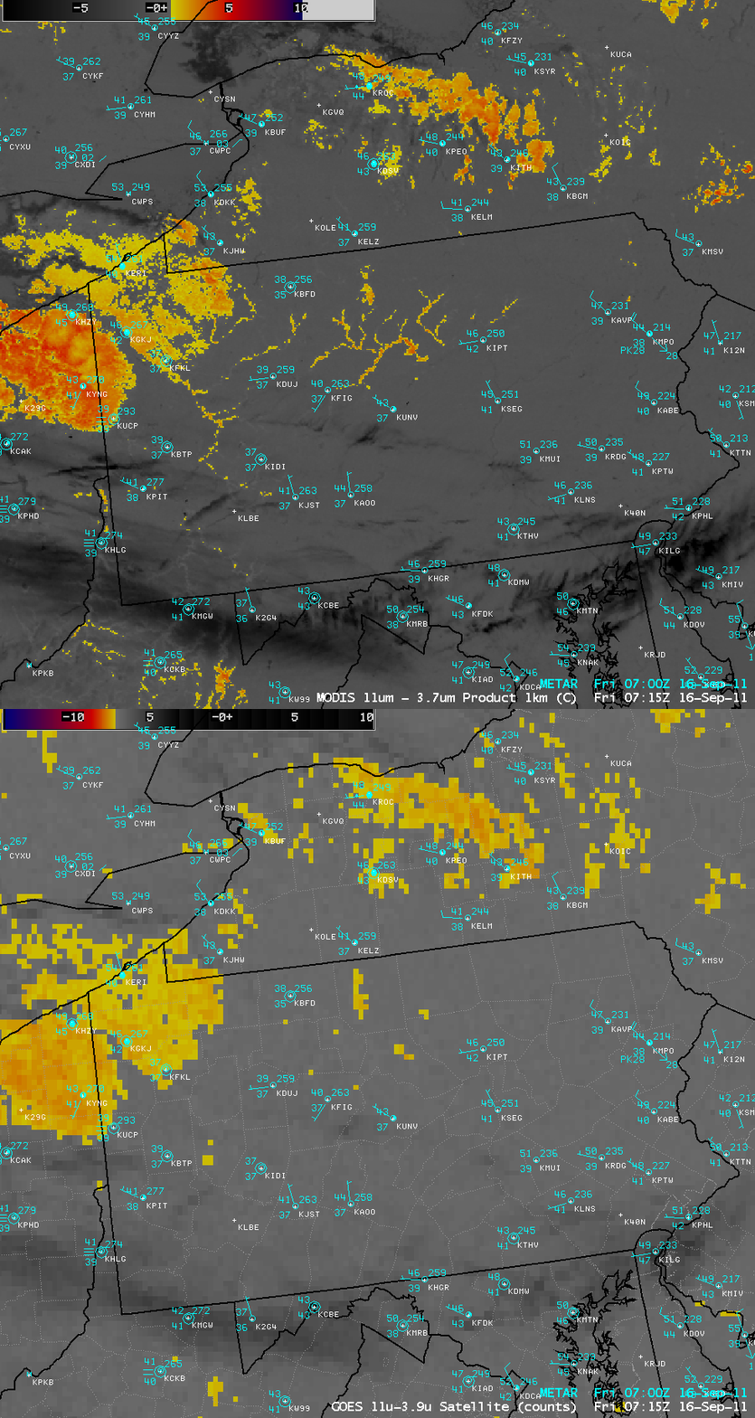
The early morning area forecast discussion issued by the National Weather service office at State College, Pennsylvania mentioned that river valley fog was being detected by the MODIS fog/stratus product:
AREA FORECAST DISCUSSION
NATIONAL WEATHER SERVICE STATE COLLEGE PA
526 AM EDT FRI SEP 16 2011.SYNOPSIS...
A LARGE HIGH PRESSURE SYSTEM OVER THE GREAT LAKES WILL BUILD SLOWLY EAST TO NEW ENGLAND BY SUNDAY AND MONDAY. A DYING COLD FRONT WILL LIKELY PUSH INTO THE REGION LATE MONDAY OR TUESDAY. A DIGGING TROF AND ASSOCIATED SLOW MOVING COLD FRONT COULD AFFECT THE REGION BY LATE NEXT WEEK..NEAR TERM /UNTIL 6 PM THIS EVENING/... EARLY AM MODIS 11-3.7UM IMAGERY SHOWING DENDRITIC PATTERN OF FOG IN THE DEEP RIVER VALLEYS OF THE ALLEGHENY MTNS.
A comparison of AWIPS images of the 1-km resolution MODIS fog/stratus product with the corresponding 4-km resolution GOES-13 fog/stratus product (above) demonstrated the advantage of higher spatial resolution for detecting such small-scale features. A subtle fog signal was beginning to show up at this time in the GOES-13 fog/stratus product image, but it was difficult to tell whether it was due to noise or actual fog features.
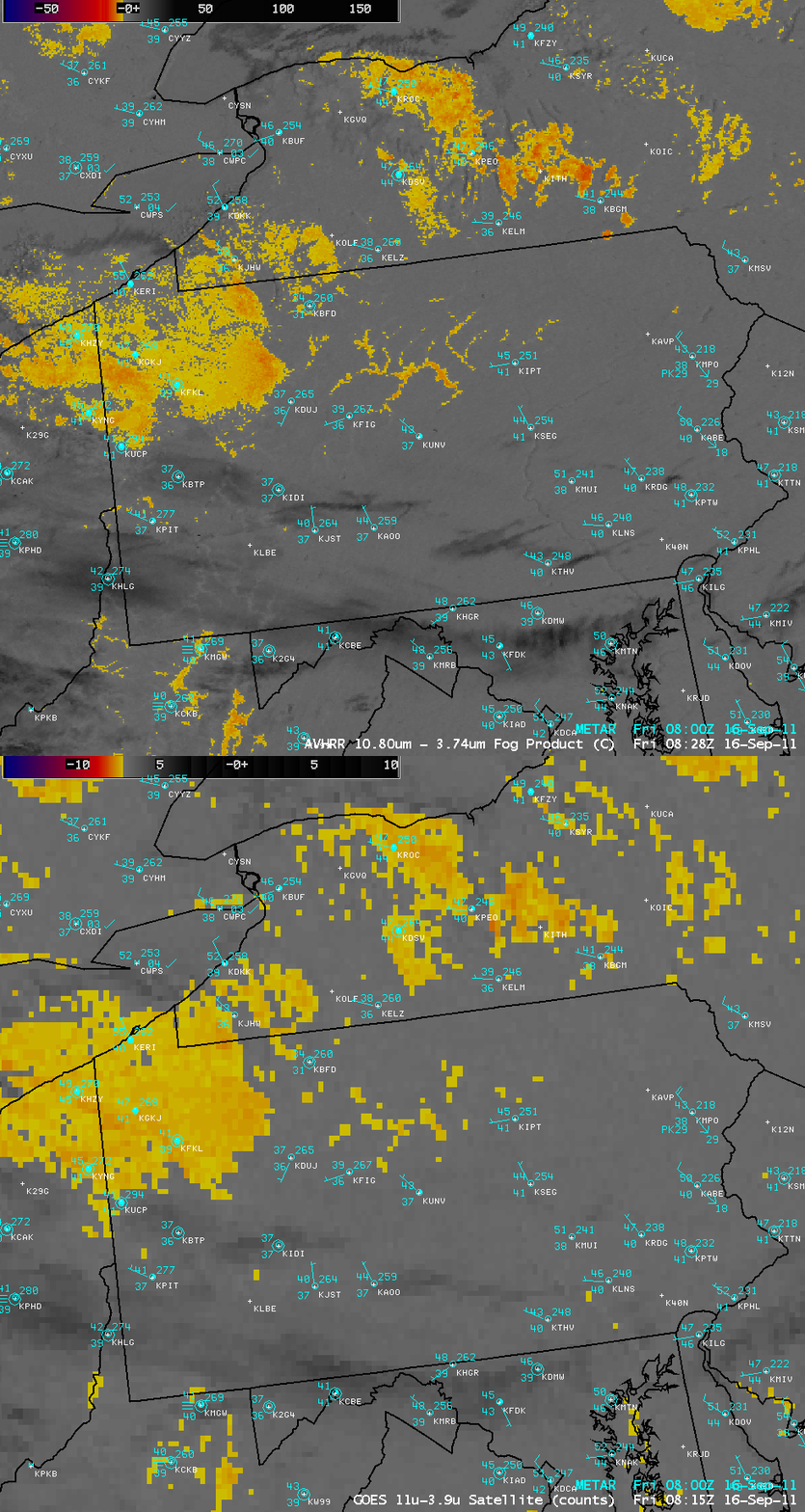
About an hour and 15 minutes later, a similar comparison using a 1-km resolution POES AVHRR fog/stratus image and the corresponding 4-km resolution GOES-13 fog/stratus product image (below) showed that while the fog signal had become better defined by this time on the GOES-13 image, the POES AVHRR image again showed the river valley fog features with much greater clarity.


