Hurricane Irene
On 22 August 2011 Tropical Storm Irene intensified to become the first Atlantic basin hurricane of the 2011 season. McIDAS images of GOES-13 0.63 µm visible channel data (above; click image to play animation) showed that while no eye was yet apparent, a number of discrete convective bursts could be seen during the day. The GOES-13 satellite had been placed into Rapid Scan Operations (RSO) mode, providing images as frequently as every 5-10 minutes.
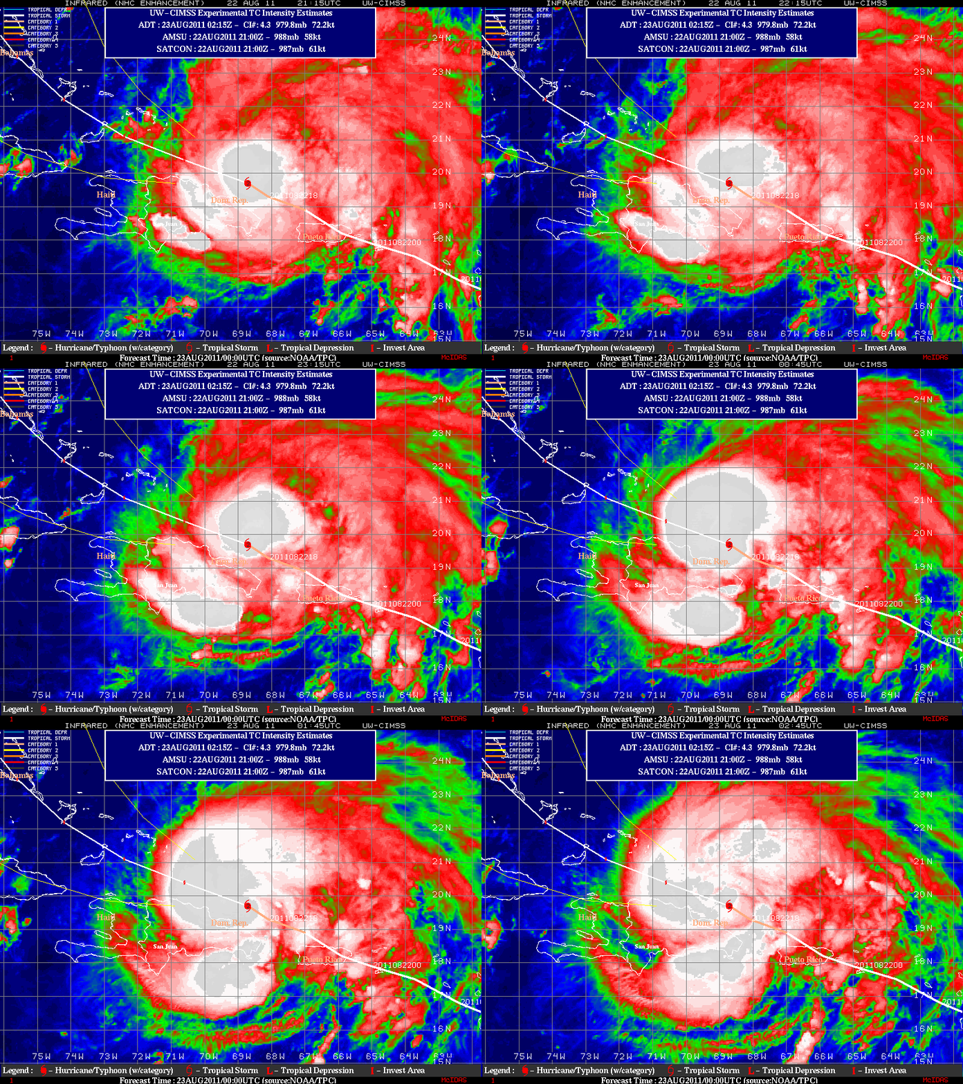
An animation of GOES-13 10.7 µm IR images from the CIMSS Tropical Cyclones site (below) showed that large convective bursts continued into the night-time hours, as Hurricane Irene reached Category 2 intensity.
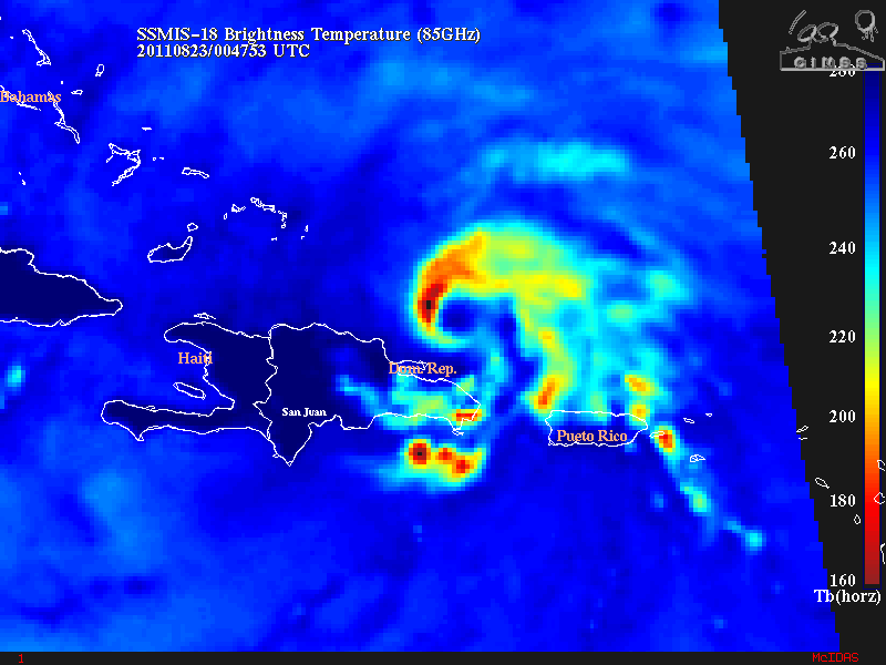
The presence of a central dense overcast meant that no eye was apparent on the GOES IR imagery — but a DMSP SSMIS 85 GHz microwave brightness temperature image (below) showed that an eye was indeed in the process of forming at 00:48 UTC on 23 August.
===== 23 August Update =====
On 23 August 2011, some hints of an eye began to appear early in day on GOES-13 0.63 µm visible channel images (above), but the view of an eye structure became obscured by a series of large convective bursts later in the day. As requested by the National Hurricane Center, the GOES-13 satellite remained in Rapid Scan Operations (RSO) mode, providing images as frequently as every 5-10 minutes.
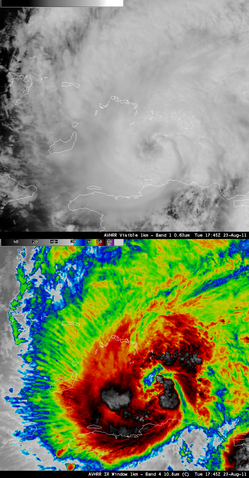
In a comparison of AWIPS images of 1-km resolution POES AVHRR 0.65 µm visible and 10.8 µm IR data (below), the hints of an eye structure could be more easily seen on the visible image, while widespread “transverse banding” within the upper level cirrus outflow was very evident on the IR image.
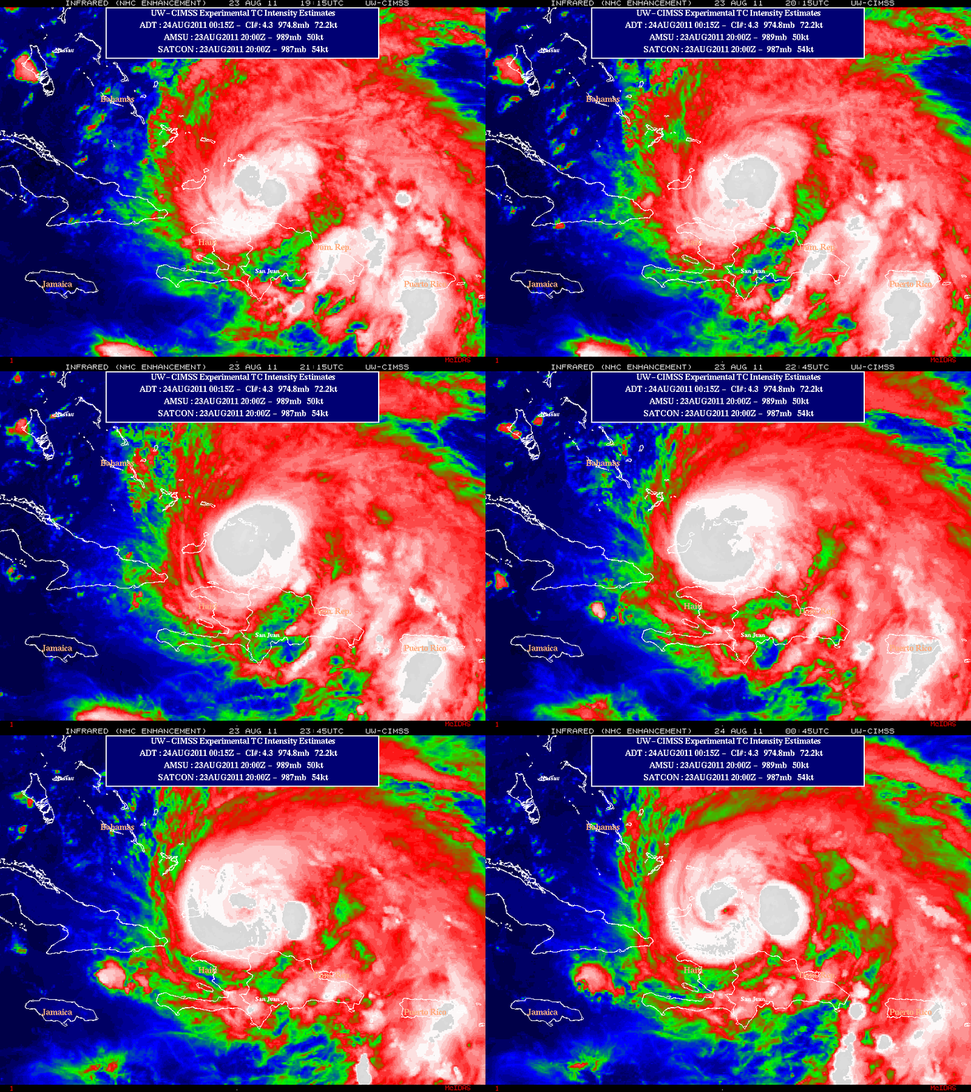
Later, during the evening hours, the signature of an eye began to appear on GOES-13 10.7 µm IR images from the CIMSS Tropical Cylones site (below).


