Fog and stratus over the Upper Midwest region
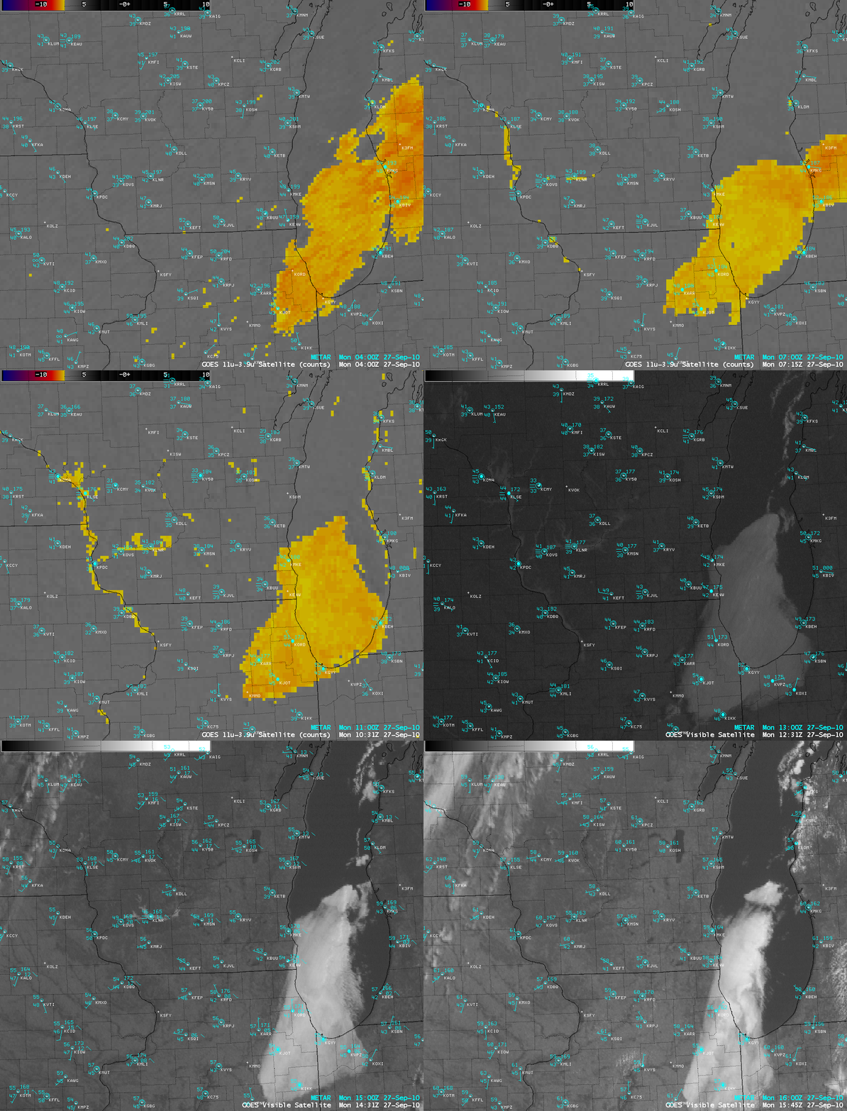
AWIPS images of the night-time 4-km resolution GOES-13 fog/stratus product and the daytime 1-km resolution GOES-13 visible images (above) showed two features of interest on 27 September 2010: (1) narrow fingers of river valley fog forming during the overnight hours — and then burning off during the early morning hours — over parts of the Mississippi River valley and the Wisconsin River valley, and (2) a larger patch of stratus cloud that lingered over southern Lake Michigan and the Chicago region.
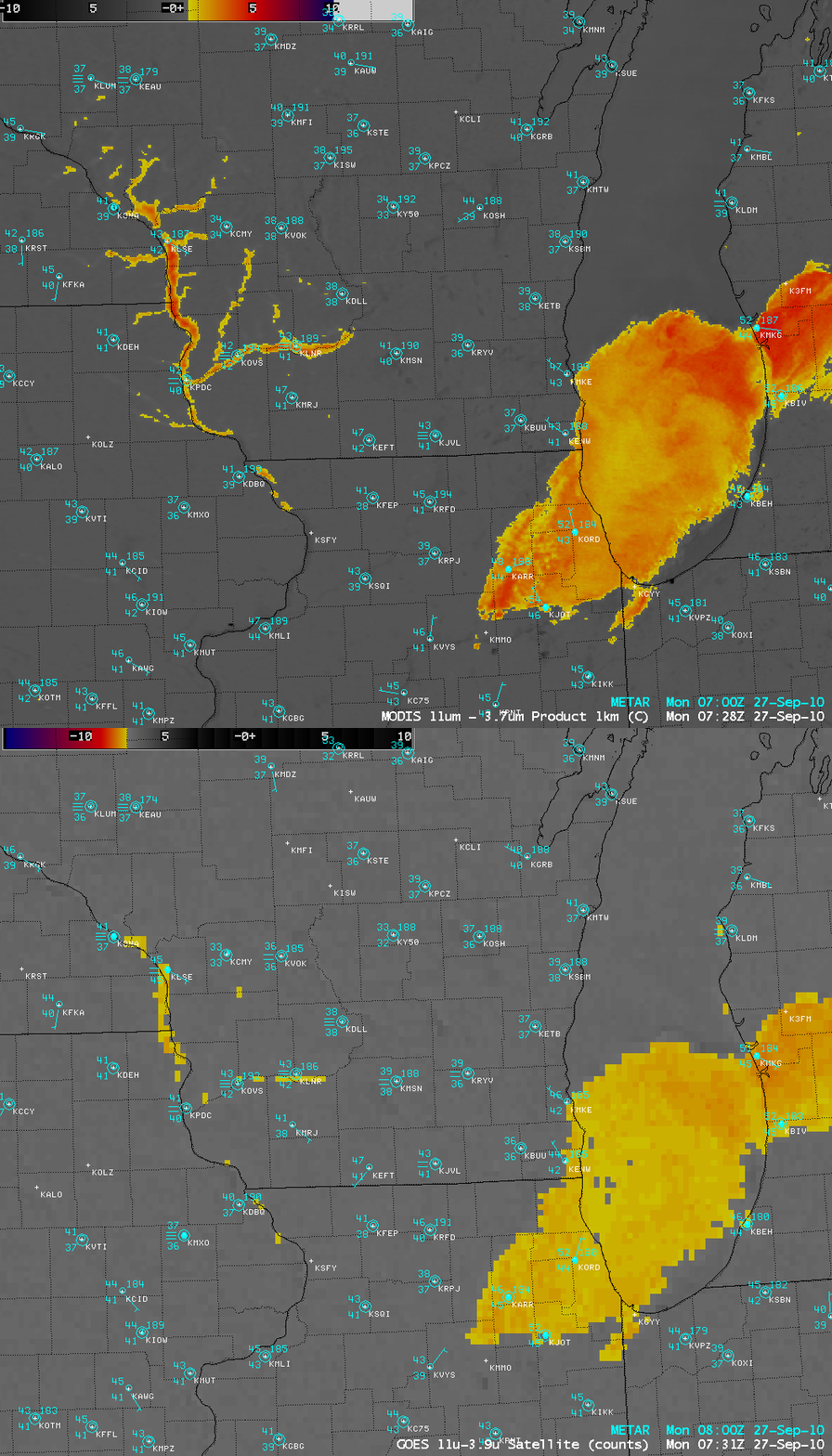
Note the improvement in the detection of the actual structure of the river valley fog features with the change from the 4-km resolution fog/stratus product images to the 1-km resolution visible images — the importance of spatial resolution for detecting river valley fog is also obvious on a comparison of the 1-km resolution MODIS fog/stratus product image with the corresponding GOES-13 fog/stratus product image (below).
==========================================
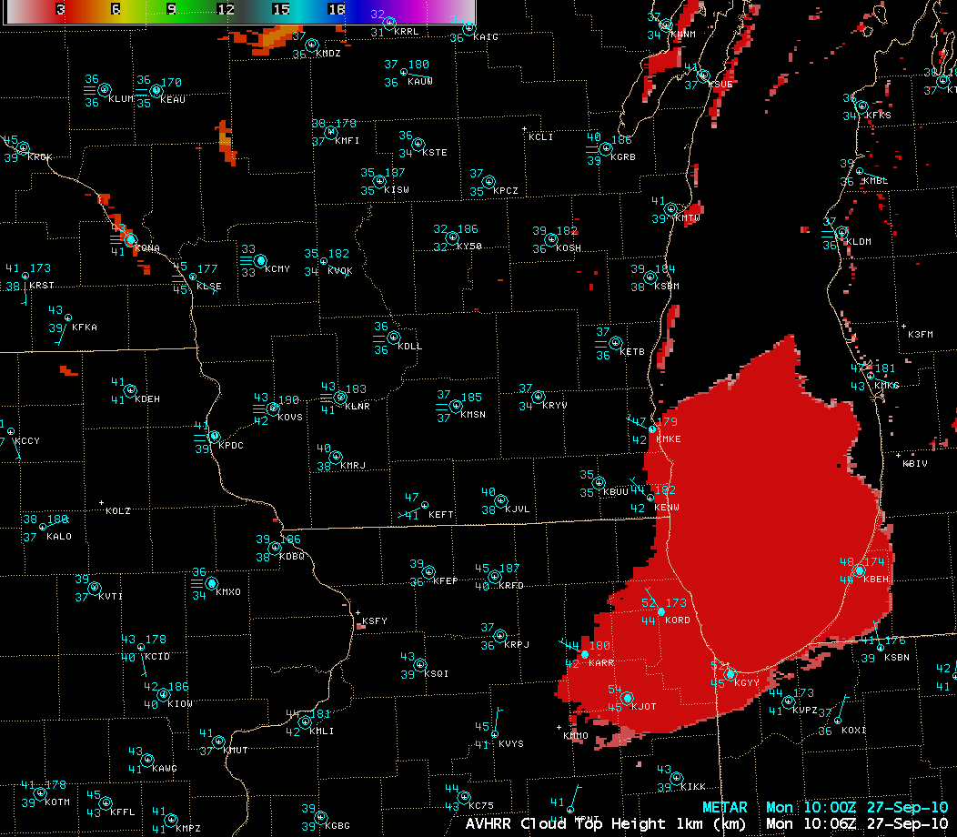
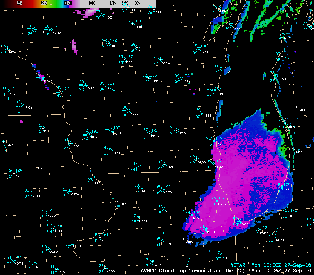
Other satellite products that could be utilized to further characterize the large patch of stratus cloud over southern Lake Michigan and the Chicago region are the 1-km resolution POES AVHRR Cloud Top Height (CTH) product (above), which showed CTH values of around 3 km, and the 1-km resolution POES AVHRR Cloud Top Temperature (CTT) product (below), which depicted CTT values of 0º C to -2º C across much of the feature.


