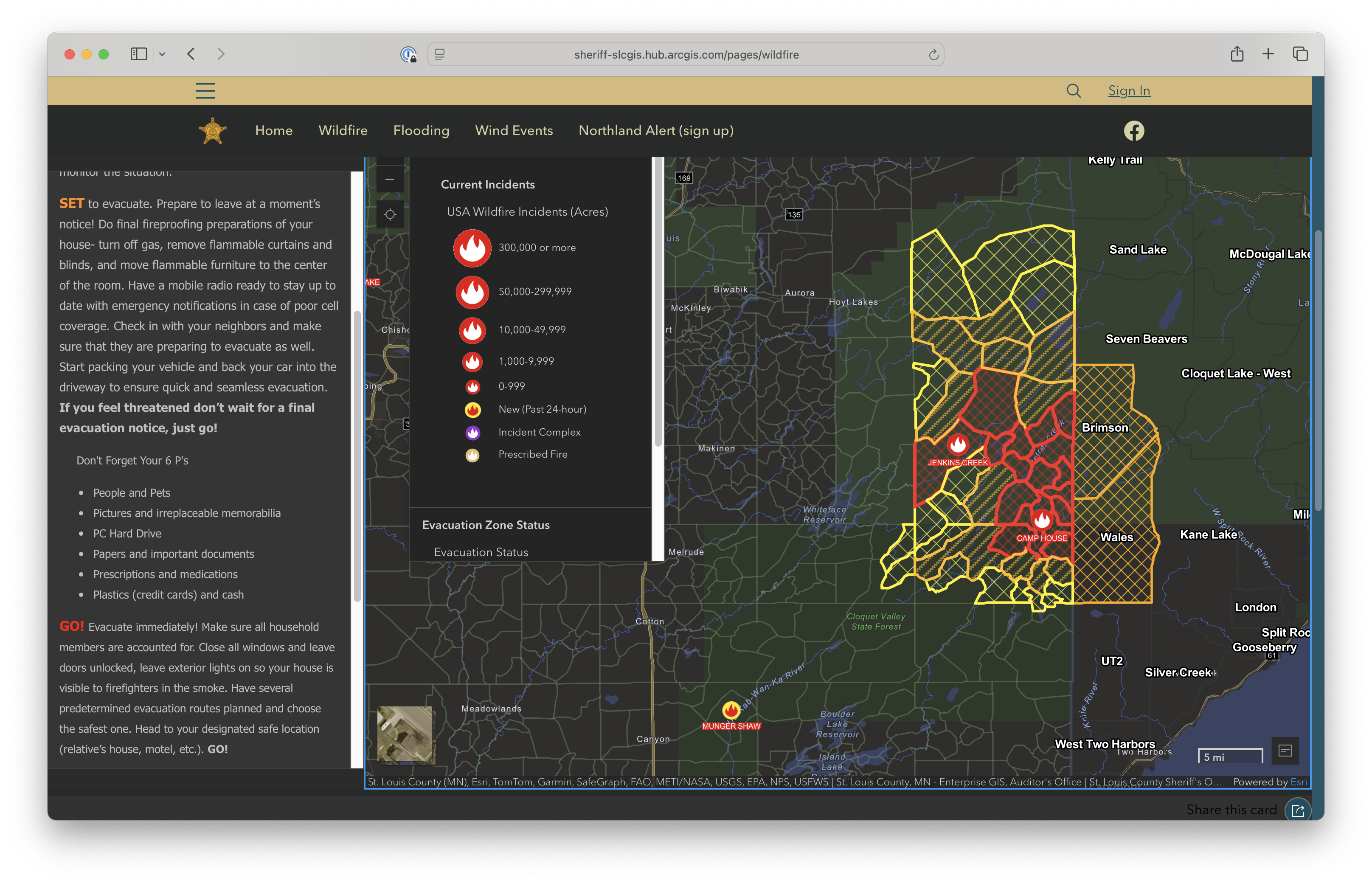
Camp House and Jenkins Creek wildfires in northeast Minnesota
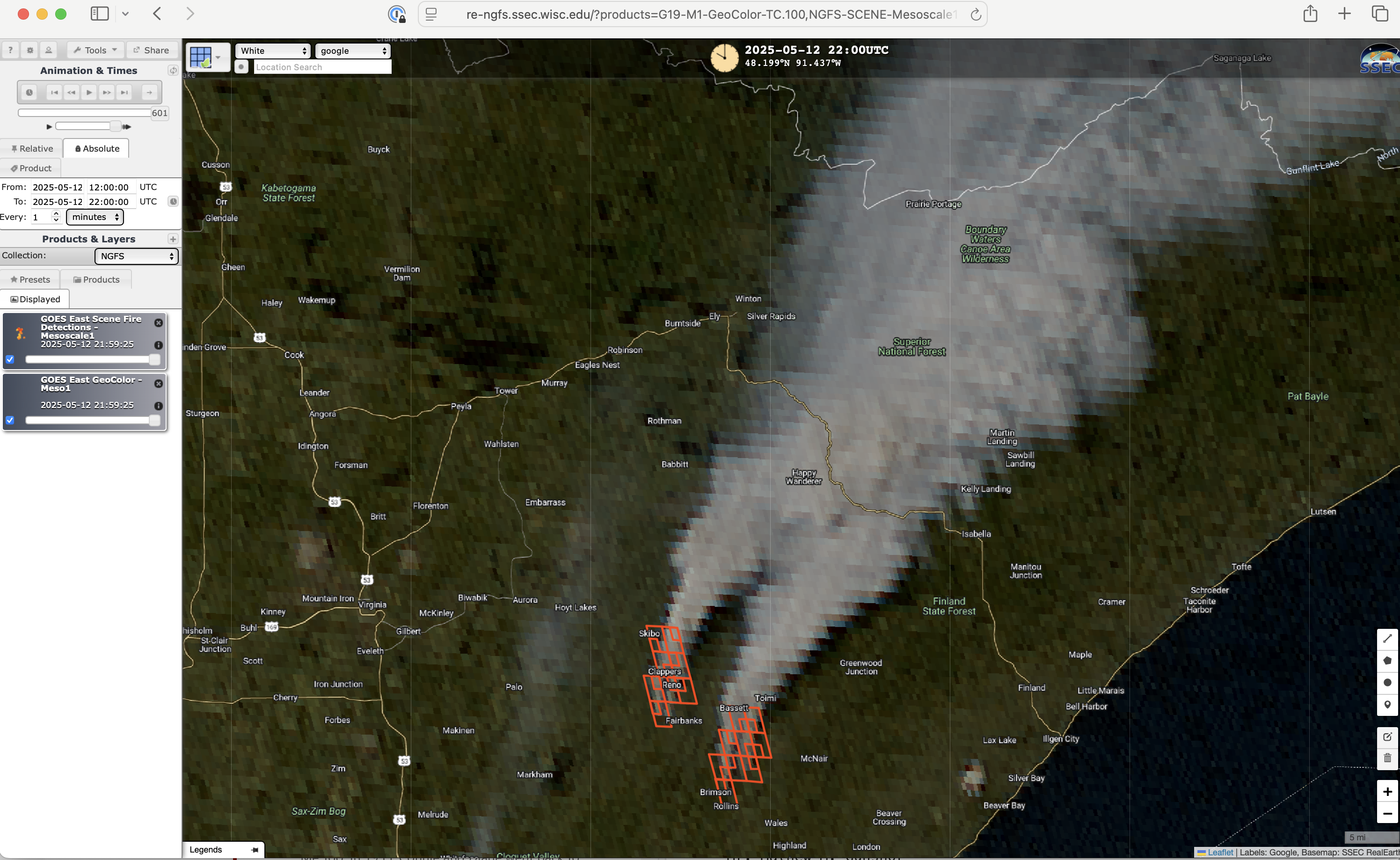
1-minute GOES-19 GeoColor RGB images with an overlay of NGFS fire detection polygons, from 1200-2200 UTC on 12 May [click to play MP4 animation]
Thick smoke drifted northeastward across the Boundary Waters Canoe Area Wilderness and crossed the Canadian border — GOES-19 Aerosol Optical Depth values with these smoke plumes were as high as 1.0 (below).
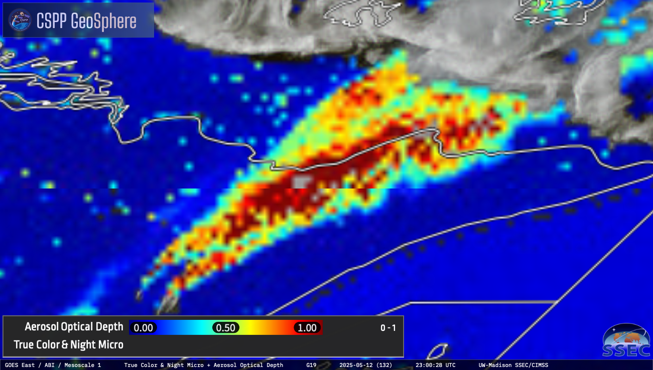
1-minute GOES-19 Aerosol Optical Depth derived product [click to play MP4 animation]
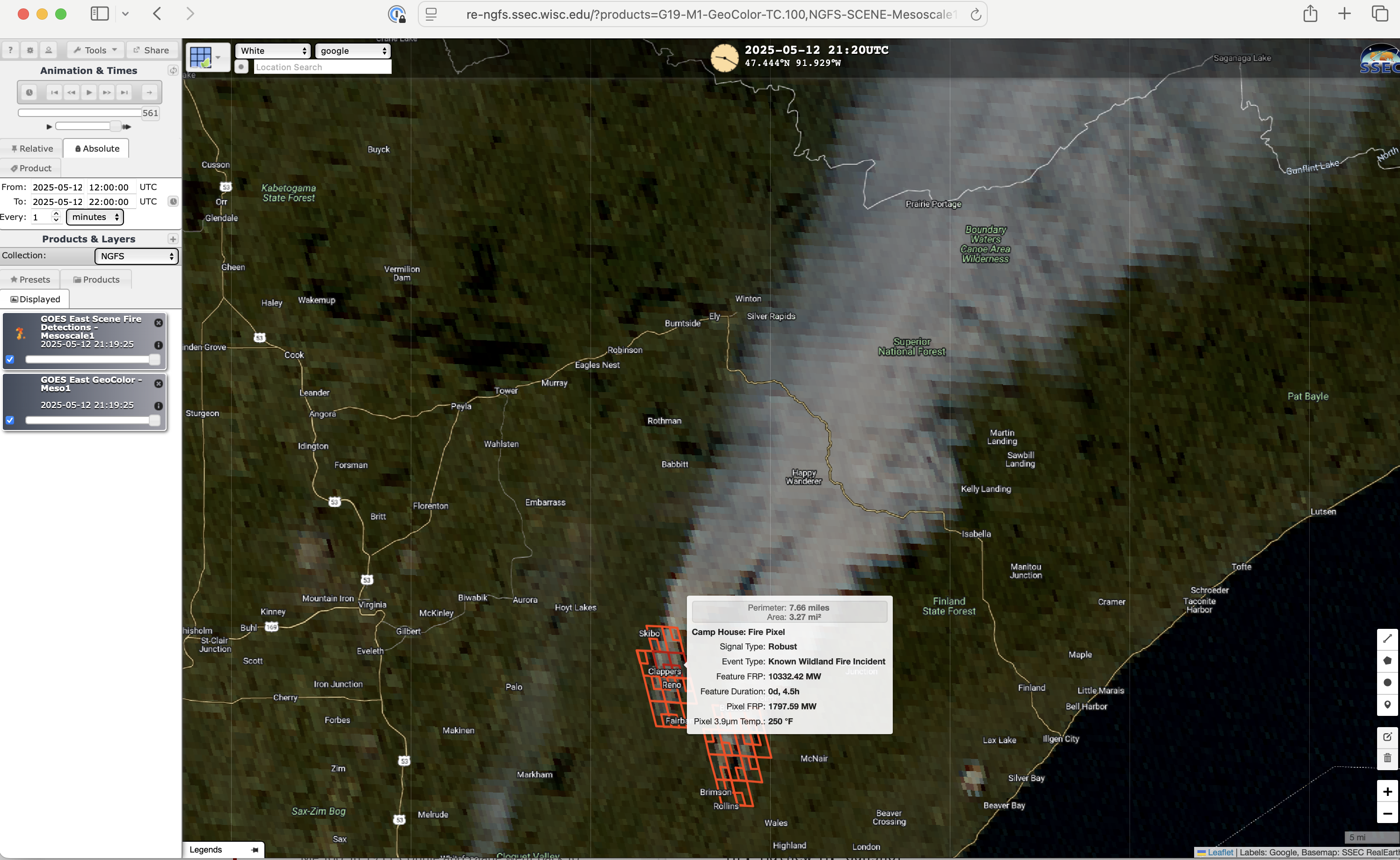
NGFS probe of the Jenkins Creek Fire at 2120 UTC on 12 May [click to enlarge]
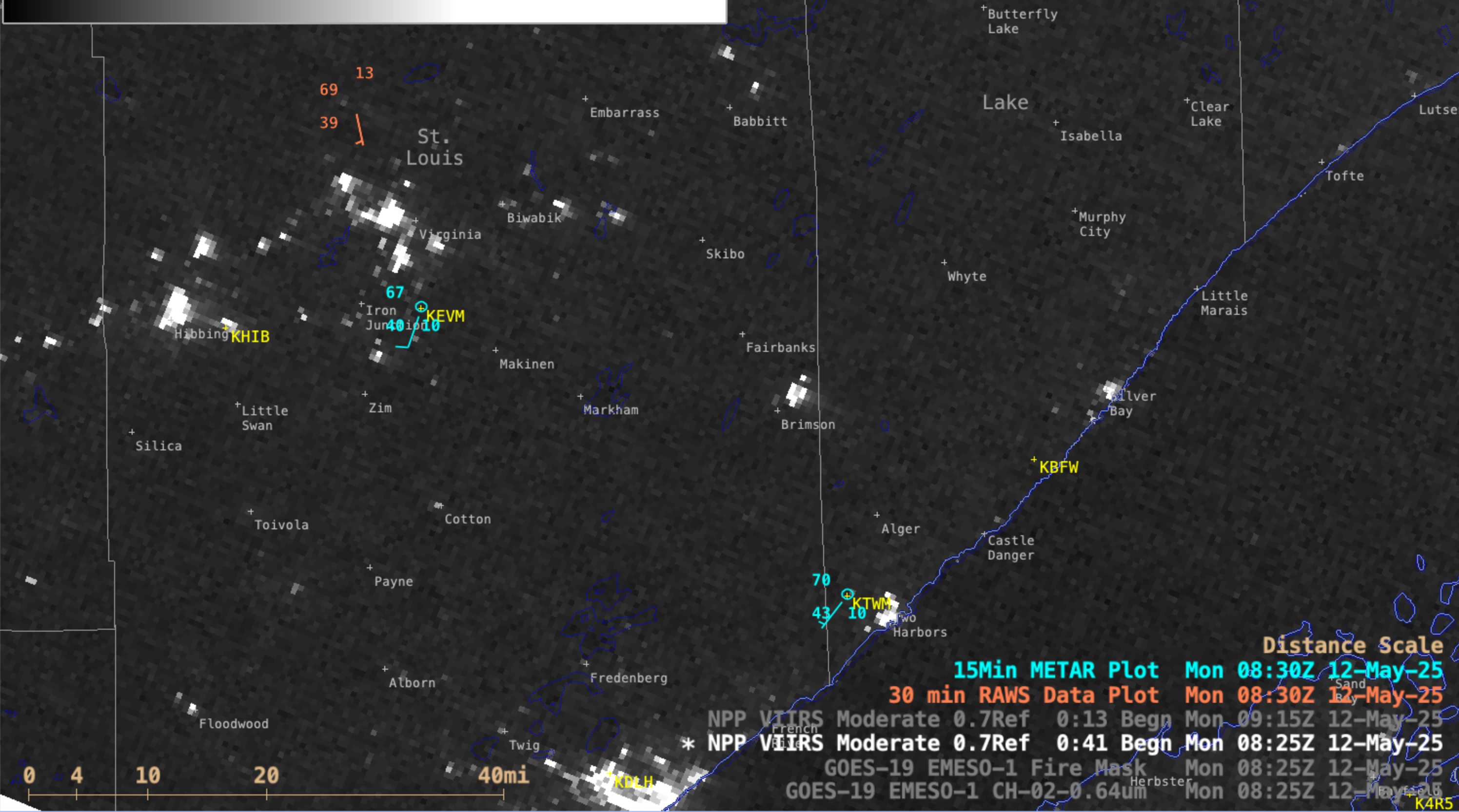
NOAA-21 (mislabeled as NPP) VIIRS Day/Night Band (0.7 µm) image valid at 0831 UTC on 12 May [click to enlarge]
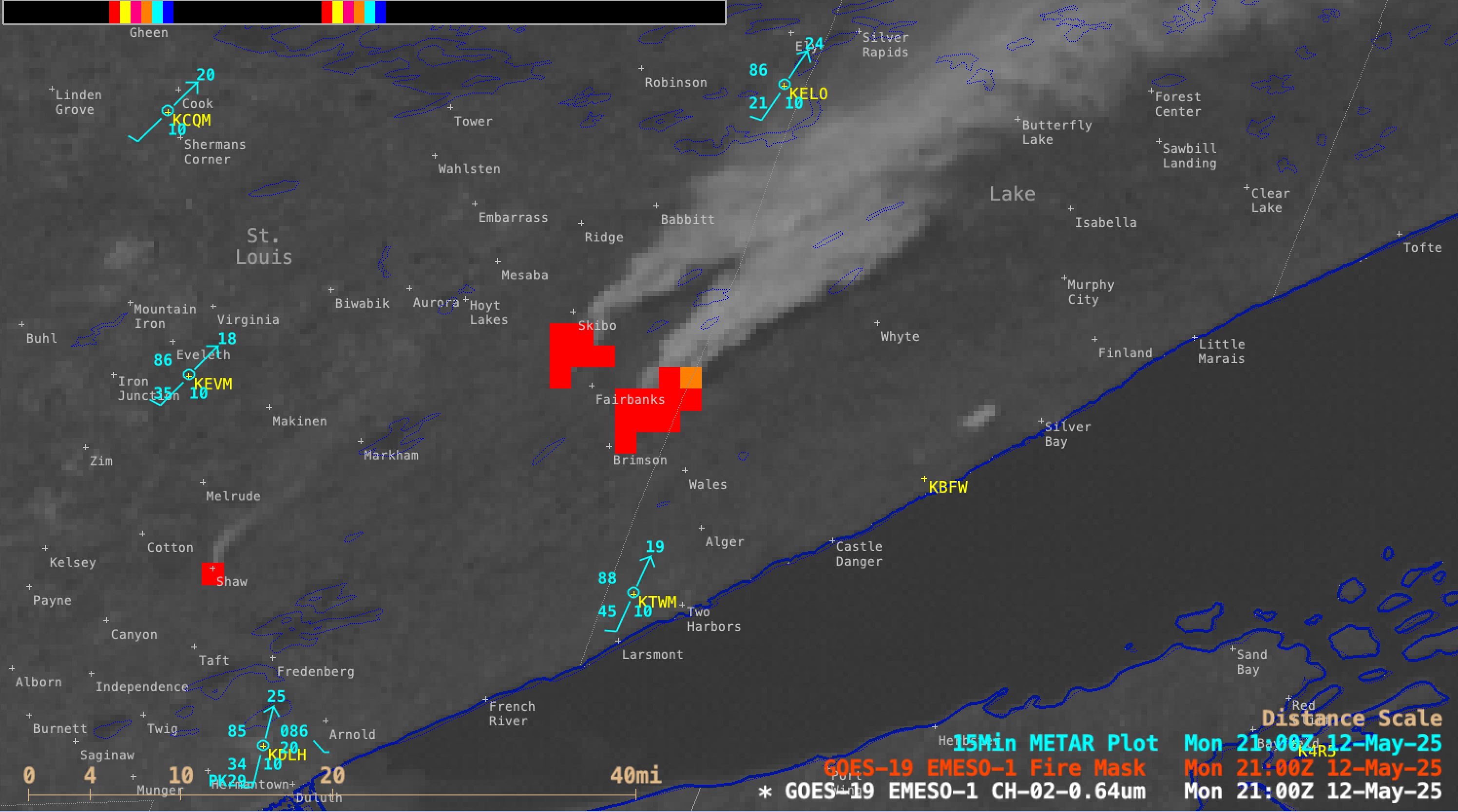
1-minute GOES-19 Visible (0.64 µm) images with an overlay of the Fire Mask derived product, from 1301-2300 UTC on 12 May [click to play MP4 animation]
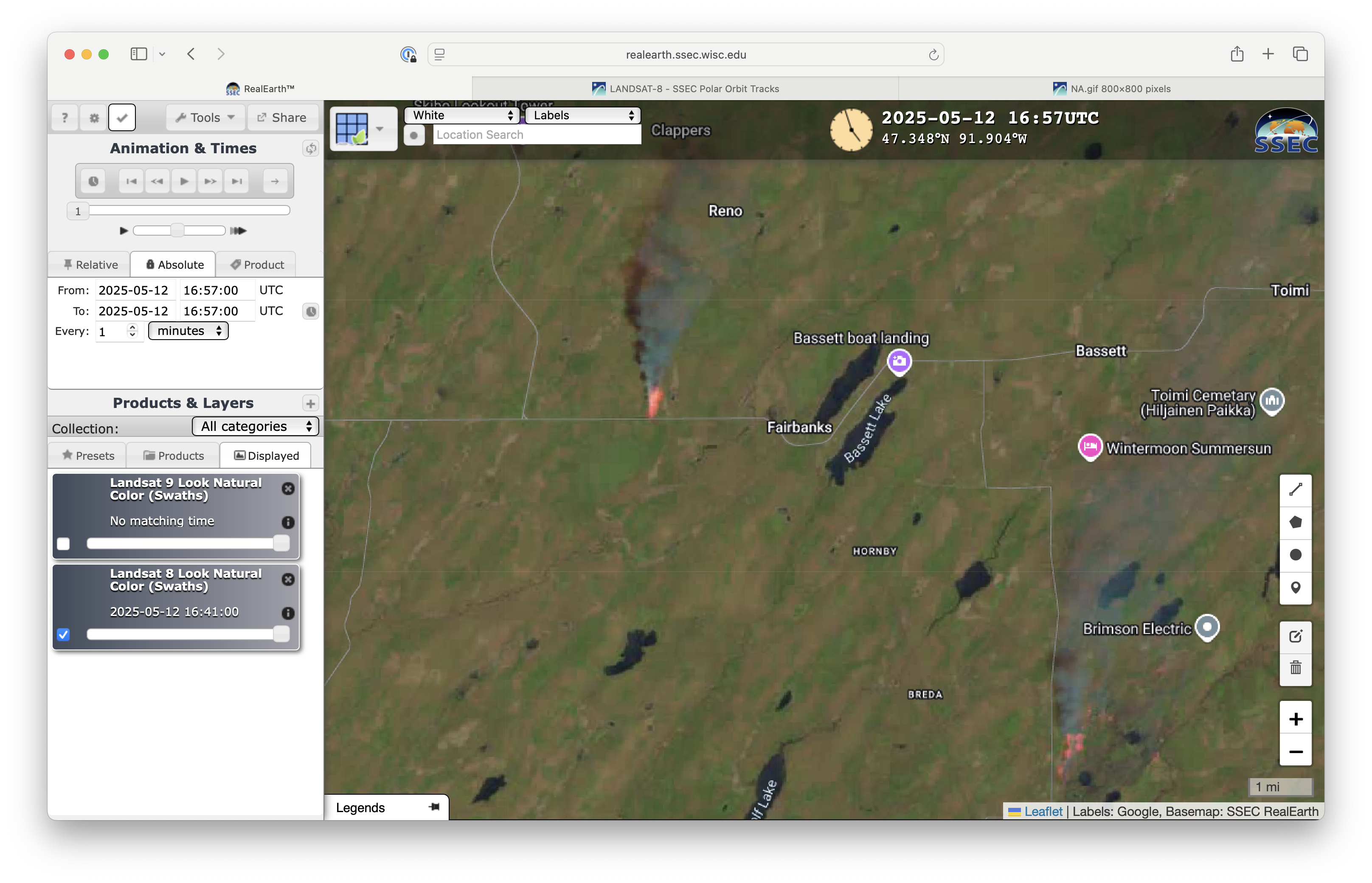
Landsat-8 “Natural Color” RGB image at 1657 UTC on 12 May [click to enlarge]