Significant Flooding in Northeast Australia
The past few days have brought devastating rain and flooding to the Australian state of Queensland, in the country’s northeast. The community of Paluma received more than 1.4 meters (4.5 feet) of rain over the weekend, and damage to roads and bridges carried out by the torrents of water have effectively cut off parts of northern Queensland from the rest of the country. Thousands of residents have been told to evacuate While the rains have started to abate, the damage will be felt for many months.
The Blended Total Precipitable Water (TPW) product provides a quantitative assessment of just how much water was present in the atmosphere. TPW is measured with microwave instruments, and thus can be measured even in the presence of clouds. However, microwave sounders are only found on polar-orbiting satellites which means that a particular location is going to be observed by several different satellites over the course of a day. Satellites from NOAA, NASA, the US Department of Defense, EUMATSAT, and others all are making TPW observations operationally. The Blended TWP product corrects across all of these instruments with their unique traits to create a globally continuous product that updates at a temporal resolution that is far finer than can be addressed by a single satellite.
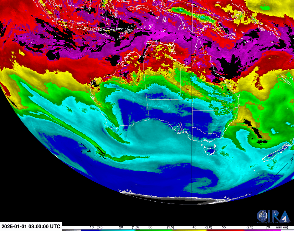
This Blended TPW loop shows the evolution of the TPW from 0300 UTC to 1700 UTC on 31 January 2025. It is clear that northeastern Australia is beset with moisture-laden air, as TPW values are easily over 70 mm.
The MIMIC-TPW2 hourly composite product is created from retrievals using AMSU-B and MSU onboard NOAA-18, NOAA-19, Metop-A and Metop-B; it also uses retrievals from ATMS onboard the Suomi-NPP, NOAA-20 and NOAA-21 polar orbiting satellites. In a 3-day animation of MIMIC-TPW2 (below), a cyclonic gyre of high TPW (with values often exceeding 70 mm, denoted by lighter shades of violet) is evident in the vicinity of far northern Queensland.
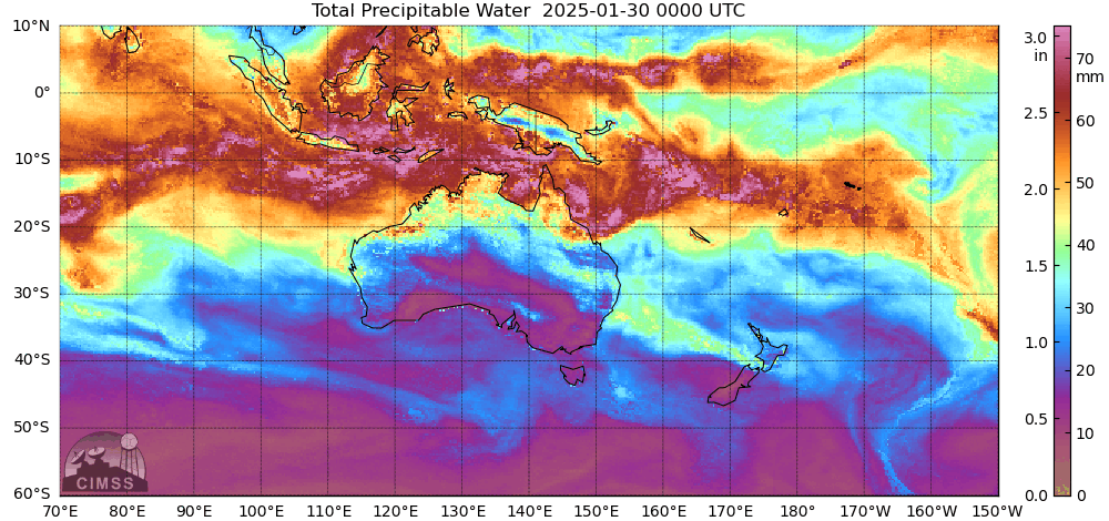
Hourly MIMIC-TPW2 images, from 0000 UTC on 30 January to 2300 UTC on 1 February
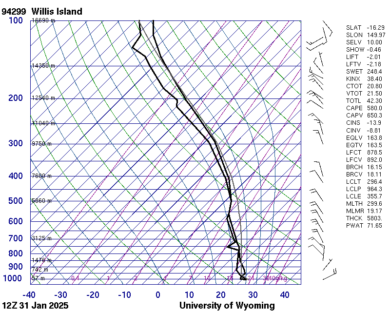
The sounding from Willis Island, about 280 miles east of the Queensland shore in the Coral Sea, affirms how moist the air was. In effect, the atmosphere was saturated throughout the whole depth of the troposphere.
The ensuing convection was extremely vigorous, with cloud top temperatures dropping below -80 C as can be seen in the zoomed-in loop of the 10.4 micron window channel from the geostationary Himawari-9 satellite. Numerous overshooting tops are present, and given the high altitude of the tropical tropopause, those clouds are topping out at over 46,000 feet (14 km). With very little lateral propagation of these storms, it’s easy to see why the rainfalls were so substantial.
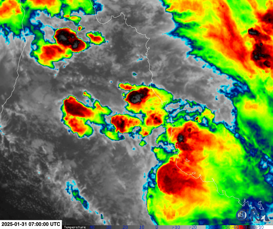
Image sources above include: CIRA RAMMB Slider, University of Wyoming Sounding Archive, CIMSS Tropical Cyclones
_________
A longer animation of Himawari-9 Infrared images (below) revealed that cloud-top 10.4 µm infrared brightness temperatures were occasionally -90ºC or colder (yellow-to-gray pixels embedded within darker purple regions) — for example, near Cairns YBCS at 1030 UTC.

Himawari-9 Clean Infrared Window (10.4 µm) images, from 0000 UTC on 31 January to 0000 UTC on 1 February (courtesy Scott Bachmeier, CIMSS) [click to enlaarge]
A Himawari-9 Rain Rate derived product from the RealEarth site is shown below — Extreme rates (shades of red to violet) were associated with some of the convective clusters.
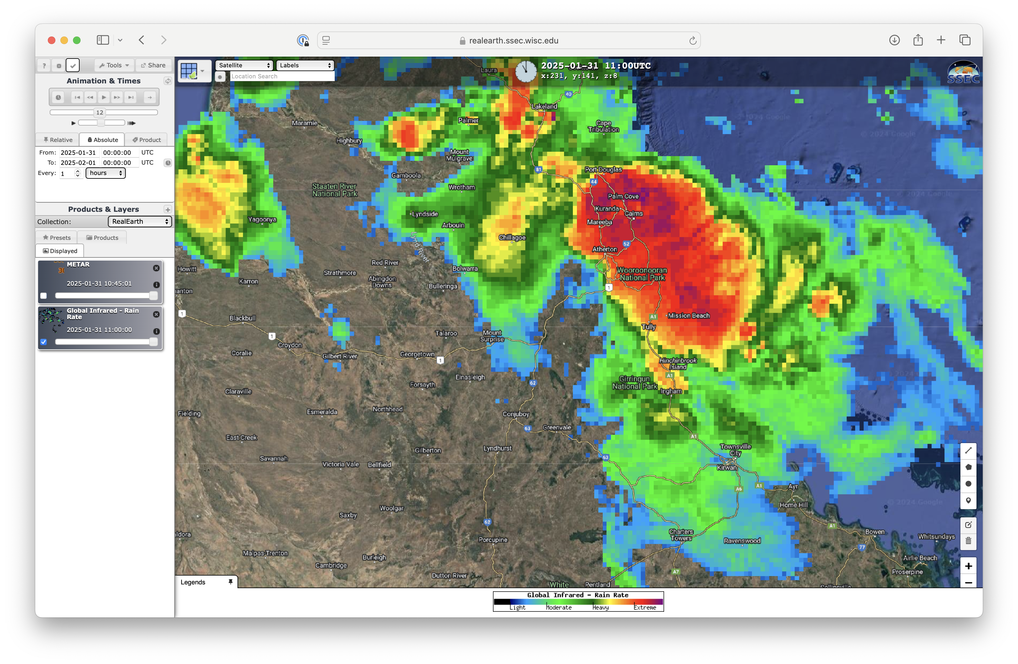
Himawari-9 Rain Rate derived product, from 0000 UTC on 31 January to 0000 UTC on 1 February (courtesy Scott Bachmeier, CIMSS) [click to play MP4 animation]