Tropical Cyclone Nat in the South Pacific Ocean
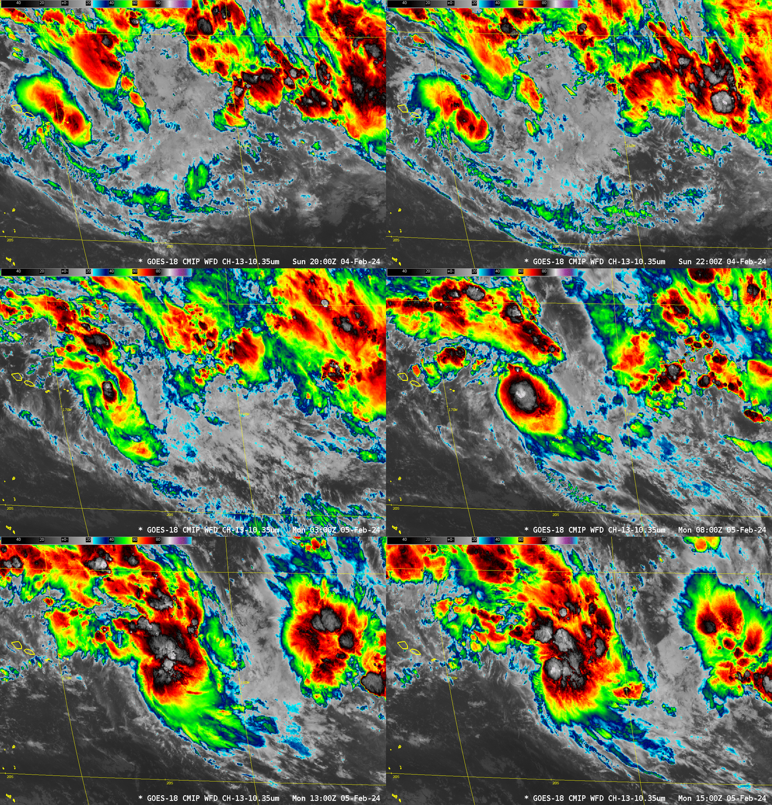
Abundant convection over the southern Pacific Ocean has organized into a tropical cyclone (named Nat) as the system moved to the east of the Samoan Islands. GOES-18 infrared imagery, above, shows the strong convection that developed just east of Olosega; by 0700 UTC on 5 February 2024, very cold cloud tops (brightness temperatures cooler than -90oC) appeared near 14oS, 165oW (shown here) as the system moved steadily to the east.
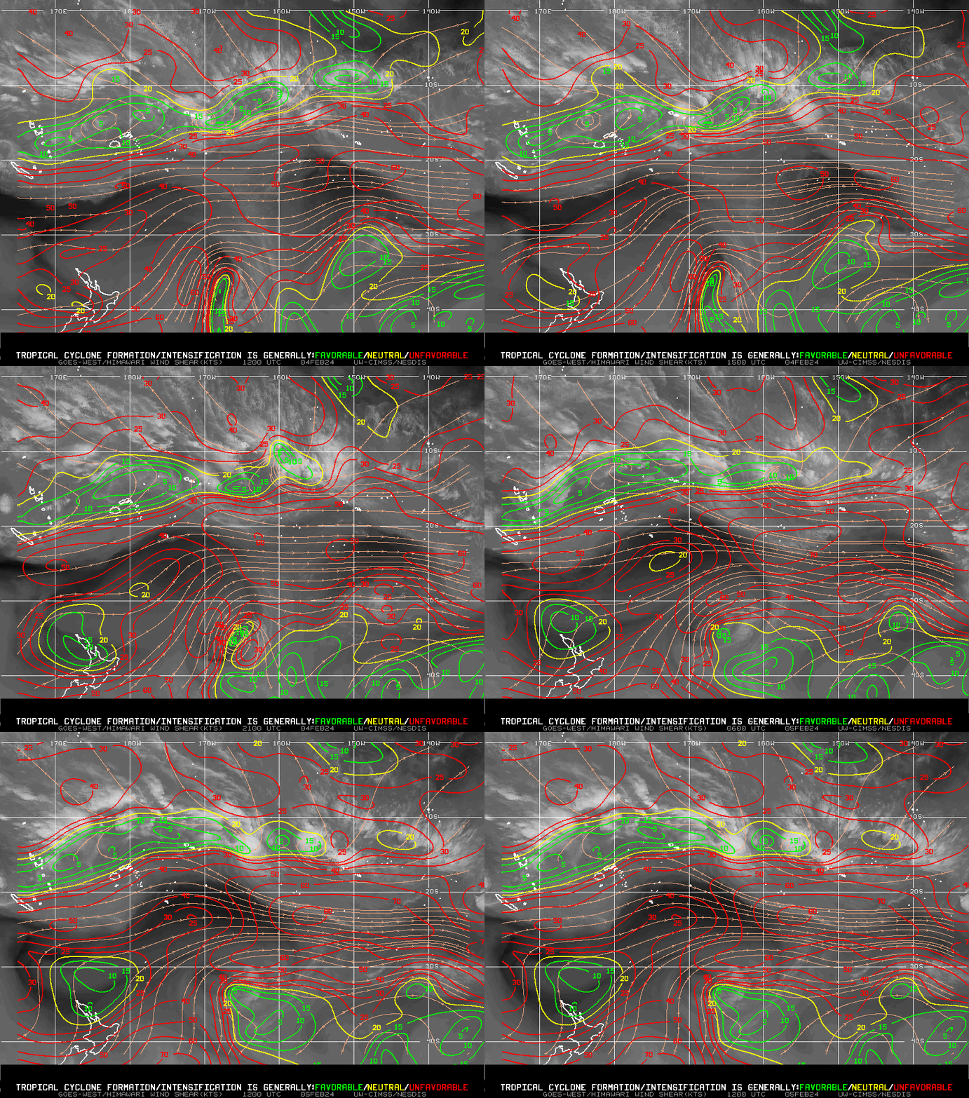
The tropical cyclone developed in a narrow ribbon of low shear values that have persisted for at least the 24 hours ending at 1200 UTC on 5 February, as shown in the analysis below from the CIMSS Tropical Cyclone page (direct link to product).
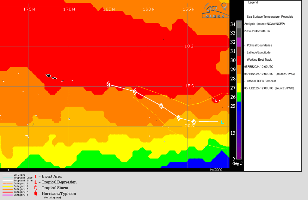
Sea-surface temperatures under the system are very warm, around 30oC. The projected path, however, take the storm poleward towards cooler SSTs. In addition, the path takes the storm where observed shear values at present quite high.
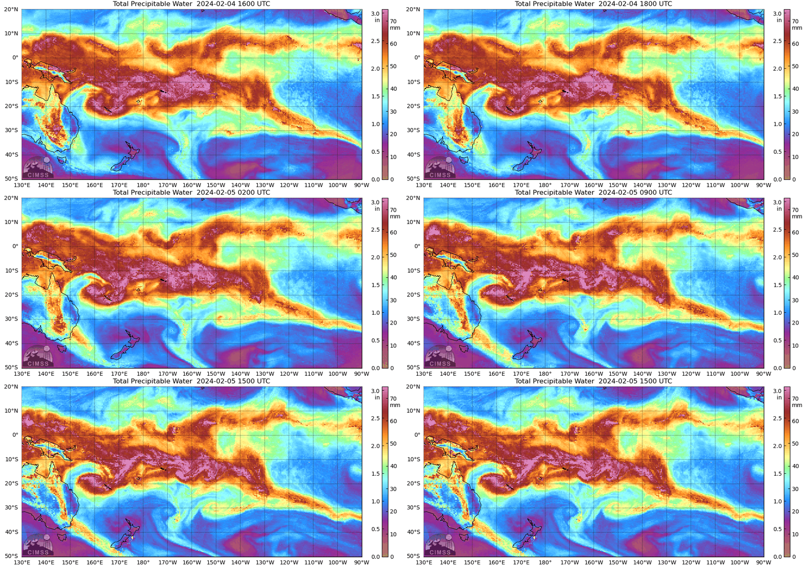
MIMIC Total Precipitable Water fields (from this site), below, show a cyclonic spin developing just east of the Samoan Islands as the storm develops. A second invest area exists near 150 W, to the east of the Tropical Cyclone, and another tropical invest is near Vanautu at 160 E. (Click here).
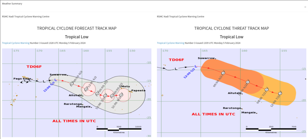
The Regional Specialized Meteorology Center (RSMC) in Fiji (link) is issuing advisories on this storm, as shown below. The forecast path is towards the east-southeast towards 20oS latitude. The Joint Typhoon Warning Center (link) is also issuing advisories (here is the 1500 UTC 5 February 2024 graphic). Some strengthening is forecast for 5-6 February, with slow weakening after that.
More information on this Cyclone is available at the CIMSS Tropical Website, at the JTWC and at the RSMC in Fiji.

