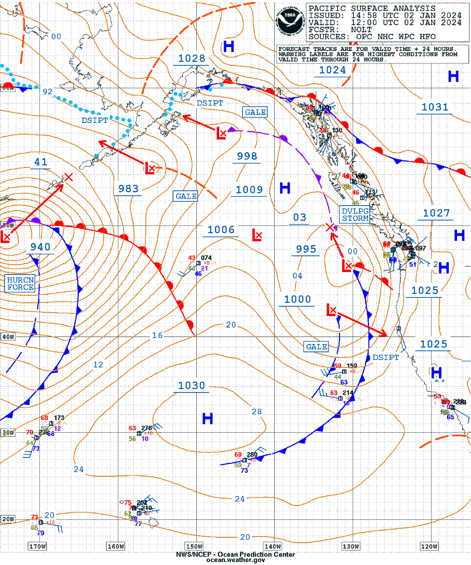
Hurricane Force Low approaches the Aleutian Islands

GOES-18 Air Mass RGB images, from 1530 UTC on 02 January to 1900 UTC on 03 January [click to play animated GIF]
As the low passed near Buoy 46072 (located just east of PAAK), the pressure there dropped to 942.7 hPa at 1940 UTC on 02 January (below).
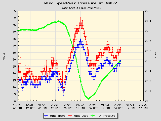
Plot of wind speed, wind gust and air pressure at Buoy 46072
GOES-18 Air Mass RGB images with plots of Metop ASCAT winds at 2150 UTC on 02 January and 0730 UTC on 03 January (below) depicted wind speeds in the 50-60 knot range to the south and southwest of the low center.
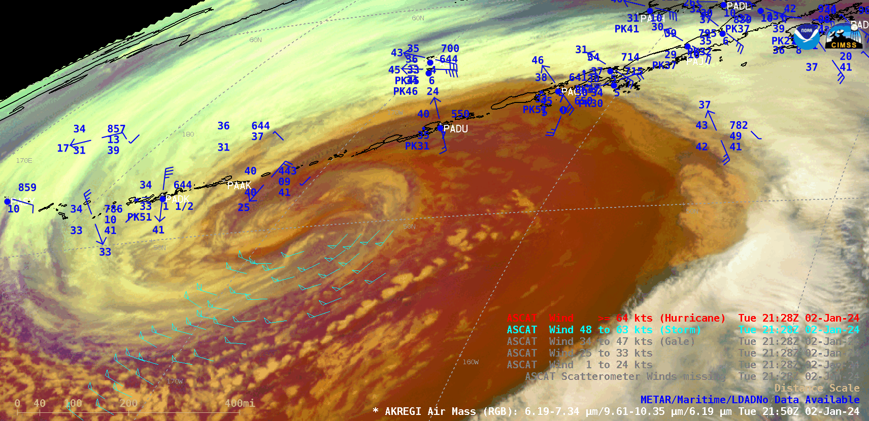
GOES-18 Air Mass RGB images with Metop ASCAT winds plotted in cyan, at 2150 UTC on 02 January and 0730 UTC on 03 January [click to enlarge]

GCOM-W1 AMSR2 Wind Speeds, at 1332 UTC on 02 January and 0042 UTC on 03 January [click to enlarge]