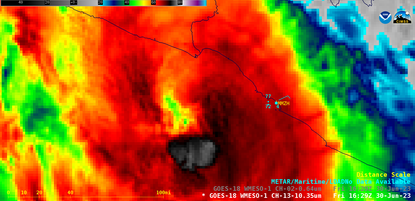
East Pacific Hurricane Beatriz off the coast of Mexico

GOES-18 “Red” Visible (0.64 µm) and “Clean” Infrared Window (10.3 µm) images [click to play animated GIF | MP4]
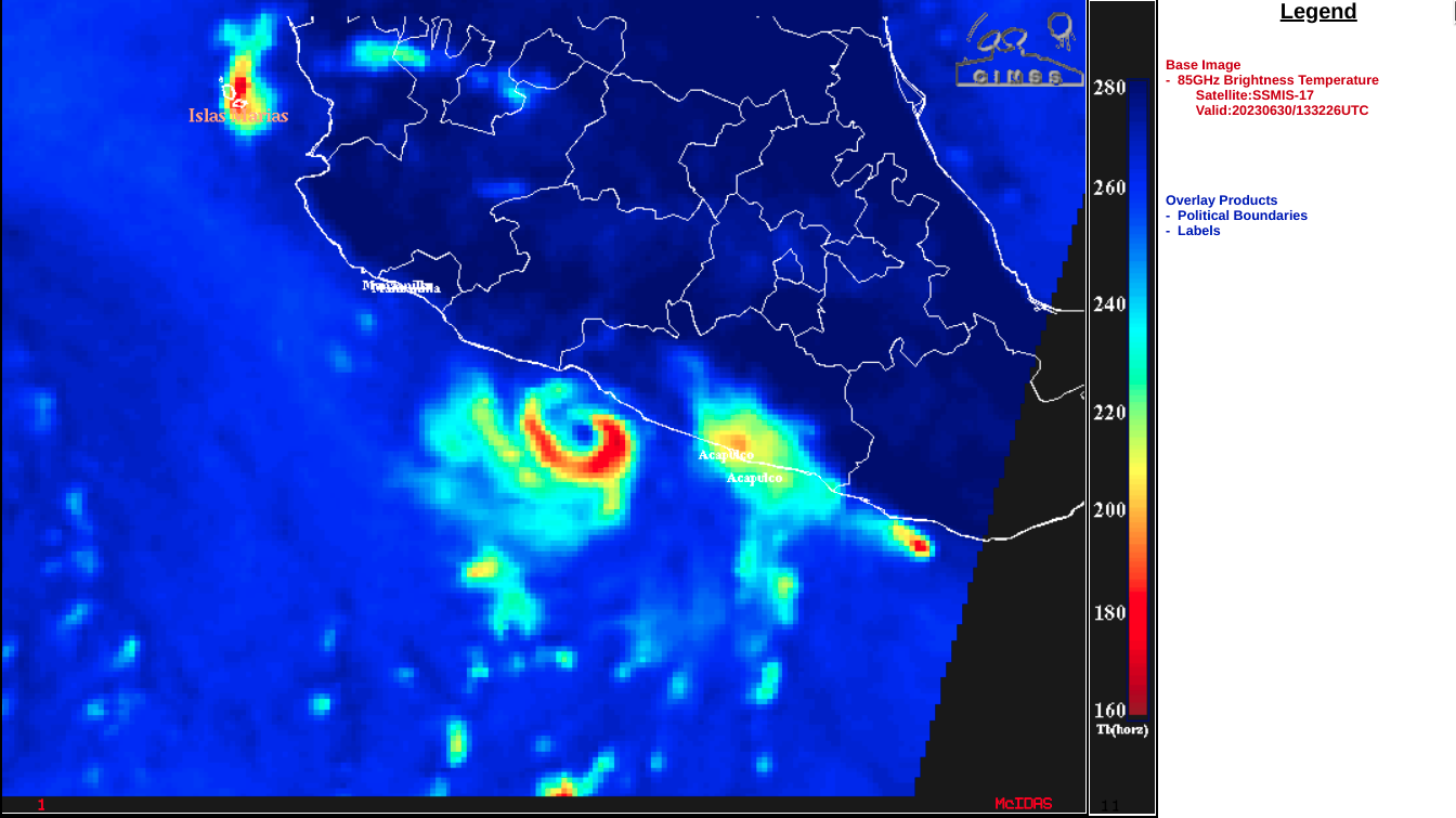
A DMSP-17 Microwave (85 GHz) image at 1322 UTC (below) from the CIMSS Tropical Cyclones site indicated that the eyewall had not yet completely closed at that time.
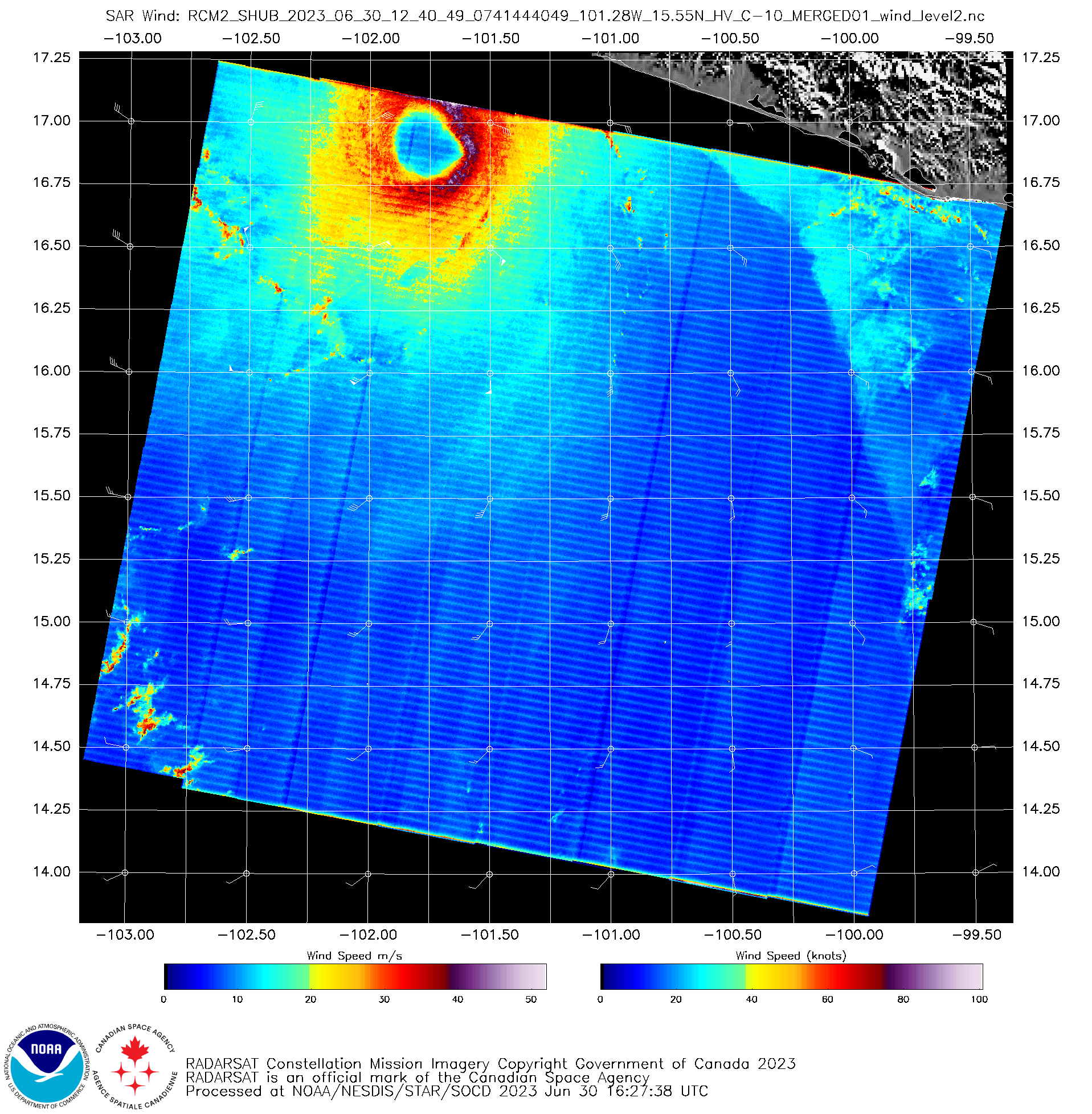
However, Synthetic Aperture Radar (SAR) winds (below) from an earlier 1240 UTC overpass of RCM-2 (source) did suggest that a closed eye had formed — and the peak radial wind speed at that time was 79 knots.


