Tehuano gap wind event

True Color RGB mages from GOES-18 (left), GOES-17 (center) and GOES-16 (right) [click to play animated GIF | MP4]
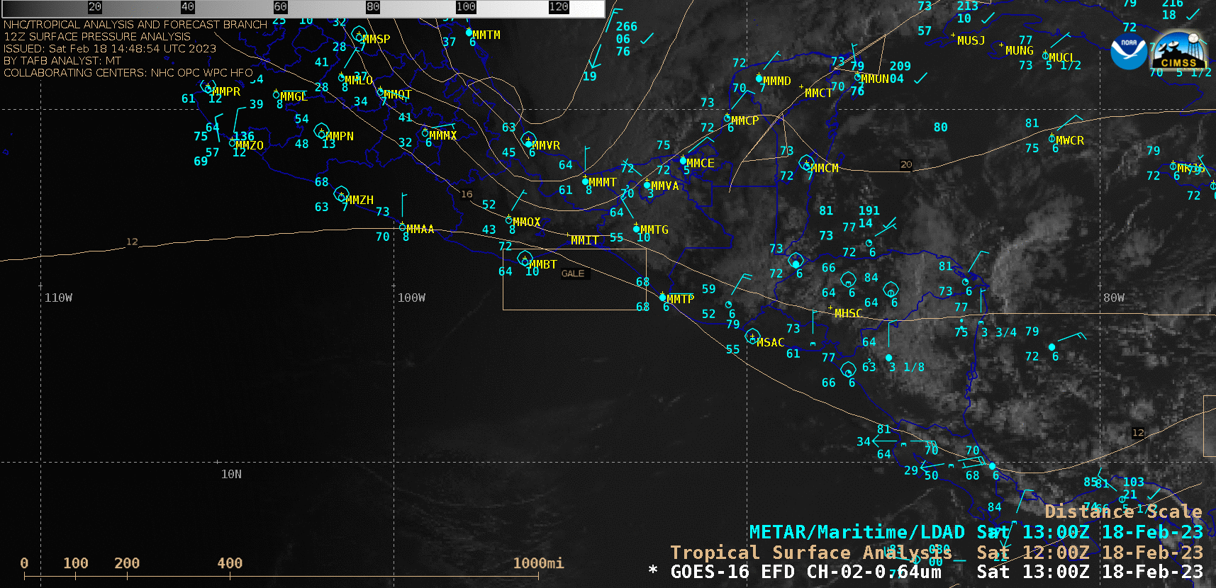
GOES-16 “Red” Visible (0.64 µm) images, with plots of hourly surface/ship/buoy reports and the 18 UTC surface analysis [click to play animated GIF | MP4]
In a closer view of regional topography (below), the narrow Chivela Pass could be seen north-northeast of Ixtepec (station identifier MMIT), through which the northerly flow of cold air is accelerated.
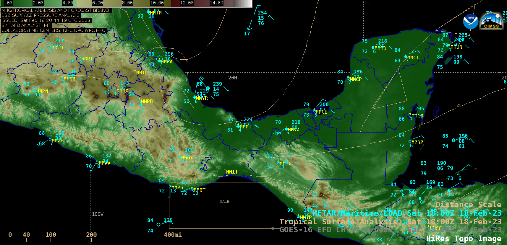
Topography image, with plots of surface/ship/buoy reports and the surface analysis at 18 UTC [click to enlarge]
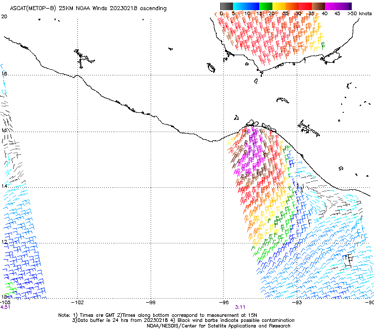
ASCAT wind barbs from Metop-B and Metop-C [click to enlarge]