Super Typhoon Hinnamnor in the West Pacific
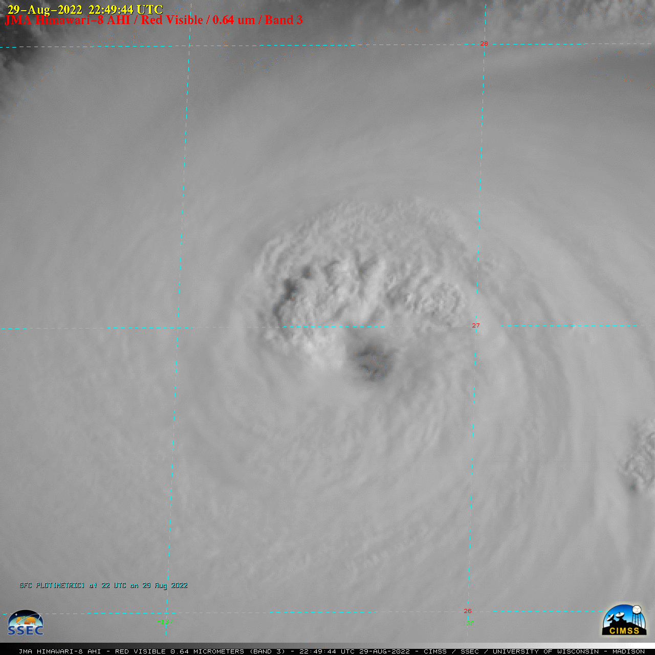
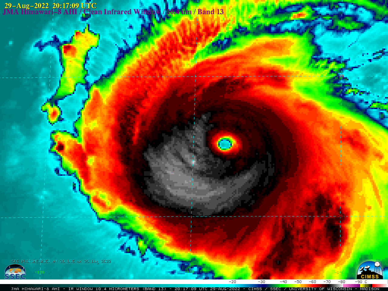
2.5-minute rapid scan JMA Himawari-8 Visible (0.64 µm) images (above) showed rapidly-intensifying Category 4 Typhoon Hinnamnor as it moved across the West Pacific Ocean (southeast of Japan) on 29 August 2022. Mesovortices within the eye were faintly evident though breaks in patchy high clouds overhead.2.5-minute Himawari-8 Infrared (10.4 µm) images (below) revealed a few pulses of convection which exhibited cloud-top infrared brightness temperatures of -80°C and colder (violet pixels).
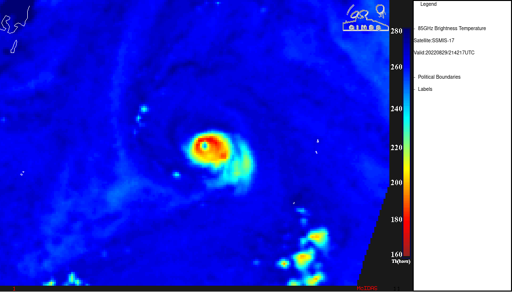
A DMSP-17 SSMIS Microwave (85 GHz) image at 2142 UTC from the CIMSS Tropical Cycones site (below) also depicted the well-defined eye and eyewall structure.===== 30 August Update =====
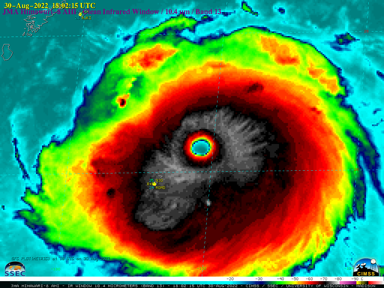
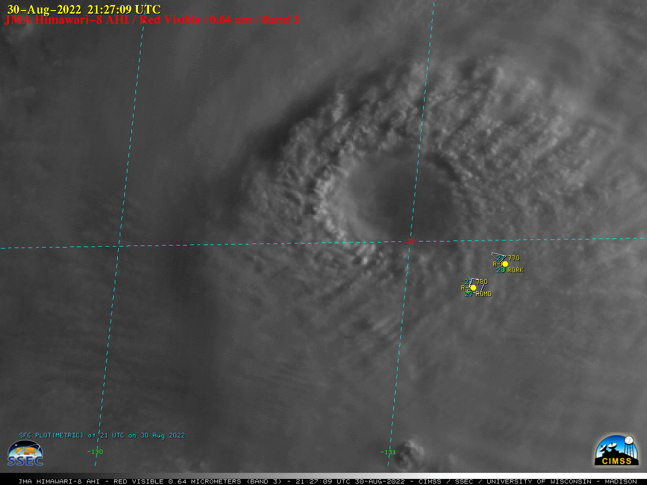
On the following day, Himawari-8 Infrared (10.4 µm) images (above) showed the well-defined eye and surrounding eyewall as Hinnamnor reached Category 5 intensity at 1200 UTC. An eyewalll replacement cycle began around 2100 UTC, leading to a slight decline in intensity (to Category 4) and a deteriorating eye structure.Post-sunrise Himawari-8 Visible (0.64 µm) images (below) better showed how close the eye passed to the Japanese islands of Kitadait?jima (RORK, where winds gusted to 98 knots) and Minamidait?jima (ROMD, where winds gusted to 69 knots).
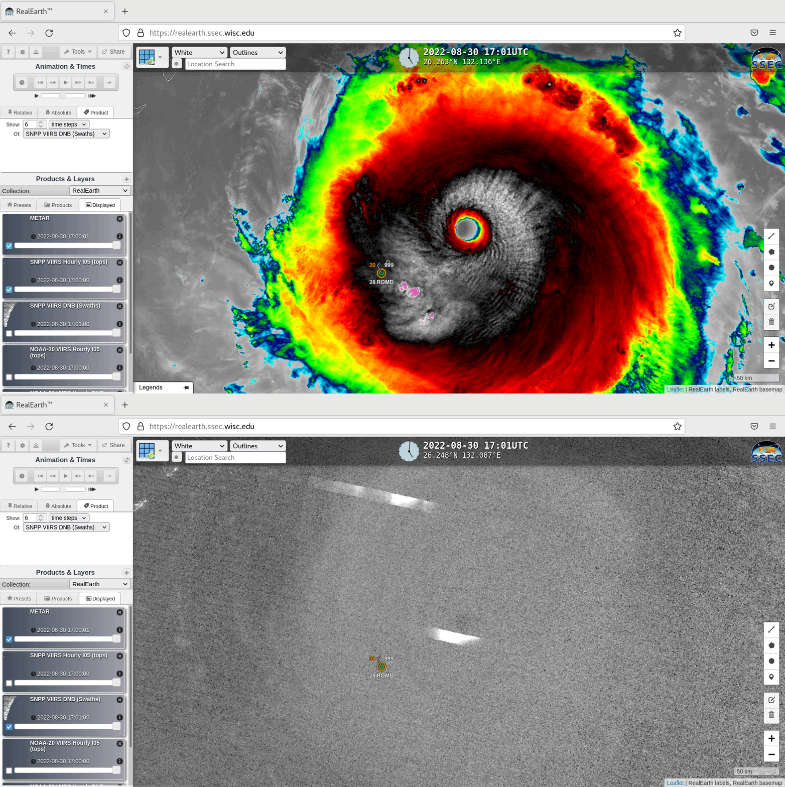
In a toggle between nighttime Suomi-NPP VIIRS Infrared Window (11.45 µm) and Day/Night Band (0.7 µm) images valid at 1717 UTC, viewed using RealEarth (below), the Day/Night Band image displayed a bright lightning streak just southwest of the eye — showing clouds within the eyewall being illuminated by intense lightning activity; cloud-top gravity waves were evident southeast of the eye in the Infrared image.