Valentine’s Day snow event in the Kansas City area
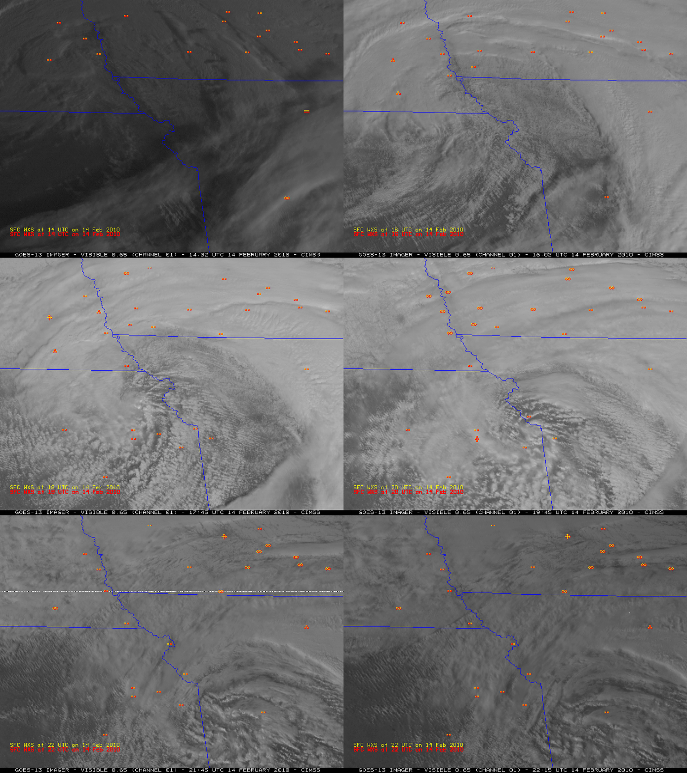
The National Weather Service forecast office at Kansas City / Pleasant Hill, Missouri posted a nice overview of the Valentine’s Day snow event that caused a number of multiple-vehicle accidents in the Kansas City area. McIDAS images of the 1-km resolution GOES-13 visible channel data (above) revealed the tight circulation of the system as it spiraled across the area, as well as the development of mesoscale convective elements that produced moderate to heavy snowfall rates on 14 February 2010.
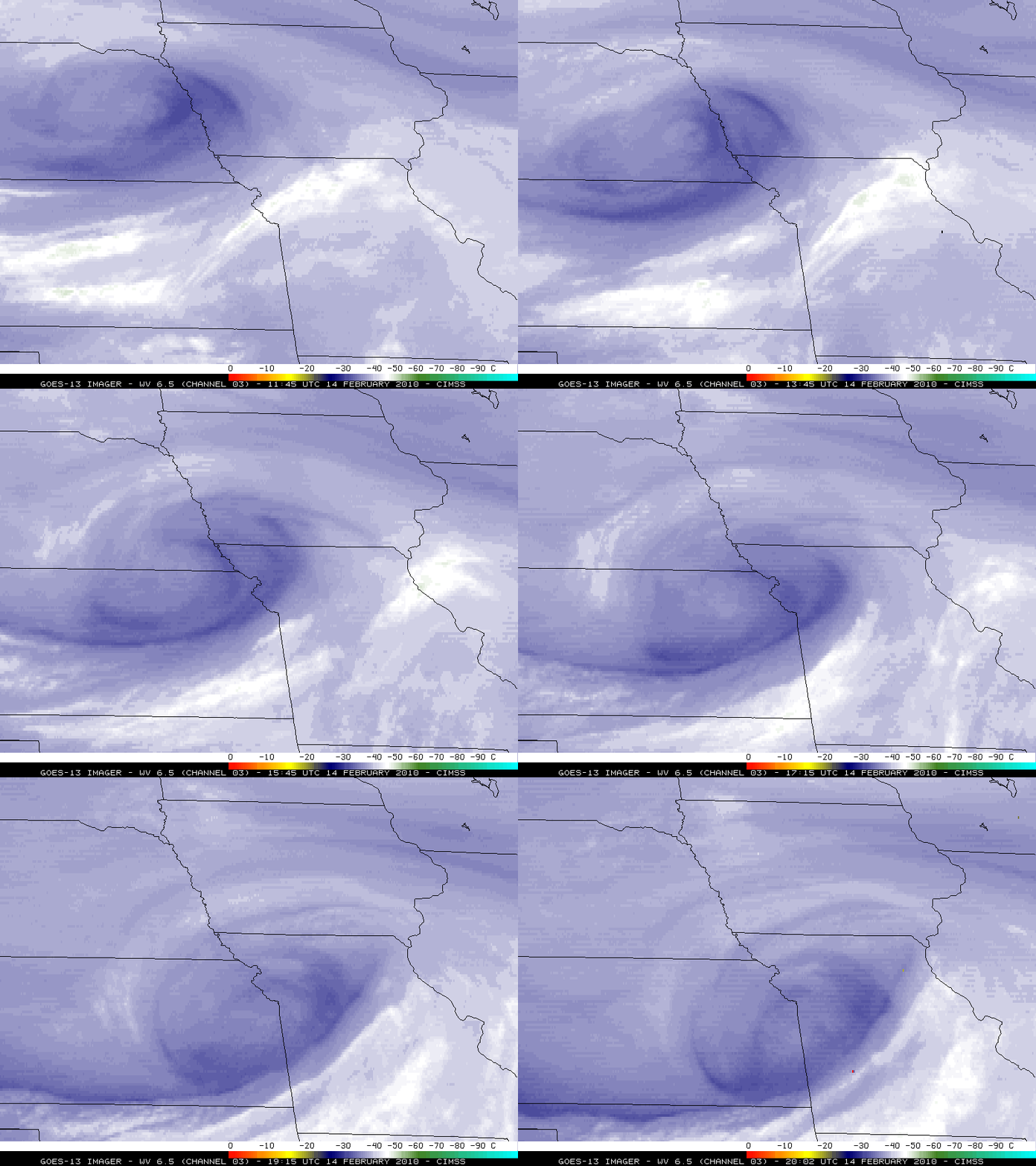
An animation of the 4-km resolution GOES-13 6.5 µm water vapor channel images (below) showed the mid-tropospheric circulation associated with the disturbance as it propagated southeastward across the region.
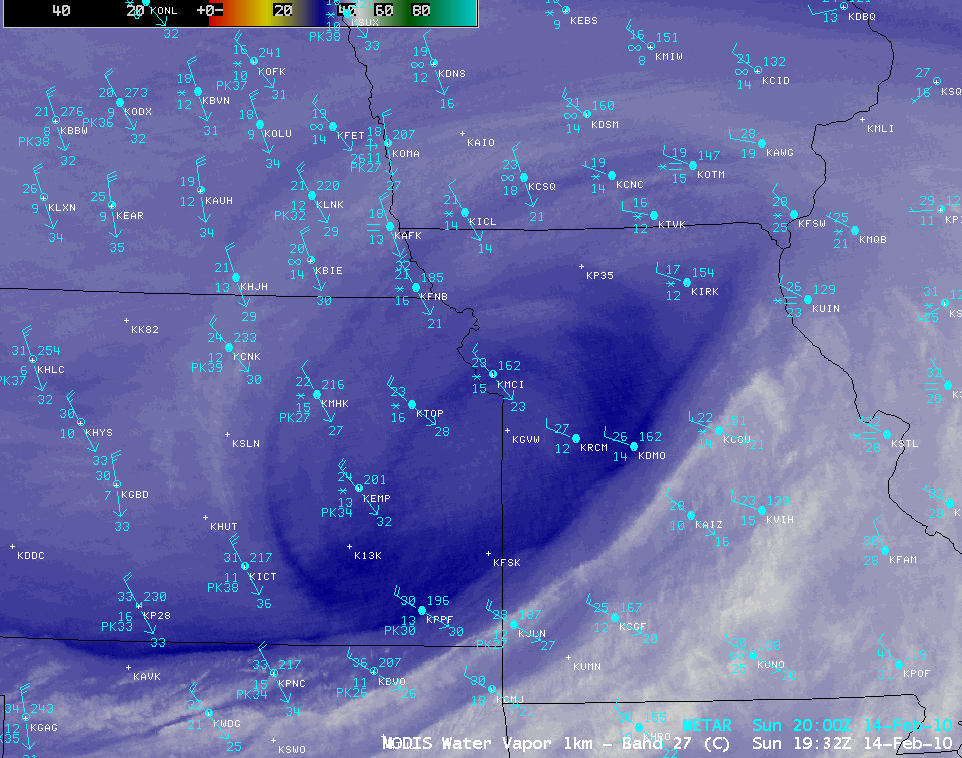
An AWIPS image of the 1-km resolution MODIS 6.7 µm water vapor channel data (below) showed a better picture of the mid-tropospheric circulation at 19:32 UTC or 1:32 pm local time.
==================
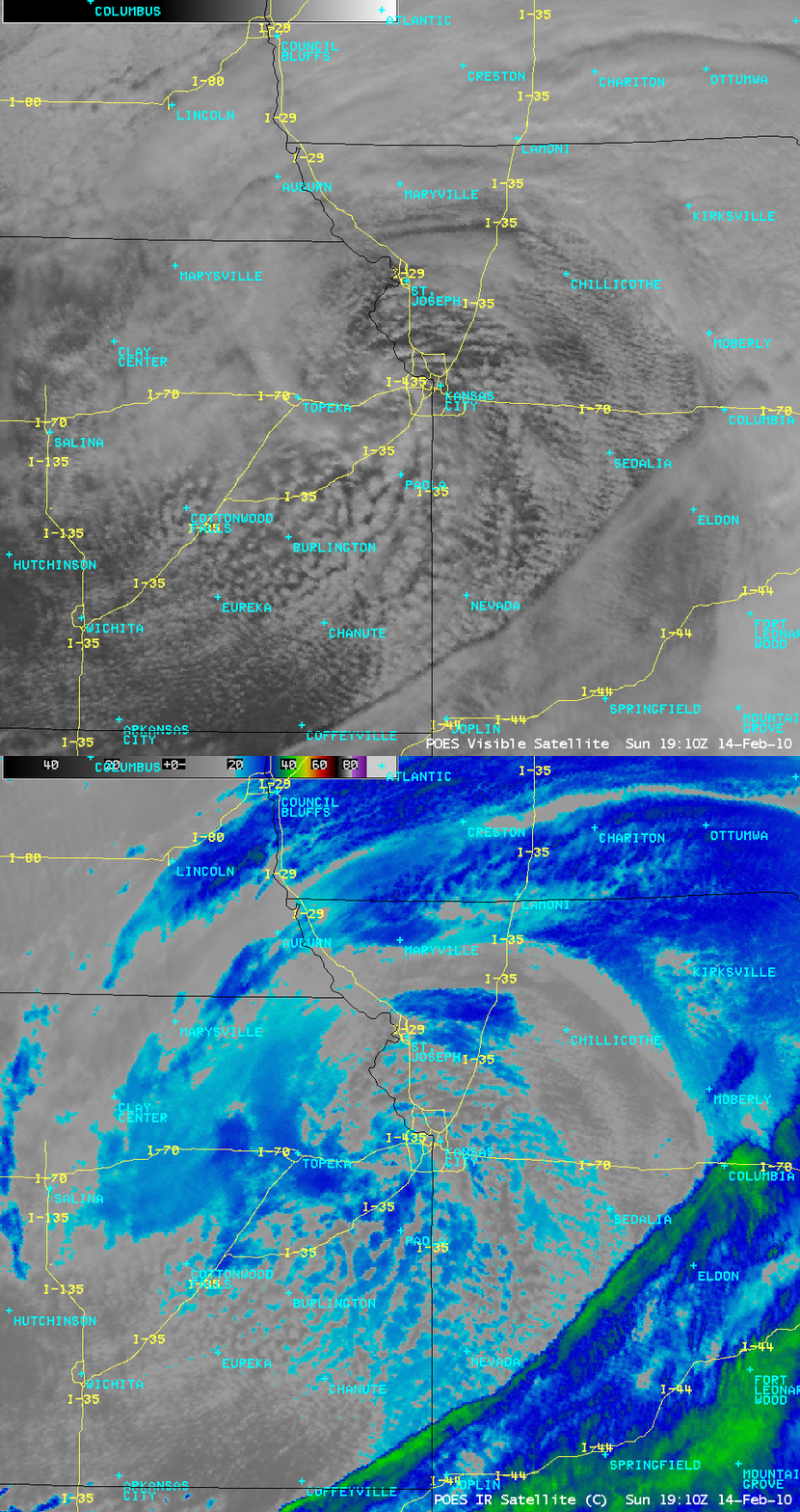
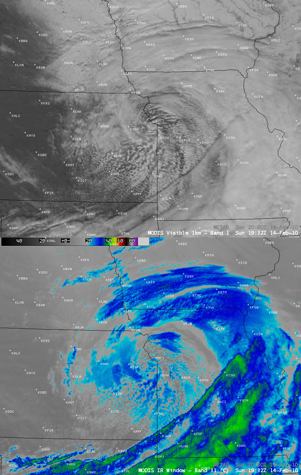
AWIPS images of the 1-km resolution POES AVHRR visible channel and 10.8 µm IR channel data (above) and the 1-km resolution MODIS visible channel and 11.0 µm IR channel data (below) offered closer views of the convective elements that were producing mesoscale areas of moderate to heavy snowfall rates. Many of the cloud top IR brightness temperatures were in the -20º to -30º C range (cyan to dark blue color enhancement).
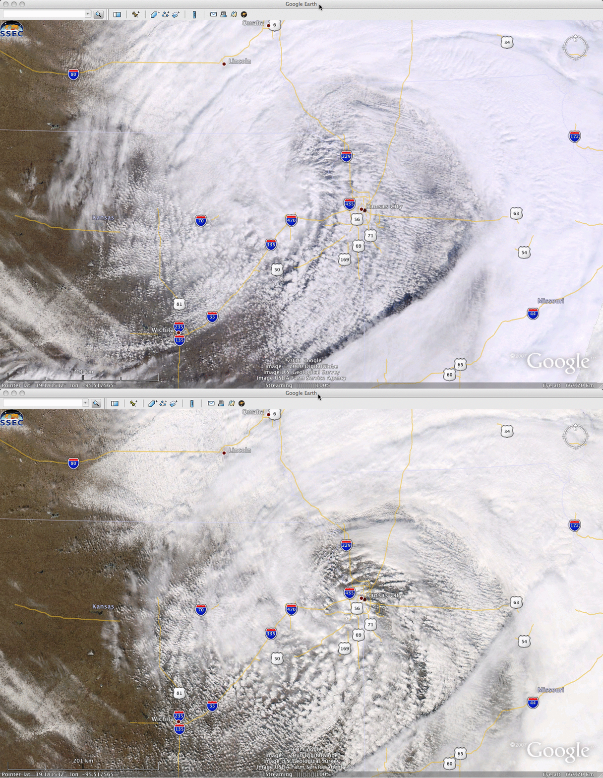
A comparison of 250-meter resolution MODIS Red/Green/Blue (RGB) true color images from the SSEC MODIS Today site (below, displayed using Google Earth) offered a very detailed view of the cloud structures at the time of the Terra satellite overpass (17:55 UTC or 11:55 am local time) and the Aqua satellite overpass (19:32 UTC or 1:32 pm local time).


