Pyrocumulonimbus clouds with lightning produced by the Dixie Fire in California
![GOES-17 “Red” Visible (0.64 µm, top left), Shortwave Infrared (3.9 µm, top right), “Clean” Infrared Window (10.35 µm, bottom left) and Fire Temperature RGB (bottom right) [click to play animation | MP4]](https://cimss.ssec.wisc.edu/satellite-blog/images/2021/07/210719_goes17_visible_shortwaveInfrared_infraredWindow_fireTemperatureRGB_Dixie_Fire_CA_anim.gif)
GOES-17 “Red” Visible (0.64 µm, top left), Shortwave Infrared (3.9 µm, top right), “Clean” Infrared Window (10.35 µm, bottom left), and Fire Temperature RGB (bottom right) [click to play animation | MP4]
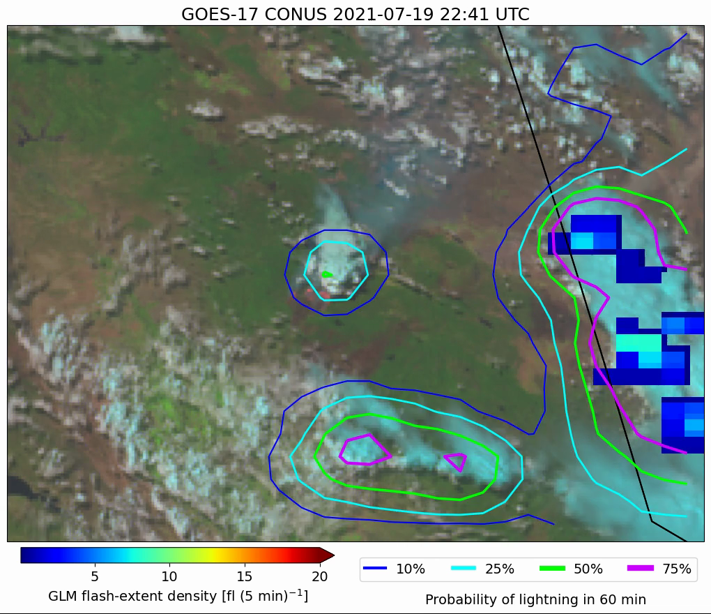
GOES-17 Day Land Cloud Fire RGB images (below) include plots of GLM Flash Extent Density and contours of ProbSevere LightnngCast probability — and show that LightningCast probability exceeded 50% as early as 2241 UTC (the time of the initial pyroCb formation), with the first GLM lightning being detected 40 minutes later at 2321 UTC. LightCast probability first exceeded 75% at 2341 UTC — with GLM Flash Extent Density increasing in coverage and intensity 30 minutes later after 0011 UTC (associated with the second pyroCb anvil as it drifted north-northeastward).

GOES’-17 Day Land Cloud Fire RGB images, with GLM Flash Extent Density and contours of ProbSevere LightningCast probability (credit: John Cintineo, CIMSS) [click to play MP4 animation]