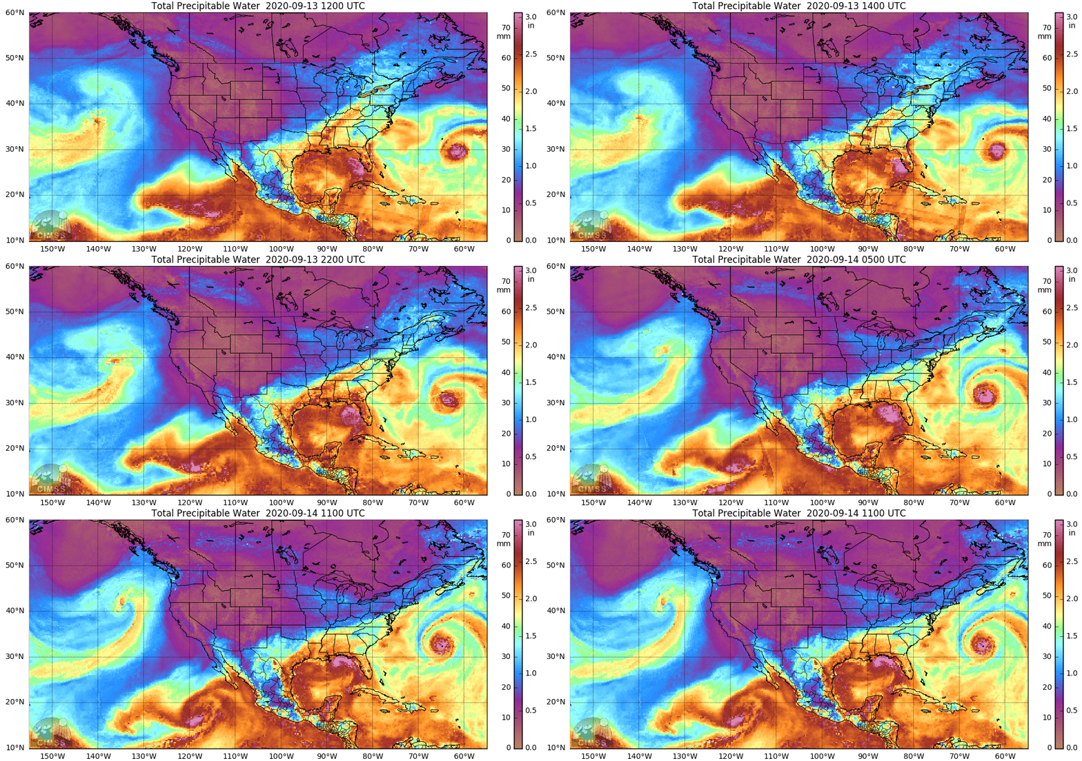
Hurricane Sally in the northern Gulf of Mexico
Sally was upgraded to a Hurricane at 1600 UTC on 14 September. (Link)
Hurricane warning have been issued along the central Gulf Coast on 14 September as strengthening tropical storm Sally approached. MIMIC estimates of total precipitable water, above, for the 24 hours ending at 11 UTC on 14 September show the moist airmass in the Gulf that is helping to sustain the storm. (Also apparent in the imagery: Hurricane Paulette, moving over the island of Bermuda, and Pacific Tropical Storm Karina. (For more information on these storms (and other storms during this active Atlantic Hurricane Season), and for the latest on Sally, refer to the National Hurricane Center)
Both Suomi NPP and NOAA-20 overflew Sally between 0700 and 0800 UTC on 14 September, and Day Night Band imagery for the storm (source) is shown below. The 50-minute time step between the two images show little because of a lack of lunar illumination, but westward expansion of the cloud shield near the Mississippi River delta is apparent. This suggests adequate upper-level divergence for continued storm intensification.
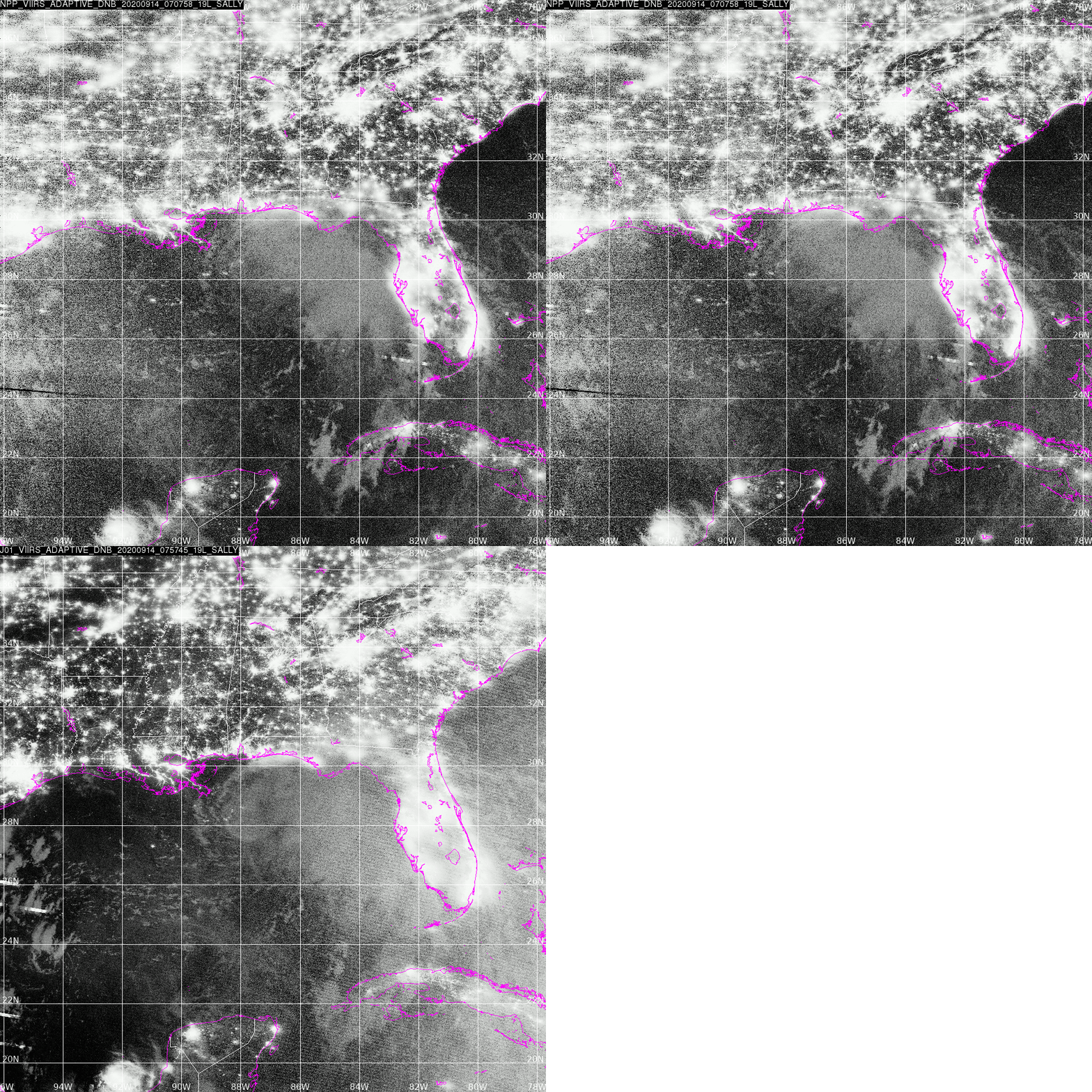
Suomi NPP (0707 UTC ) and NOAA-20 (0757 UTC) Day Night Band imagery on 14 September 2020 (Click to enlarge)
GOES-16 animations of infrared imagery for the 12 hours endings near 1300 UTC on 14 September, below, also show an expansion in the size of the coldest cloud tops in the storm’s center. A frontal zone is also apparent in the infrared imagery, stretching from New York/Pennsylvania southwestward to north Texas. This front will limit how far north the effects of Sally — post landfall — can move. (The forecast as of 14 September moves the post-landing remnants of Sally through Georgia).
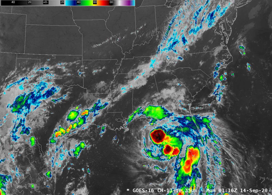
GOES-16 Clean Window Infrared (10.3 µm) Imagery over Sally, 0116 – 1316 UTC 14 September 2020 (Click to animate)
Low-level Water vapor infrared imagery (GOES-16 Band 10, at 7.3 µm; click here for the Upper-level Water vapor infrared imagery, at 6.2 µm), below, using an enhancement courtesy William Churchill, WFO Key West (Click here for the Band 10 animation with a more familiar, perhaps, ‘dry yellow’ enhancement), also shows the expansion of the clouds in the central core of the storm. An apparent outflow channel from the storm south over Cuba also shows up in the animation.
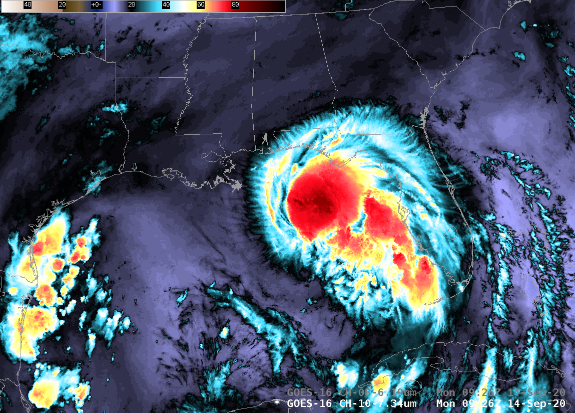
GOES-16 Low-Level water vapor Infrared (7.3 µm) Imagery over Sally, 0926 – 1331 UTC 14 September 2020 (Click to animate)
A GOES-16 mesoscale sector is viewing the development of Sally, allowing for 1-minute imagery. Visible imagery below, for two hours shortly after sunrise, shows active convection ongoing in the center of the storm and an obvious expansion of the central dense overcast. Both things support strengthening is the inner core structure.
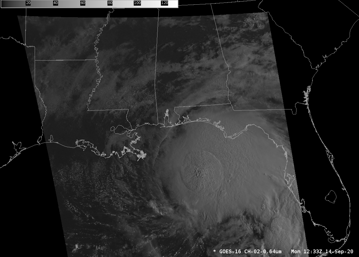
GOES-16 Visible (0.64 µm) imagery, every minute, from 1233 to 1432 UTC on 14 September 2020 (Click to animate)
===== 21 UTC Update =====
![GOES-16 “Red” Visible (0.64 µm) and “Clean” Infrared Window (10.35 µm) images (with and without an overlay of GLM Flash Extent Density) [click to play animation | MP4]](https://cimss.ssec.wisc.edu/satellite-blog/images/2020/09/sally_vis-20200914_210025.png)
GOES-16 “Red” Visible (0.64 µm) and “Clean” Infrared Window (10.35 µm) images (with and without an overlay of GLM Flash Extent Density) [click to play animation | MP4]
You can find more information on Sally at the SSEC Tropical Website (Link). For official forecasts, refer to the pages of the National Hurricane Center. Interests along the central Gulf Coast should be preparing for the arrival of this storm, in addition to monitoring its progress.


