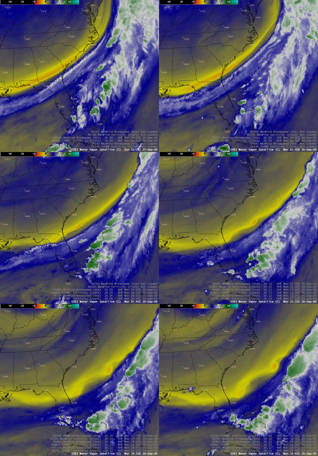
Instability vortices along a jet stream axis
AWIPS images of the GOES-12 6.5 µm “water vapor channel” (above) revealed a pair of vortices immediately poleward of a well-defined jet stream axis that was moving over the southeastern US on 28 September 2009. It was initially thought that these vortices may have represented either a type of Kelvin-Helmholtz instability (which can occur when there is sufficient velocity difference across the interface between two fluids) or a type of Rayleigh-Taylor instability (which can occur along an interface of two fluids of different densities) — however, a more likely explanation might be that these vortices were a result of barotropic instability, where the waves grew by extracting kinetic energy from the shear flow from which they were embedded.
If a horizontal circulation developed due to barotropic instability being forced by the horizontal wind shear, this could result in the formation of the vortex structures seen on the water vapor imagery. The warm/dry spot on the images (exhibiting brightness temperature values as warm as -11º C, darker orange color enhancement) was probably a pocket of warm/dry air that originated from the poleward edge of the moisture gradient — once the vortex formed, the warm/dry air in the center could not escape, and its properties would be preserved. (Thanks to Jordan Gerth, Justin Sieglaff and Chris Rozoff at CIMSS…and Michael Morgan at UW-AOS for providing valuable inputs and helping to provide an explanation)
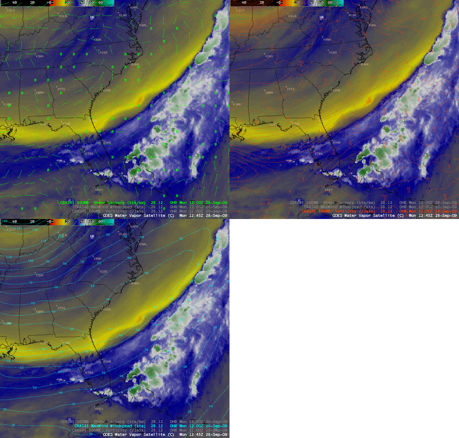
Overlays of parameters from the 45-km resolution CRAS model at 12:00 UTCÂ (below) showed the presence of a 50-60 knot jet axis just south of the primary dry-to-moist gradient on the water vapor image, along with a ribbon of 500 hPa vorticity and a 500 hPa wind shear axis over the region where the water vapor vortices were forming.
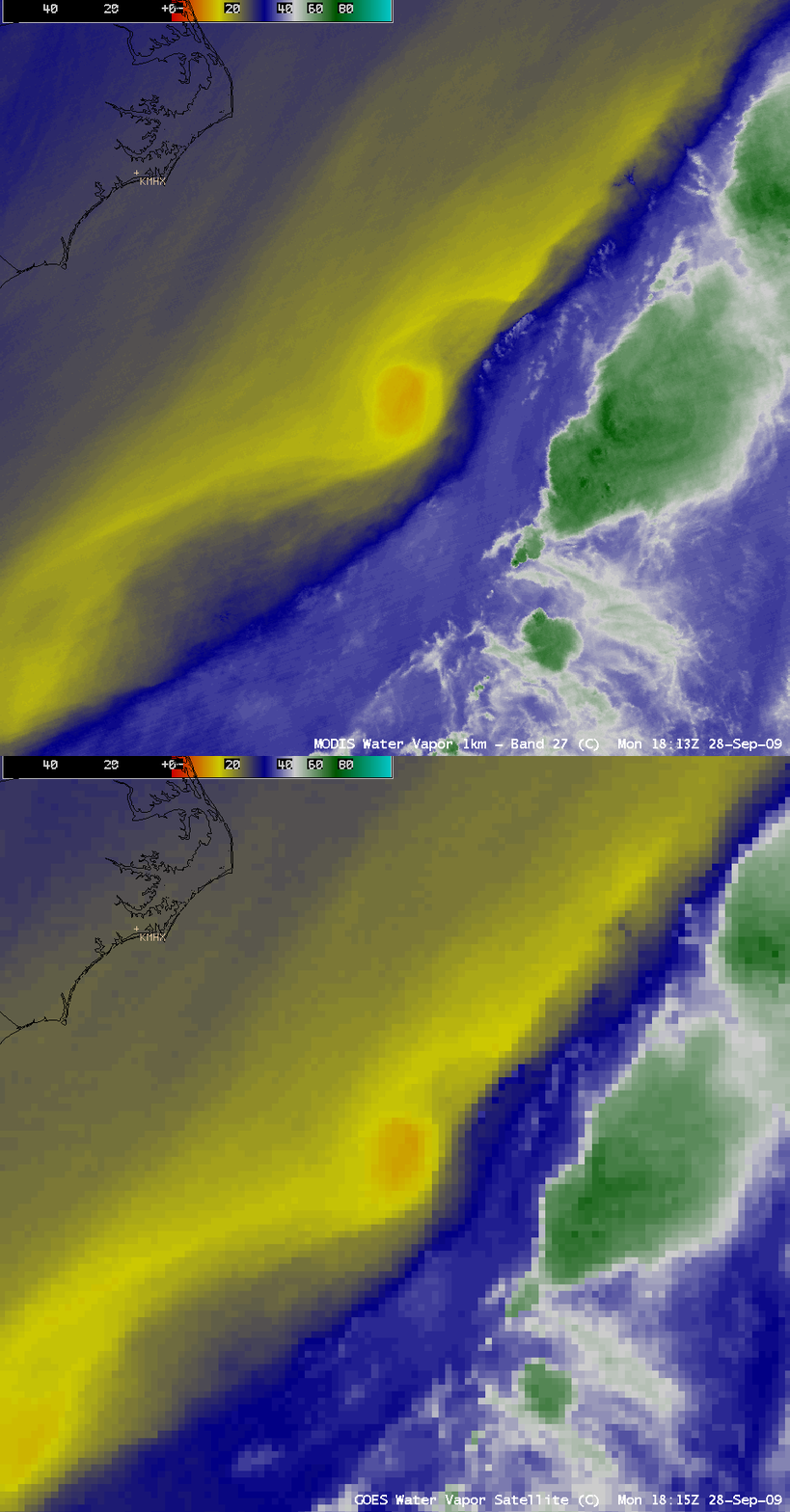
A comparison of the 1-km resolution MODIS 6.7 µm water vapor image and the 4-km resolution GOES-12 6.5 µm water vapor image (below) show the advantage of improved spatial resolution for displaying the structure and gradients associated with the leading vortex around 18:15 UTC.
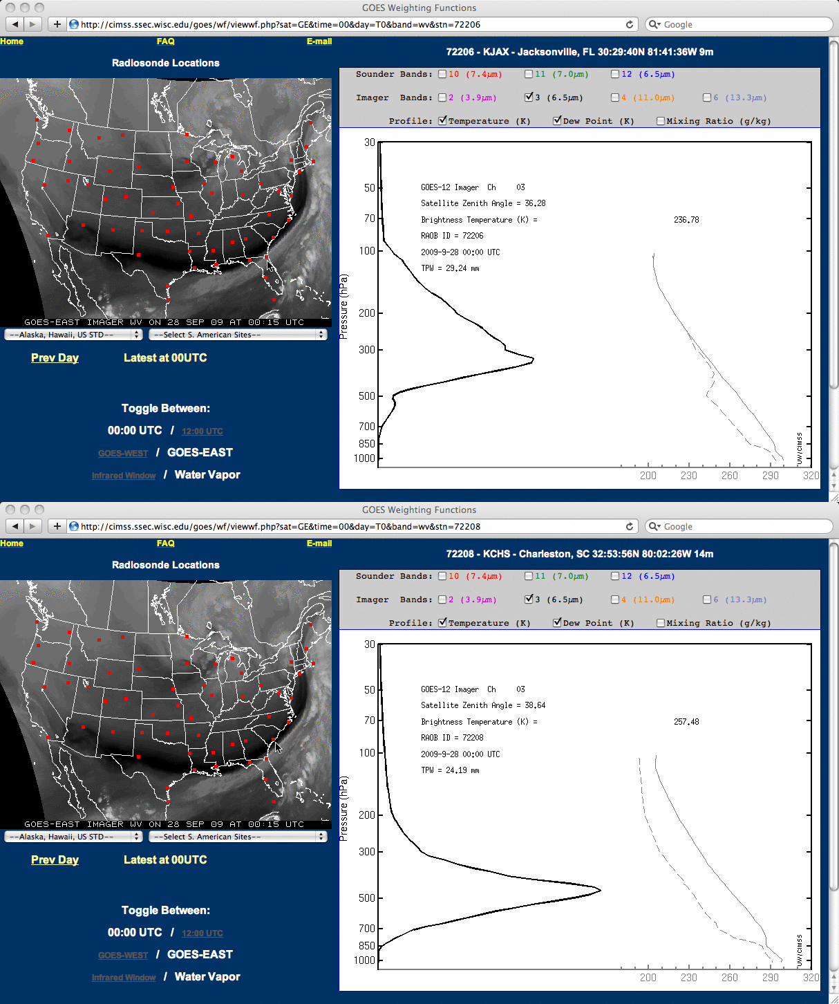
Examining the GOES-12 imager water vapor weighting function profiles at 00:00 UTC for Charleston SC (located in the “dry” portion of the sharp water vapor image gradient) and Jacksonville FL (located in the “moist” portion of the sharp water vapor image gradient) shows that there would be a pronounced downward shift in the altitude of features displayed on the water vapor image in the region of dry air located poleward of the jet stream axis.
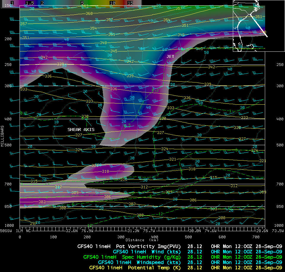
A northwest-to-southeast oriented vertical cross section using GFS40 model fields (below) displayed a minor intrusion of potential vorticity (the colored image portion of the cross section) downward into the upper troposphere immediately poleward of the jet stream core (which was located between the 200 and 250 hPa pressure levels). The wind speed shear axis was located at a much lower altitude (between the 400 and 500 hPa pressure levels), closer to the altitude peak of the water vapor channel weighting function in the region of drier air.


