POES AVHRR and MODIS imagery in AWIPS
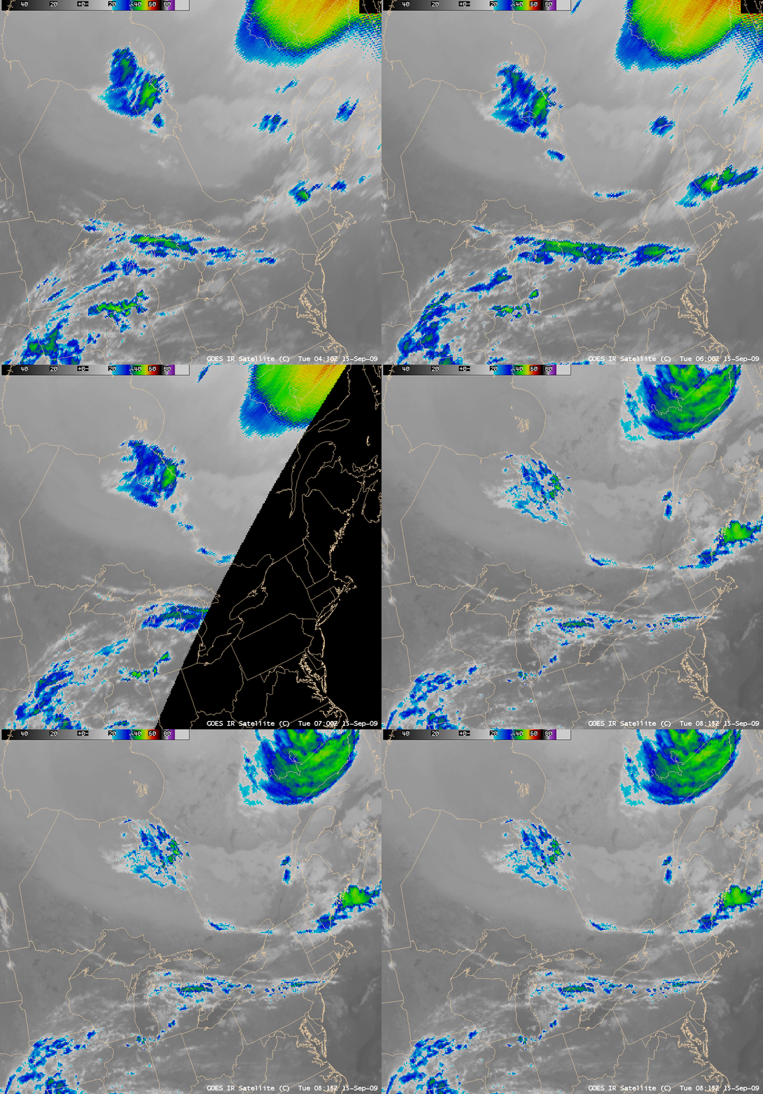
AWIPS images of the GOES 10.7 µm IR window channel (above) showed that a patch of high-level clouds was moving southeastward over a band of low-level clouds that was in place across much of Ontario and Quebec, Canada on 15 September 2009. The GOES IR brightness temperatures associated with this patch of high clouds were in the -20º C to -40º C range (cyan to green color enhancement) — but the 4-km resolution of the GOES data over eastern Canada was significantly degraded during some of the pre-dawn hours due to the fact that GOES-12 (GOES-East) data was unavailable during that satellite’s Fall eclipse period.
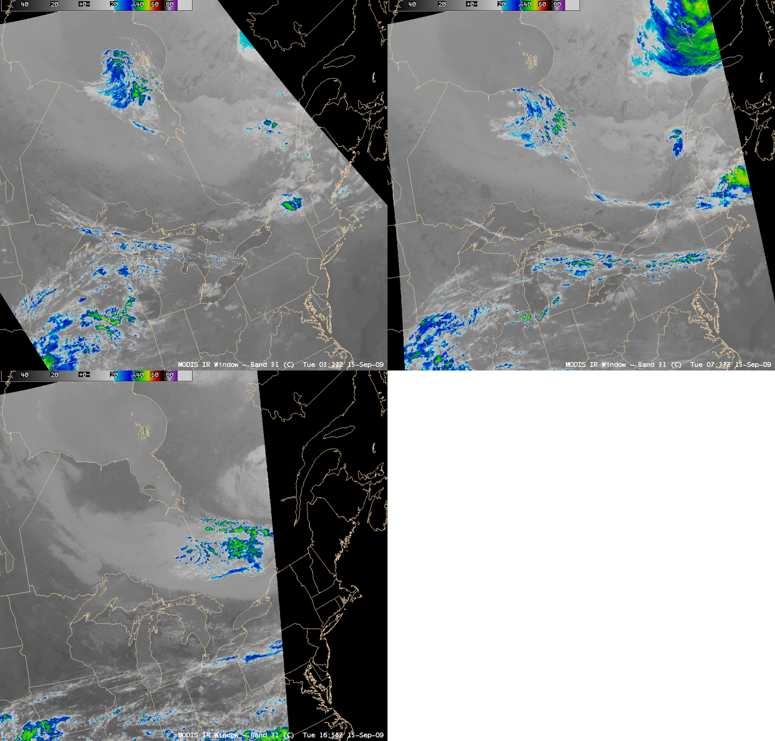
While the 1-km resolution MODIS 11.0 µm IR window channel images (below) offered a more detailed depiction of the structure of the high cloud feature, the temporal resolution of the MODIS images was far less than those available from GOES.
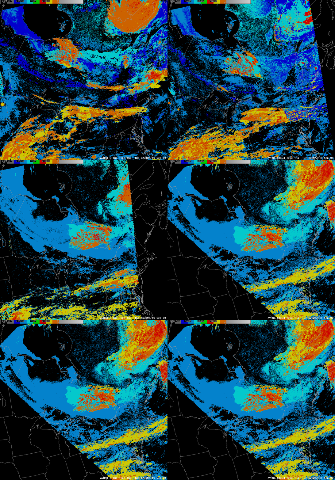
CIMSS has recently begun to test the experimental display of NOAA POES Advanced Very High Resolution Radiometer (AVHRR) images and derived products in AWIPS (similar to the MODIS in AWIPS project initiated in 2006). One such derived AVHRR product is the 1-km resolution Cloud Type (below), which provides an indication of the phase of any particular cloud feature (e.g., liquid water droplets vs. ice crystals). The patch of high clouds moving southeastward across Ontario and Quebec was identified as a mixture of opaque ice (red), cirrus (yellow), and multi-layer (orange) — while the low cloud deck below it was identified as a mixture of fog (dark blue), liquid water droplet (medium blue), and supercooled liquid (cyan). This AVHRR Cloud Type product is one of a suite of products available from the CLAVR-x processing system.
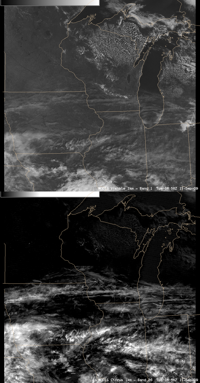
As a demonstration of the accuracy of some of these MODIS and AVHRR derived cloud products, let’s now examine the cirrus cloud and contrail features seen later in the day across southern Wisconsin. These high cloud features were rather thin, as evident on the comparison of the MODIS visible channel and the 1.3 µm near-IR “cirrus detection channel” images (below).
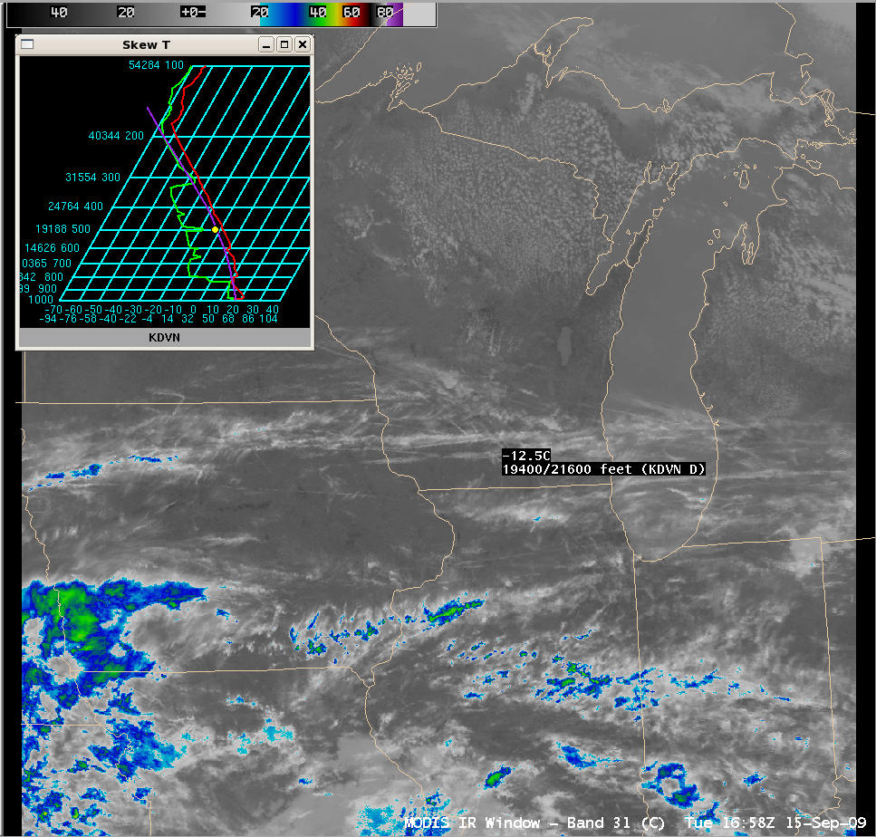
Since these high cloud features were so thin, a significant amount of radiation from the warm surface below was contaminating the IR brightness temperatures sensed by the satellite — note that the MODIS 11.0 µm IR values (below) were only as cold as -5º C to -15º C over the southern Wisconsin high cloud features, which would place the cirrus cloud and contrail features near the 500 hPa pressure level (19,000 – 22,000 feet above ground level) according to the morning rawinsonde data from Davenport, Iowa.
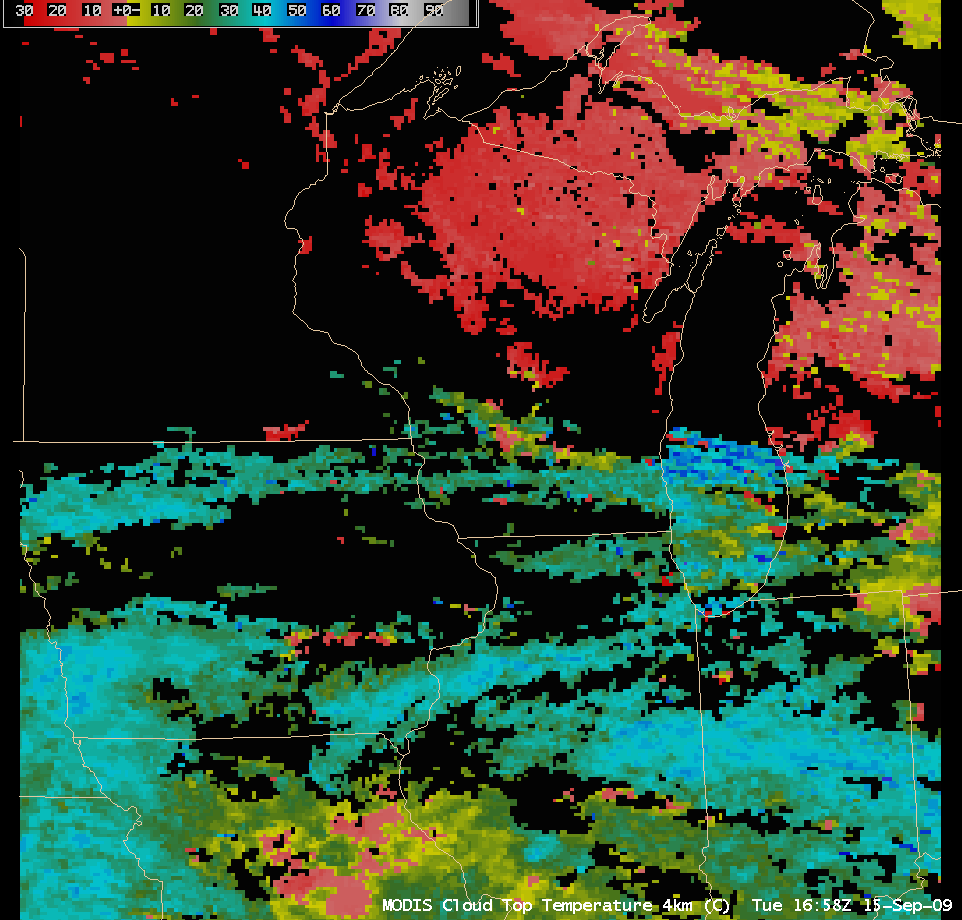
However, the 4-km resolution MODIS Cloud Top Temperature product (below) did suggest that some portions of these cirrus cloud and contrail features had temperatures as cold as -43º C (cyan color enhancement), which is closer to the expected temperature at the height of most cirrus clouds.
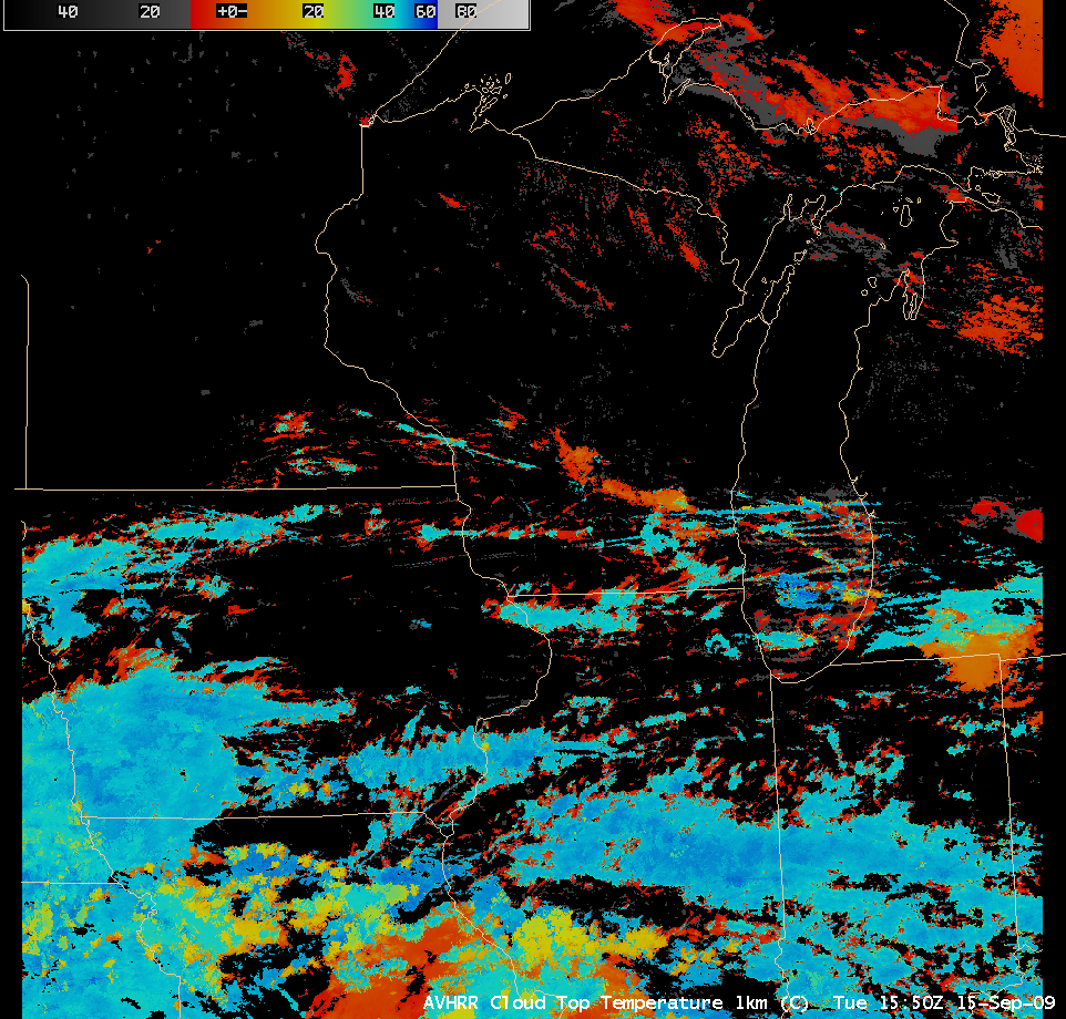
About an hour earlier, the 1-km resolution AVHRR Cloud Top Temperature values (below) were in the -45º C to -48º C range (cyan color enhancement), again much closer to the expected range of temperatures for such high-altitude cloud features.
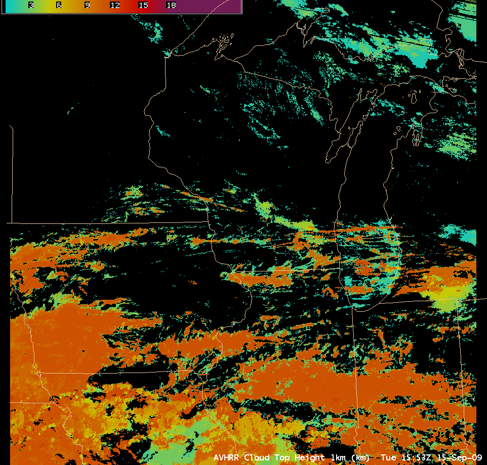
The AVHRR Cloud Top Height product (below) indicated that portions of these cirrus cloud and contrail features were as high as 10-11 km above the surface (orange color enhancement) — this was in good agreement with ground-based lidar data from the SSEC Lidar Group, which showed the tops of the thicker cirrus clouds to be around 11 km.


