Severe thunderstorms in Texas and Oklahoma
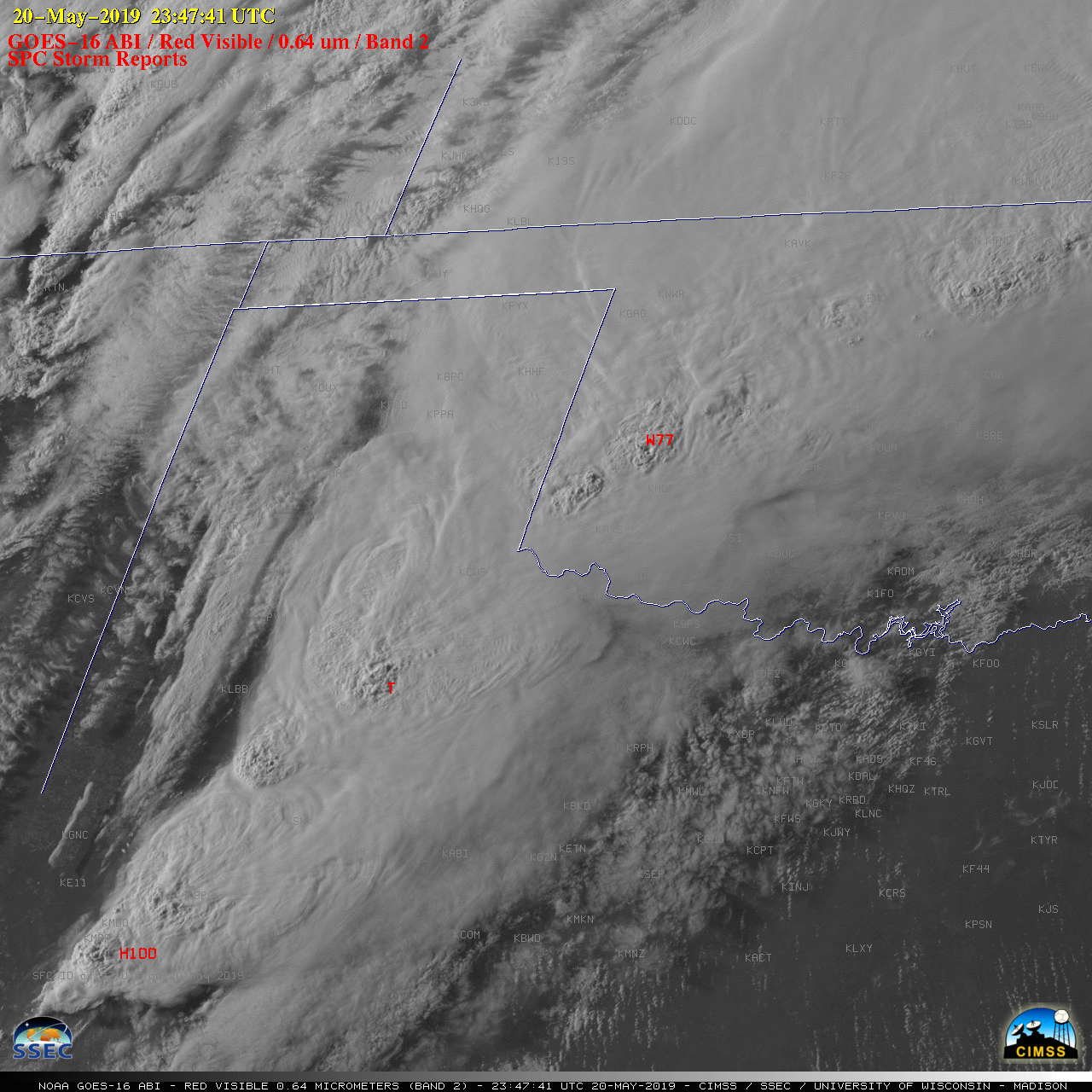
GOES-16 “Red” Visible (0.64 µm) images, with SPC Storm Reports plotted in red [click to play MP4 animation]
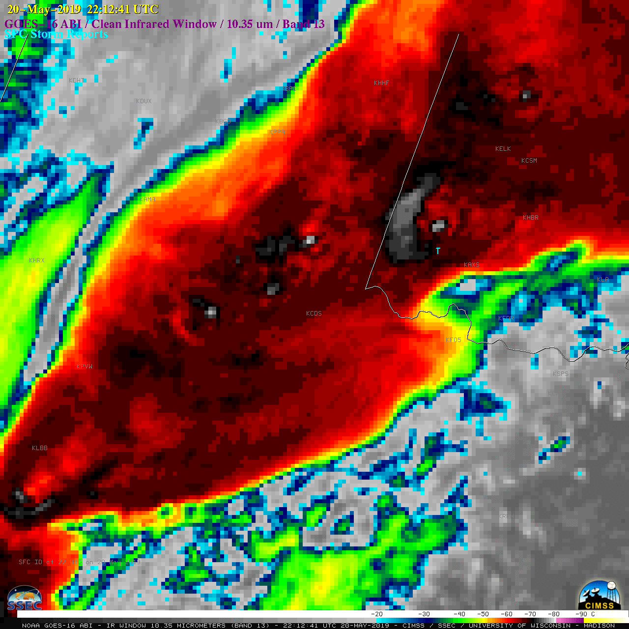
The corresponding GOES-16 “Clean” Infrared Window (10.35 µm) images (below) indicated that cloud-top infrared brightness temperatures were frequently as cold as -70 to -80ºC (black to white to violet enhancement) with the more vigorous thunderstorms.
![GOES-16 "Clean" Infrared Window (10.35 µm) images, with SPC Storm Reports plotted in cyan [click to play MP4 animation]](https://cimss.ssec.wisc.edu/satellite-blog/wp-content/uploads/sites/5/2019/05/G16_IR_TX_OK_SVR_20MAY2019_2019140_234741_GOES-16_0001PANEL.GIF)
GOES-16 “Clean” Infrared Window (10.35 µm) images, with SPC Storm Reports plotted in cyan [click to play MP4 animation]
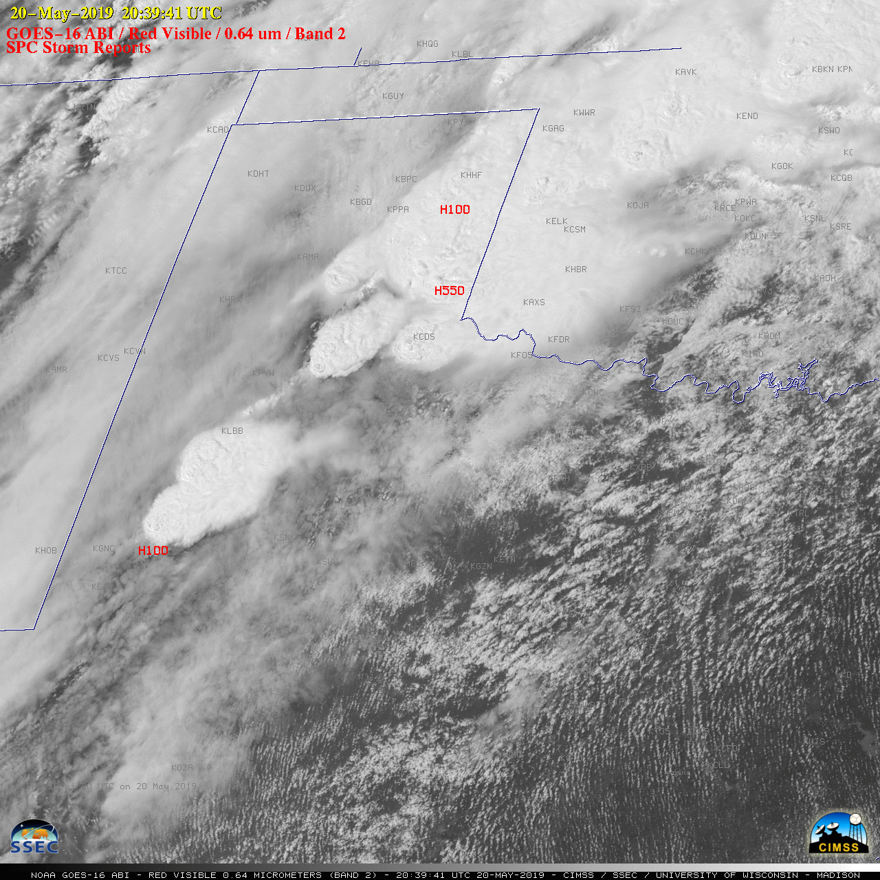
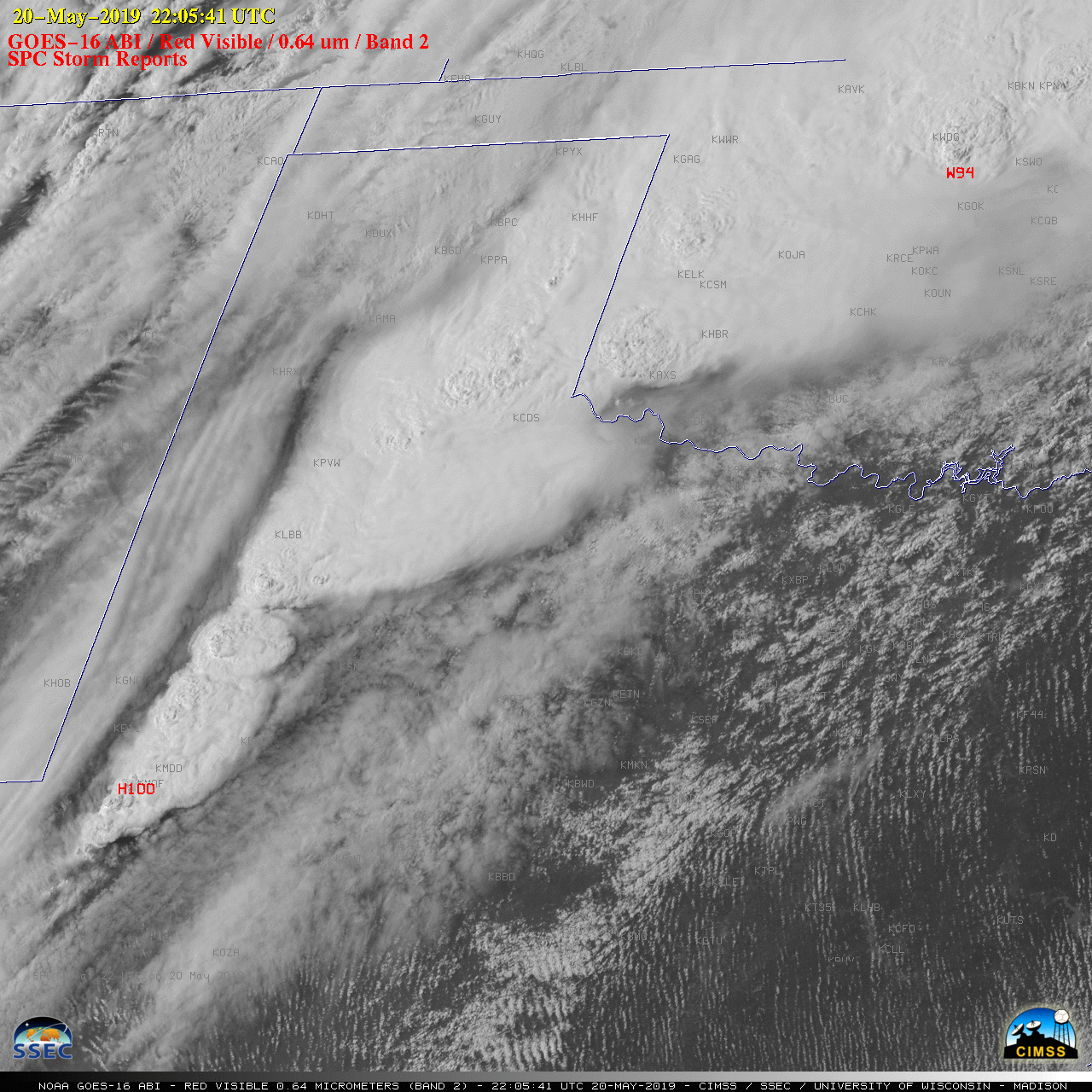
![GOES-16 "Red" Visible (0.64 µm) images, with SPC Storm Reports plotted in red [click to play MP4 animation]](https://cimss.ssec.wisc.edu/satellite-blog/wp-content/uploads/sites/5/2019/05/G16_VIS_ZOOM_TX_OK_SVR_20MAY2019_2019140_203941_GOES-16_0001PANEL.GIF)
GOES-16 “Red” Visible (0.64 µm) images, with SPC Storm Reports plotted in red [click to play MP4 animation]
![GOES-16 "Clean" Infrared Window (10.35 µm) images, with SPC Storm Reports plotted in cyan [click to play MP4 animation]](https://cimss.ssec.wisc.edu/satellite-blog/wp-content/uploads/sites/5/2019/05/G16_IR_TX_OK_SVR_ZOOM_20MAY2019_2019140_203941_GOES-16_0001PANEL.GIF)
GOES-16 “Clean” Infrared Window (10.35 µm) images, with SPC Storm Reports plotted in cyan [click to play MP4 animation]
![GOES-16 Low-level (7.3 µm), Mid-level (6.9 µm) and Upper-level (6.2 µm) Water Vapor images [click to play MP4 animation]](https://cimss.ssec.wisc.edu/satellite-blog/wp-content/uploads/sites/5/2019/05/tx_wv8-20190520_220841.png)
GOES-16 Low-level (7.3 µm), Mid-level (6.9 µm) and Upper-level (6.2 µm) Water Vapor images [click to play MP4 animation]
![GOES-16 Split Window Difference (10.3-12.3 µm) images [click to play animation | MP4]](https://cimss.ssec.wisc.edu/satellite-blog/wp-content/uploads/sites/5/2019/05/190520_goes16_splitWindowDifference_NM_TX_blowing_dust_anim.gif)
GOES-16 Split Window Difference (10.3-12.3 µm) images [click to play animation | MP4]
![Suomi NPP VIIRS True Color and False Color RGB images, along with the Flood Detection Product [click to enlarge]](https://cimss.ssec.wisc.edu/satellite-blog/wp-content/uploads/sites/5/2019/05/190521_suomiNPP_viirs_truecolor_falsecolor_floodingLandFraction_OK_anim.gif)
Suomi NPP VIIRS True Color and False Color RGB images, along with the Flood Detection Product [click to enlarge]
![Terra MODIS False Color RGB images over northern Oklahoma on 15 May and 21 May [click to enlarge]](https://cimss.ssec.wisc.edu/satellite-blog/wp-content/uploads/sites/5/2019/05/190515_190521_modis_falsecolor_OK_anim.gif)
Terra MODIS False Color RGB images over northern Oklahoma on 15 May and 21 May [click to enlarge]