Hurricane Michael reaches Category 3 intensity

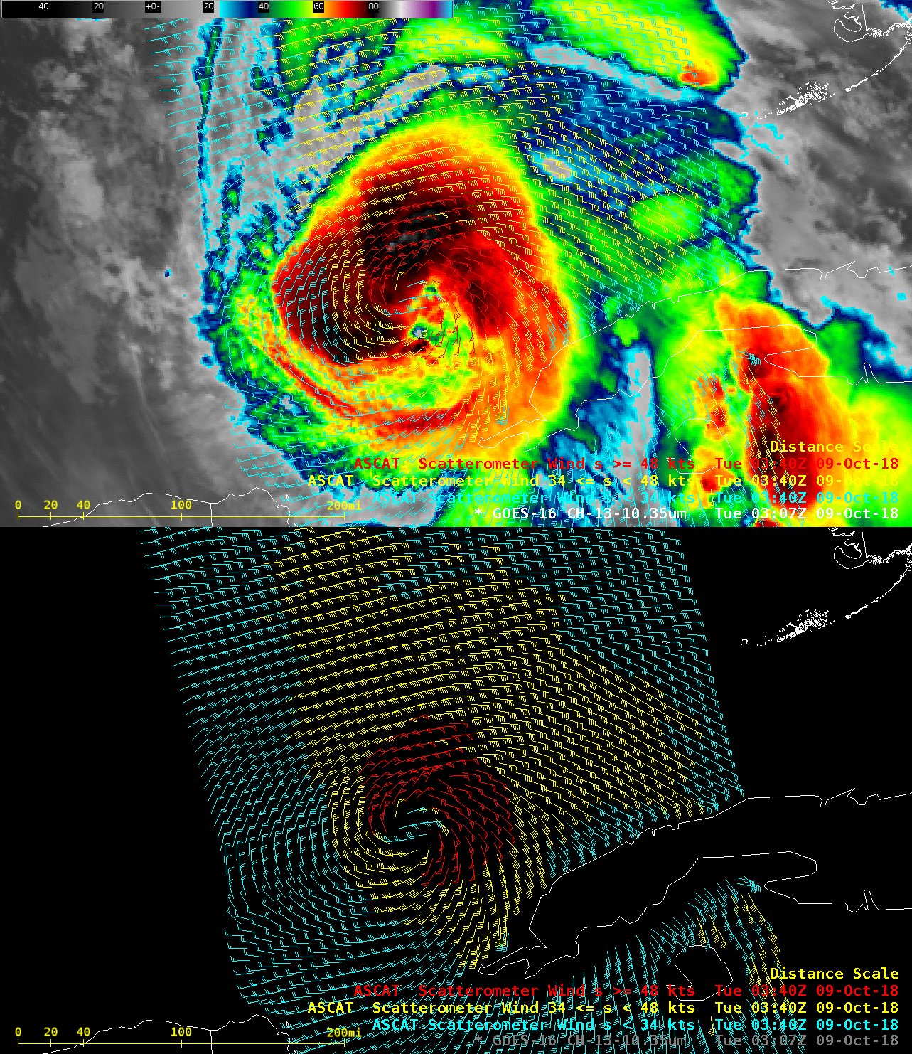
GOES-16 “Clean” Infrared Window (10.3 µm) image, with Metop-A ASCAT surface scatterometer winds [click to enlarge]
A toggle between Suomi NPP VIIRS Day/Night Band (0.7 µm) and Infrared Window (11.45 µm) images at 0752 UTC (below; courtesy of William Straka, CIMSS) revealed transverse banding north of the storm center on the Infrared image, and mesospheric airglow waves propagating westward away from Michael on the Day/Night Band image.
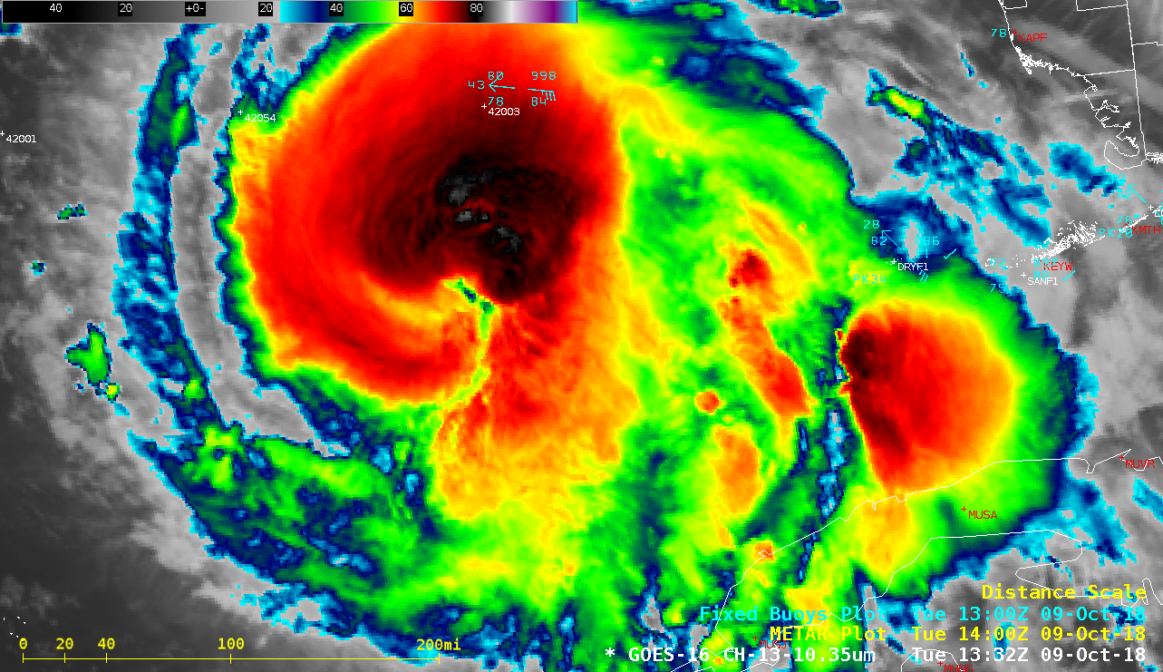
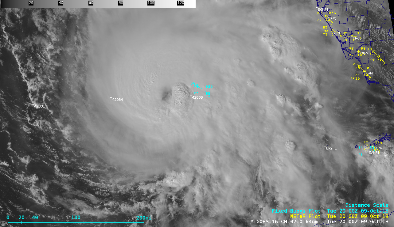
5-minute GOES-16 (GOES-East) “Clean” Infrared Window (10.3 µm) images from 0517-1332 UTC (below) showed a series of relatively brief convective bursts around the storm center, but in general Michael exhibited a somewhat disorganized appearance during that time period. After sunrise, 1-minute Mesoscale Domain Sector GOES-16 “Red” Visible (0.64 µm) images (below) revealed the gradual formation of a more well-defined eye during the day, with episodic clusters of convective “hot towers” developing in the southeastern and eastern portions of the eyewall — which then rotated around to the north and northwest of the eye. By 18 UTC Michael had intensified to a Category 3 storm. 1-minute GOES-16 “Clean” Infrared Window images (below) indicated that infrared brightness temperatures associated with these hot towers were often as cold as -80º to -89ºC (violet to darker purple enhancement). Michael had been encountering unfavorable deep-layer wind shear and had also been moving over a pocket of water with low Ocean Heat Content northwest of Cuba (below). However, once the hurricane began to move over waters having higher OHC in addition to warm Sea Surface Temperature, it gradually began to intensify from a Category 2 to a Category 3.

![Suomi NPP VIIRS Day/Night Band (0.7 µm) and Infrared Window (11.45 µm) images [click to enlarge]](https://cimss.ssec.wisc.edu/satellite-blog/wp-content/uploads/sites/5/2018/10/181009_0752utc_suomiNPP_viirs_DayNightBand_InfraredWindow_Hurricane_Michael_anim.gif)


![Ocean Heat Content and Sea Surface Temperature, with a plot of the track of Michael [click to enlarge]](https://cimss.ssec.wisc.edu/satellite-blog/wp-content/uploads/sites/5/2018/10/181009_ohc_sst_Michael_anim.gif)