Interesting satellite signatures in the Arctic
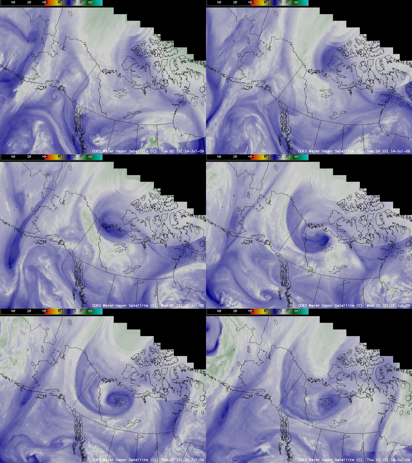
An intense upper-level low developed over the Canadian Arctic Archipelago on 14 July 2009, and subsequently migrated southwestward over the Northwest Territories, Yukon, and northeastern Alaska by 16 July 2009. AWIPS images of the GOES-11 + GOES-12 water vapor channel composite (above) showed a well-defined signature of the intensifying upper low during this period, with a large area of warmer/drier air (darker blue colors) within the circulation.
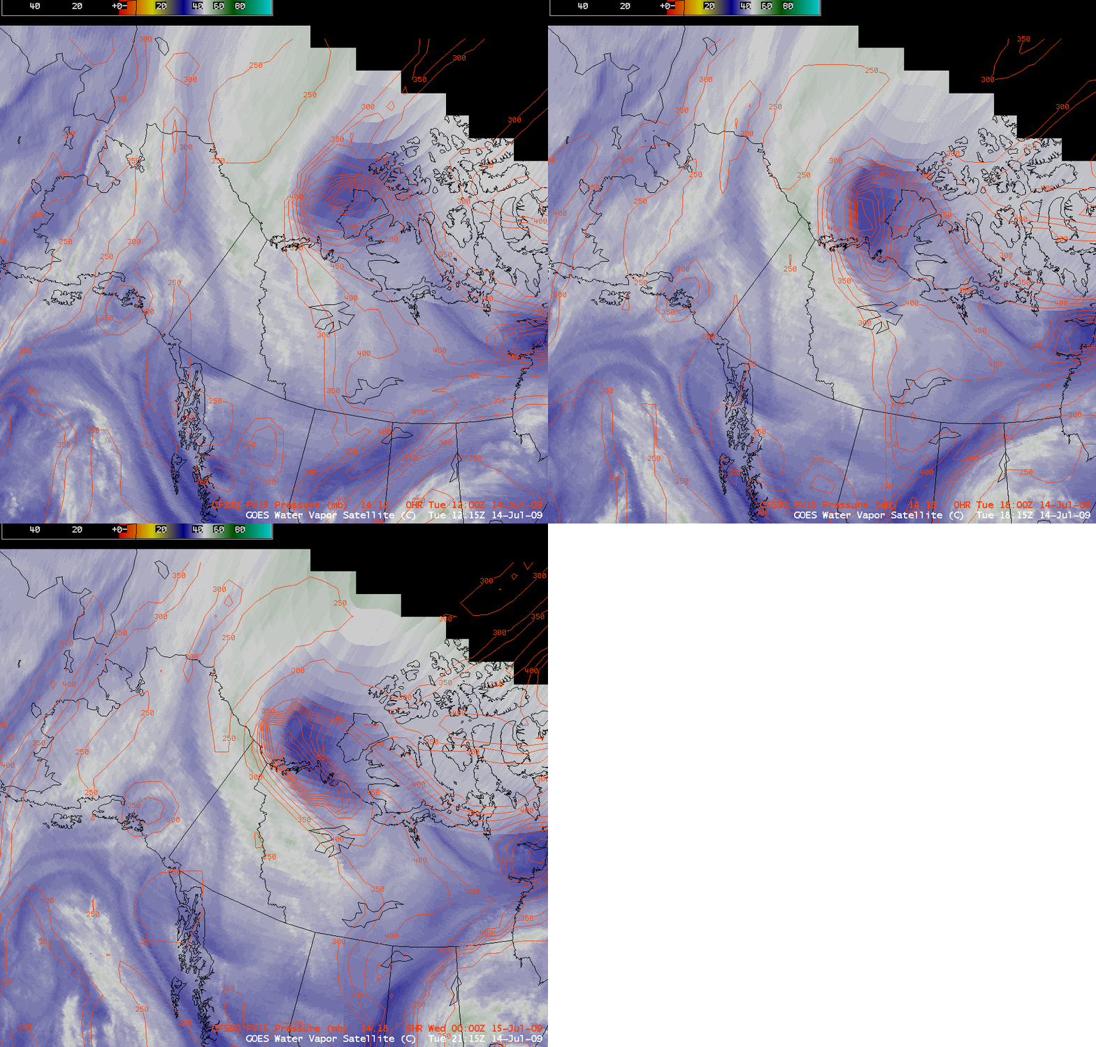
What was remarkable about this warm/dry signature on the water vapor imagery is the fact that such detail could be seen, in spite of the very large satellite viewing angle of the GOES satellites. Water vapor imagery is prone to the effect of “limb brightening” as the water vapor weighting function is shifted to higher, colder altitudes over the higher latitude regions — this tends to make water vapor imagery appear rather cold and “washed out” over the Arctic much of the time. However, in this case the dynamic tropopause (taken to be the pressure of the 1.5 Potential Vorticity Unit surface) was brought downward to the 850 hPa pressure level on 14 July (below) as the low intensified — and snow was even reported at Norman Wells (station identifier CYVQ) in the Northwest Territories on 16 July.
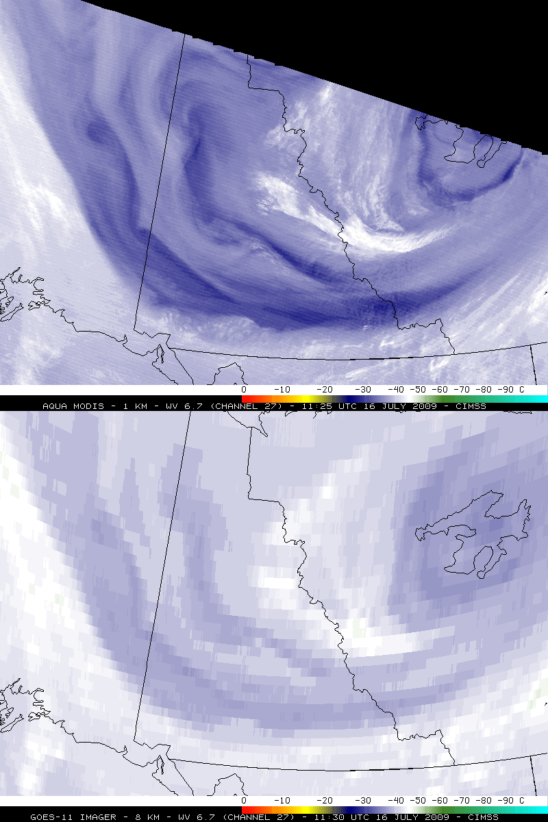
On the GOES water vapor imagery above there was a hint of some embedded vortex structure developing within the upper low circulation. These vorticies (which were likely small stratospheric intrusion vorticies) were much easier to identify on the 1-km resolution MODIS water vapor image than on the “8-km” resolution GOES-11 water vapor image (below) — this is partly due to the upward shift of the water vapor weighting function mentioned previously, and also due to the fact that the 8-km GOES-11 water vapor pixels were effectively about 30 km in size due to the very large satellite viewing angle.
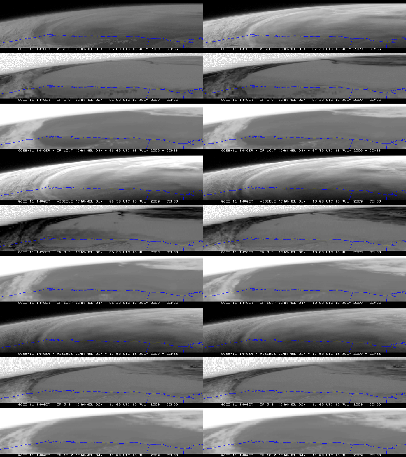
Another interesting satellite signature was the appearance of a “thermal anomaly” over the Arctic Ocean north of Alaska on the GOES-11 10.7 µm IR window channel image at 09:00 UTC (below, bottom panels). At that particular time, there is a great deal of solar reflection off the water and ice surface, which appears very bright on the visible imagery (top panels), and very hot (dark black enhancement) on the 3.9 µm shortwave IR imagery (center panels). The intense solar reflection effectively causes the IR window channel brightness temperature to “roll over” from very warm to very cold values (black to white color enhancement). This IR window channel thermal anomaly does not appear if cloud cover masks the highly reflective nature of the water and ice in the Arctic Ocean.
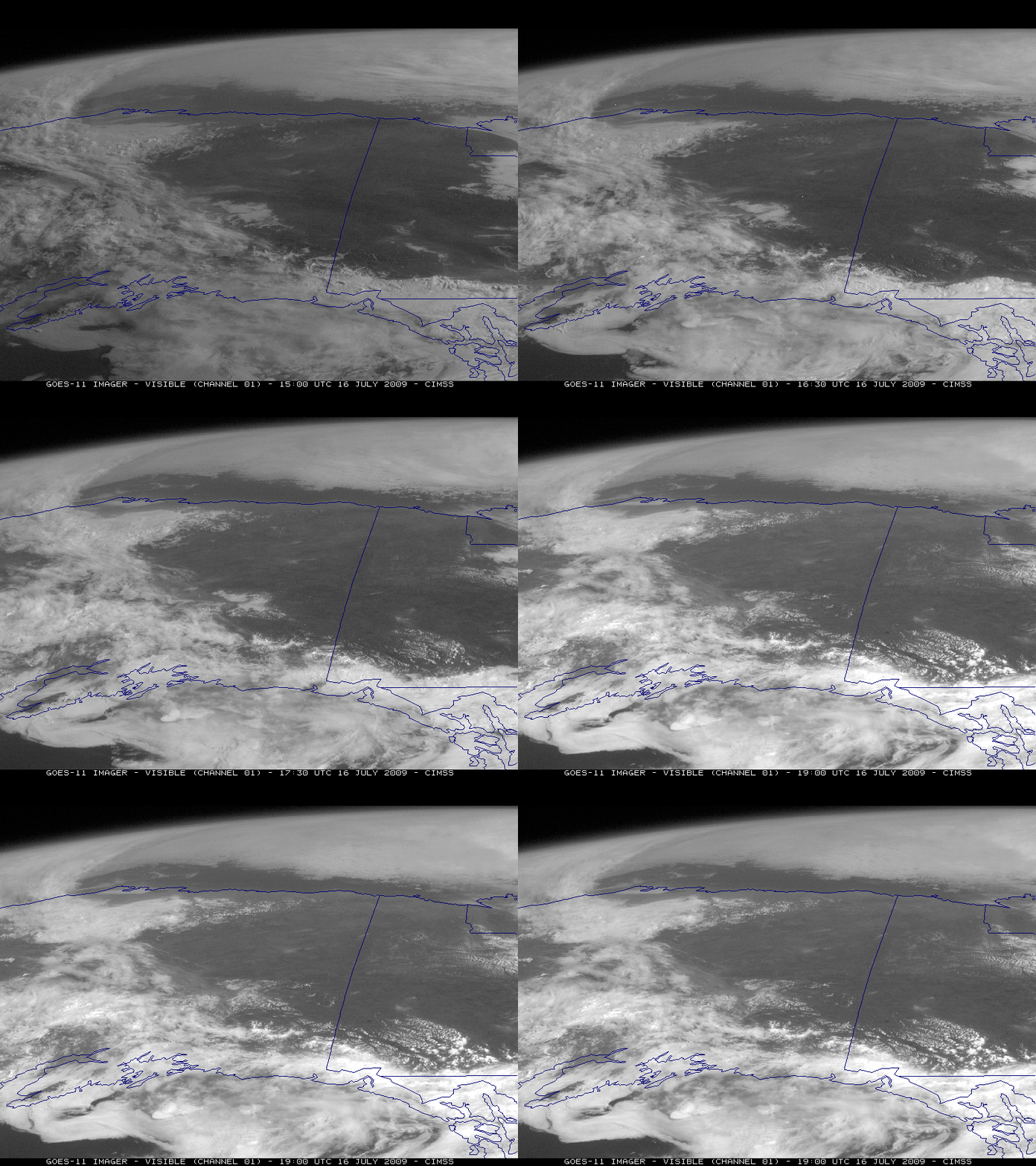
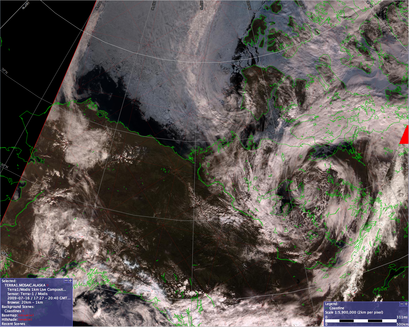
Later in the day, GOES-11 visible imagery showed that the southern edge of the ice in the Arctic Ocean had receded a considerable distance from the northern coast of Alaska (above). The ice edge could be seen in greater detail using 1-km resolution MODIS true color imagery (below, courtesy of the GINA, University of Alaska Fairbanks SwathViewer).


