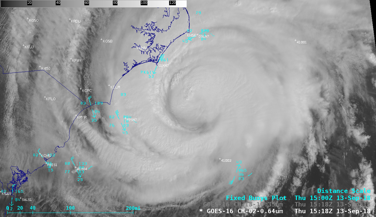
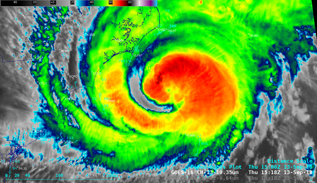
Hurricane Florence off the coast of North Carolina
A toggle between NOAA-20 VIIRS Day/Night Band (0.7 µm) and Infrared Window (11.45 µm) images (above) showed Category 2 Hurricane Florence off the coast of North Carolina at 0646 UTC on 13 September 2018. GCOM AMSR2 Microwave (89 GHz), Convective Rain Rate and Surface Rain Rate (below) indicated that the southern and southeastern portions of the eye and eyewall had become fragmented. (VIIRS and AMSR2 imagery courtesy of William Straka, CIMSS) In a toggle between DMSP-17 SSMIS Microwave (85 GHz) and GOES-16 Infrared Window (10.3 µm) images from the CIMSS Tropical Cyclones site (below), microwave imagery revealed the very large internal core of the hurricane at 1216 UTC. The Metop-A satellite passed over the western edge of Florence, with ASCAT sensing surface winds as high as 66 knots along the western edge of the storm core (below).
GOES-16 “Red” Visible (0.64 µm) image at 1427 UTC, with plots of buoy reports and Metop-A ASCAT surface scatterometer winds [click to enlarge]
![NOAA-20 VIIRS Visible (0.64 µm) and Infrared Window (11.45 µm) images at 1804 UTC [click to enlarge]](https://cimss.ssec.wisc.edu/satellite-blog/wp-content/uploads/sites/5/2018/09/180913_1804utc_noaa20_viirs_visible_infrared_Florence_anim.gif)
NOAA-20 VIIRS Visible (0.64 µm) and Infrared Window (11.45 µm) images at 1804 UTC [click to enlarge]
![Suomi NPP VIIRS Visible (0.64 µm) and Infrared Window (11.45 µm) images at 1854 UTC [click to enlarge]](https://cimss.ssec.wisc.edu/satellite-blog/wp-content/uploads/sites/5/2018/09/180913_1854utc_suomiNPP_viirs_visible_infrared_Florence_anim.gif)
Suomi NPP VIIRS Visible (0.64 µm) and Infrared Window (11.45 µm) images at 1854 UTC [click to enlarge]
![12 September Terra MODIS Sea Surface Temperature product and 13 September Terra MODIS Visible (0.65 µm) image [click to enlarge]](https://cimss.ssec.wisc.edu/satellite-blog/wp-content/uploads/sites/5/2018/09/180912_modis_sst_180913_modis_visible_Florence_anim.gif)
12 September Terra MODIS Sea Surface Temperature product and 13 September Terra MODIS Visible (0.65 µm) image [click to enlarge]
The strong winds associated with Florence created large waves which induced upwelling of colder water from below the ocean surface:
Updated #HurricaneFlorence cold #SST wake movie, for your viewing pleasure. Created using AMSR2 satellite observations. pic.twitter.com/fofxpO8suh
— Kris Karnauskas (@OceansClimateCU) September 15, 2018
Overlapping GOES-16 (GOES-East) Mesoscale Domain Sectors were providing images every 30 seconds; “Red” Visible (0.64 µm) and “Clean” Infrared Window (10.3 µm) animations are shown below. Note that a secondary eyewall began to form following a convective burst which developed southwest of the eye around 1920 UTC (Visible | Infrared) — and as the new eyewall convection quickly wrapped around to the north, Cape Lookout, North Carolina (Buoy CLKN7) recorded a peak wind speed of 73 knots at 20 UTC and 21 UTC.
The large pattern of upper-tropospheric outflow was quite apparent on GOES-16 Near-Infrared “Cirrus” (1.37 µm) images (below) — spanning a distance of approximately 1000 miles.

![NOAA-20 VIIRS Day/Night Band (0.7 µm) and Infrared Window (11.45 µm) images [click to enlarge]](https://cimss.ssec.wisc.edu/satellite-blog/wp-content/uploads/sites/5/2018/09/180913_0646utc_noaa20_DayNightBand_InfraredWindow_Florence_anim.gif)
![GCOM AMSR2 Microwave (89 GHz), Convective Rain Rate and Surface Rain Rate [click to enlarge]](https://cimss.ssec.wisc.edu/satellite-blog/wp-content/uploads/sites/5/2018/09/180913_0618utc_gcom_amsr2_microwave_rainrates_Florence_anim.gif)
![DMSP-17 SSMIS Microwave (85 GHz) and GOES-16 Infrared Window (10.3 µm) images [click to enlarge]](https://cimss.ssec.wisc.edu/satellite-blog/wp-content/uploads/sites/5/2018/09/180913_1215utc_dmsp17_microwave_goes16_infrared_Florence_anim.gif)
![Terra MODIS Visible (0.65 µm) and Infrared Window (11.0 µm) images at 1538 UTC [click to enlarge]](https://cimss.ssec.wisc.edu/satellite-blog/wp-content/uploads/sites/5/2018/09/180913_1538utc_terra_modis_visible_infrared_Florence_anim.gif)

