“Hole punch clouds” and aircraft “distrails”
Some interesting photos of “hole punch clouds” were captured on 15 November 2006 — the photos (which appeared on the 16 November Spaceweather.com site) were were taken at Stevens Point in central Wisconsin. A QuickTime animation of GOES-12 visible channel and 3.9µm shortwave IR images (above) revealed a series of aircraft dissipation trails (or “distrails”) drifting northeastward between Madison and Stevens Point during the day; particles in the aircraft exhaust were acting as ice nuclei, causing any supercooled cloud droplets to glaciate and also helping other existing cloud ice crystals to increase in size — these larger ice crystals then descended under the influence of gravity, creating precipitation-induced “holes” and “streaks” in the cloud layers aloft. A 500-meter resolution Aqua MODIS true color image centered on Madison shows better details of the structure of 2 of the northwest-to-southeast oriented “distrails” that were located north of Madison at the time of the satellite overpass.
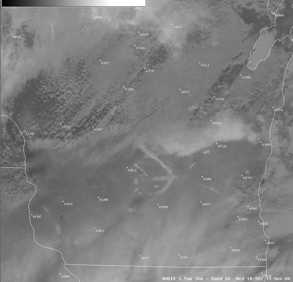
Other MODIS images and products that were available on AWIPS included the 1000-meter resolution 3.7µm shortwave IR channel (below); the brighter (colder) curved cloud signature in this image suggests that one of the aircraft had recently made a loop in the area between Madison (KMSN) and Wisconsin Dells (KDLL). It is likely that military jets from Volk Field Air National Guard Base (KVOK) were performing training exercises north of Madison, with the jet exhaust helping to initiate some of the interesting cloud patterns that were visible both on the ground and via satellite.


