Deep convection over the Gulf of Mexico
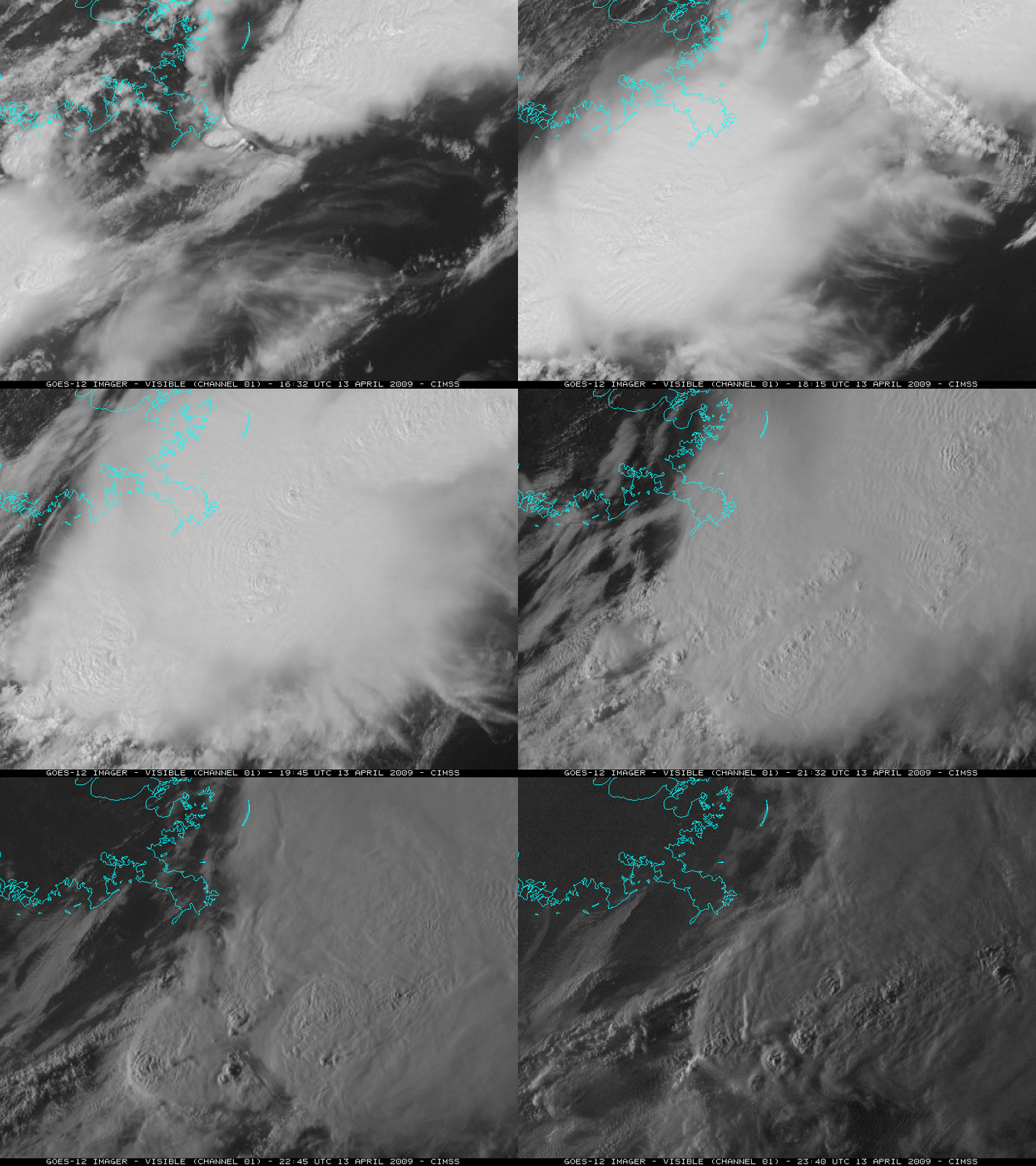
Multiple clusters of intense deep convection developed over the northeastern Gulf of Mexico during the daytime hours on 13 April 2009. According to the SPC Storm Reports, there were several reports of tornadoes and golfball-size hail in Florida and Georgia as some of these storms moved inland. GOES-12 visible images (above; QuickTime animation) show a detailed look at the intricate cloud top structure of the storms that were developing over the Gulf of Mexico — and since GOES-12 was in Rapid Scan Operations, images were available at 5-10 minute intervals.
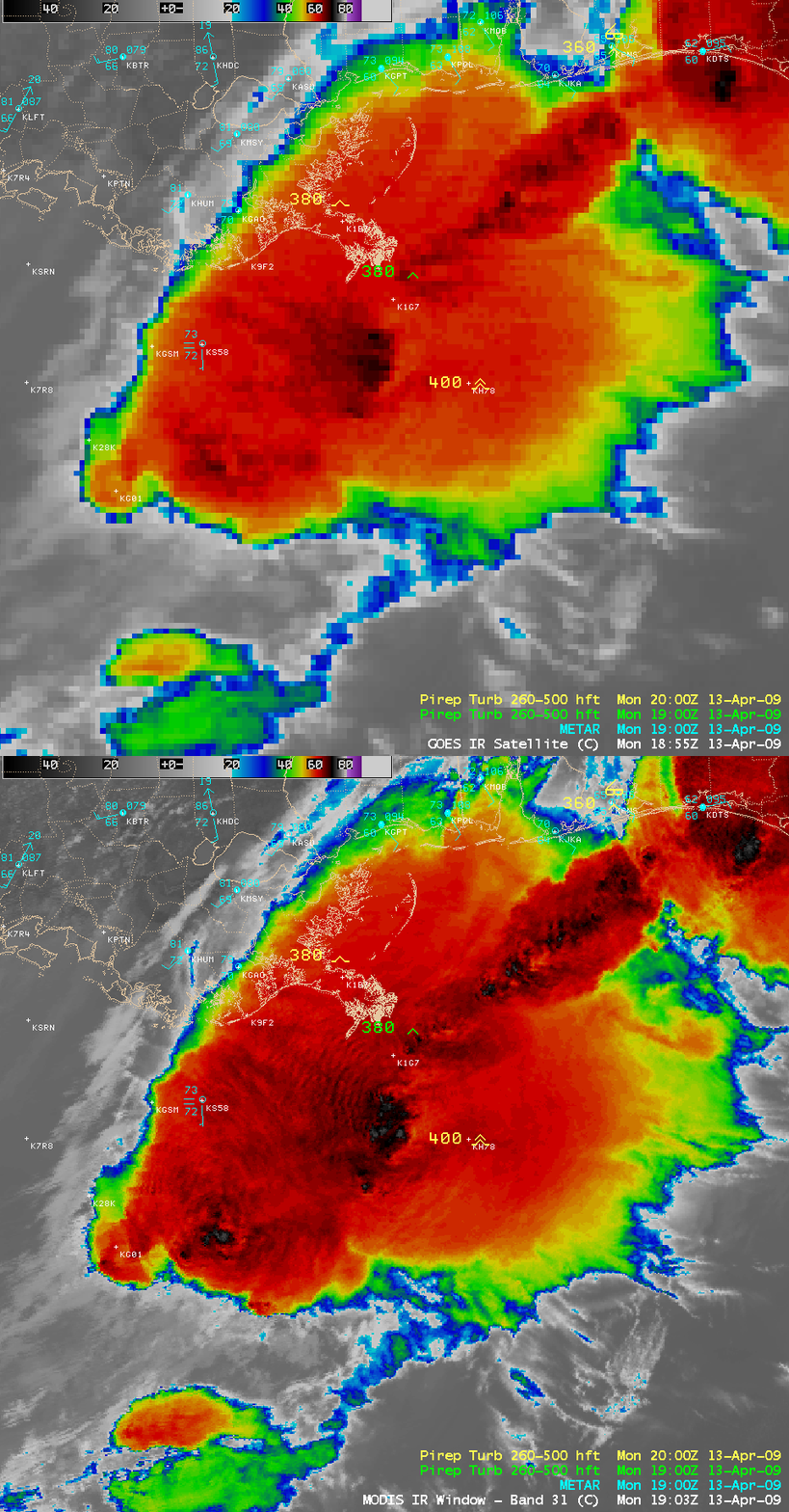
There were a few pilot reports (or PIREPS) of high-altitude turbulence as aircraft were flying over one of the clusters of convection. In particular, one aircraft reported severe turbulence at an altitude of 40,000 feet at 19:57 UTC — soon after the appearance of a rapidly-developing overshooting top feature on the visible imagery (just to the west of the aircraft location). A comparison of the 4-km resolution GOES-12 10.7 µm IR image and the corresponding 1-km resolution MODIS 11.0 µm IR image closest to the time of the severe turbulence report (below) displayed an area of very cold cloud top temperatures (as cold as -74º C) associated with this rapidly developing overshooting top. The finer spatial resolution of the MODIS IR data was also able to resolve a packet of concentric gravity waves that was propagating outward from the cold overshooting top feature.
In addition, note the “parallax shift” that is evident on the GOES IR image: features are shifted a bit to the west and the north due to the high viewing angle of the GOES-12 satellite (which is positioned at 75º West longitude over the Equator). There is minimal parallax error when viewing imagery from a polar-orbiting satellite (such as Terra and Aqua, which carry the MODIS instrument), since the satellite passes directly overhead. These 2 images are very close in time: MODIS actually passed over this region at 19:00 UTC, and the GOES-12 scan which began at 18:55 UTC was probably sampling the Gulf of Mexico region around 18:58 UTC.
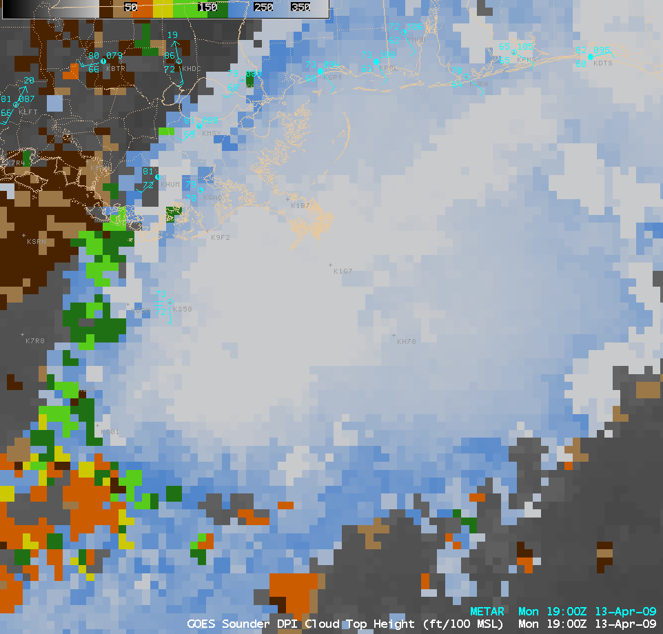
The GOES-12 sounder Cloud Top Height product (below) indicated that the highest cloud tops around the time of the MODIS image were around 44,000 feet — this places the highest parts of the thunderstorm about 4,000 feet higher than the altitude of the PIREP of severe turbulence.
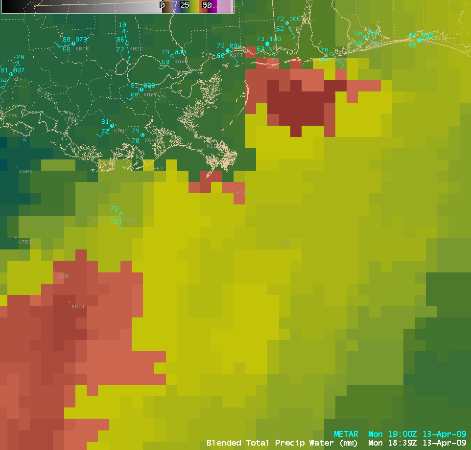
The Blended Total Precipitable Water (TPW) product (below) showed that a southwest-to-northeast oriented axis of higher TPW (values as high as 46-48 mm, darker red colors) was in place across the northeastern Gulf of Mexico, providing the necessary ingredient of moisture required for the formation of deep organized convection.
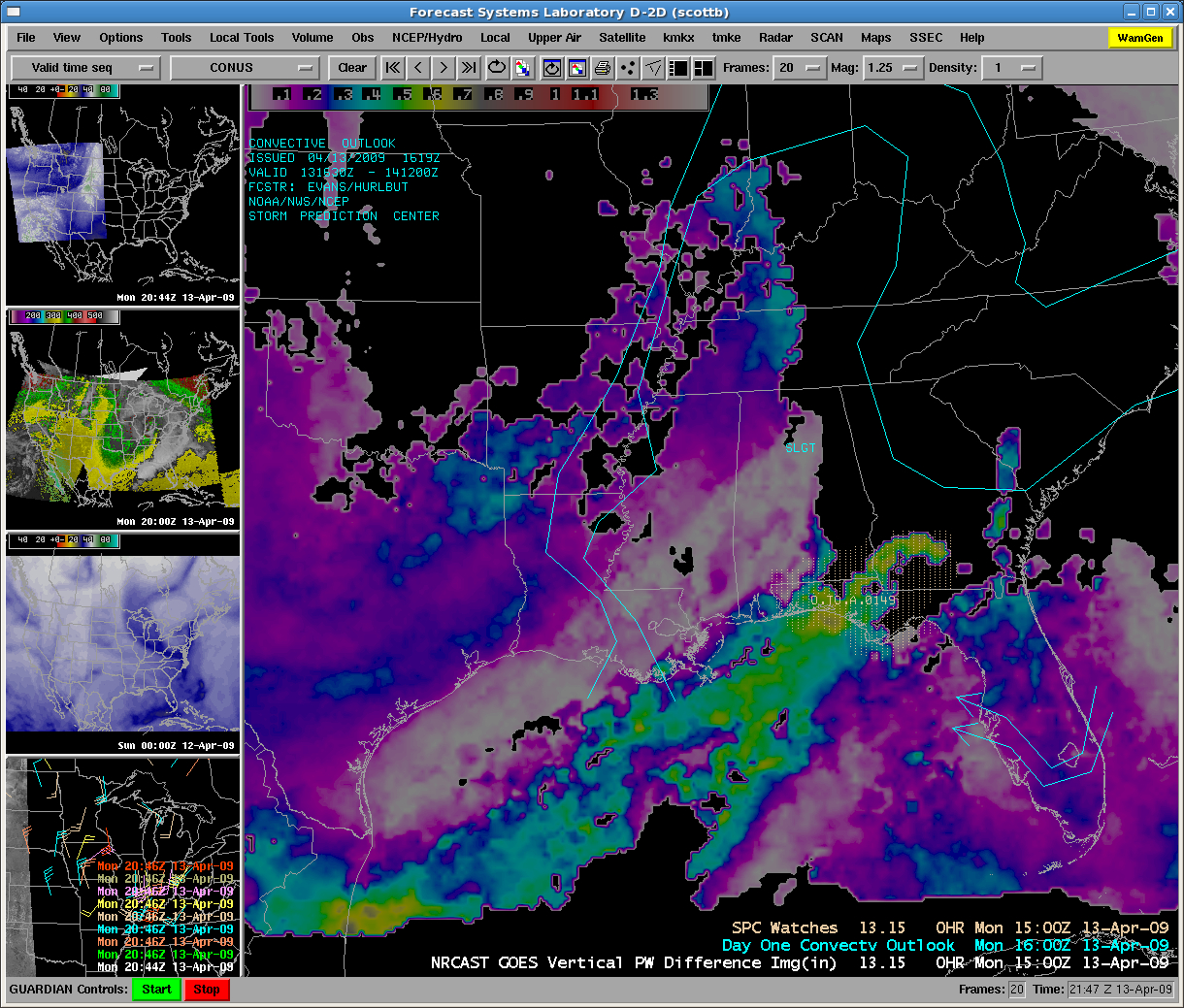
An AWIPS image of a new experimental CIMSS product is shown below: a “Nearcasting” product that uses GOES sounder-derived layer Precipitable Water data to highlight regions were mid-level dry air overlays low-level moisture. Such a moisture profile can lead to the release of convective instability. Note the axis of higher Vertical PW Differences (values greater than 0.5 inch, green to yellow colors) that extended across the Florida Panhandle into southern Georgia (where the SPC had issued Tornado Watch #149).


