Post-Tropical Cyclone Hermine
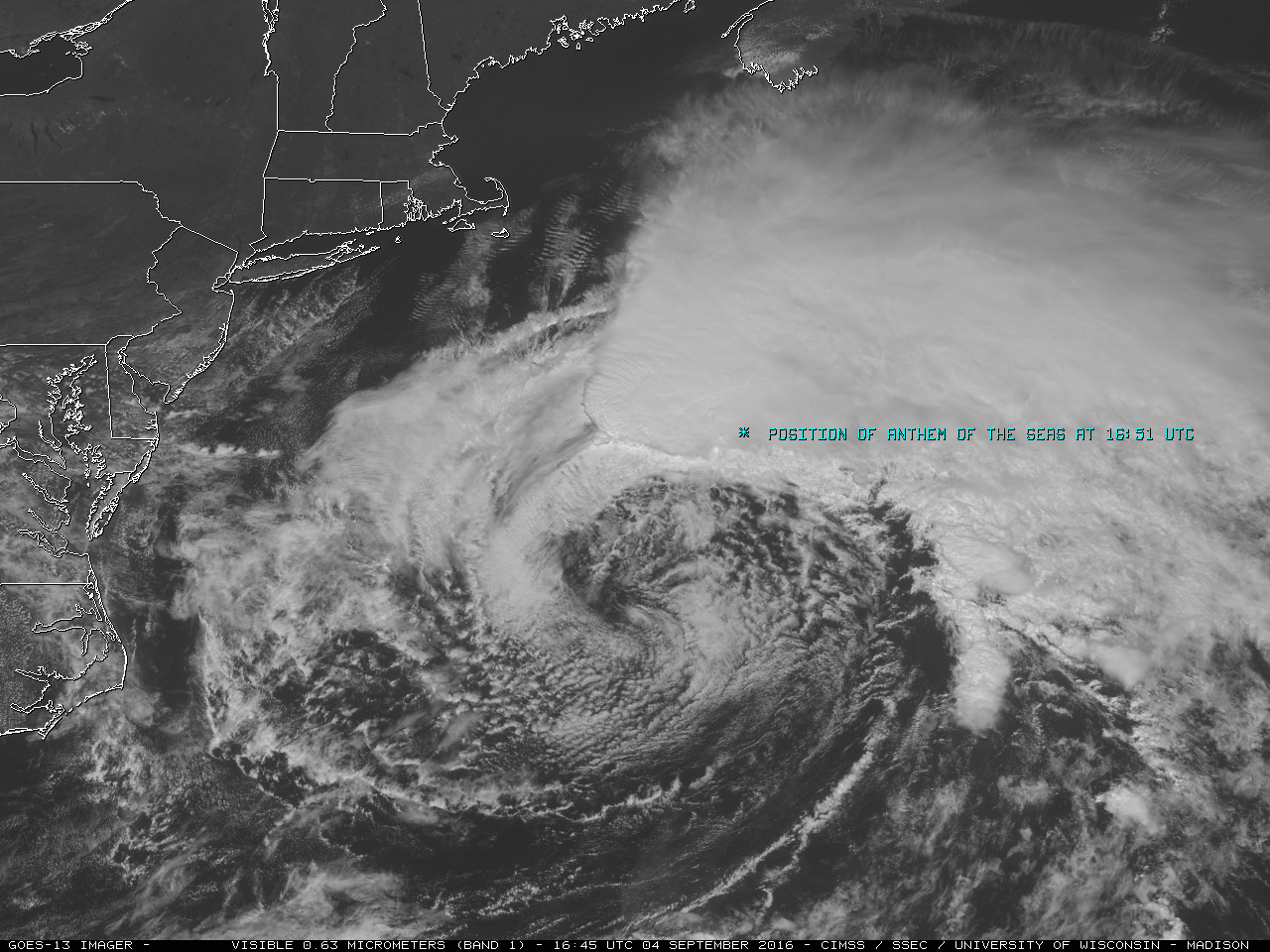
![GOES-13 Visible (0.63 µm) images, with buoy/ship reports plotted in yellow [click to play animation]](https://cimss.ssec.wisc.edu/satellite-blog/wp-content/uploads/sites/5/2016/09/160904_goes13_visible_Hermine_anim.gif)
GOES-13 Visible (0.63 µm) images, with buoy/ship reports plotted in yellow [click to play animation]
![GOES-13 Visible (0.63 µm) images, with buoy/ship reports plotted in yellow [click to play animation]](https://cimss.ssec.wisc.edu/satellite-blog/wp-content/uploads/sites/5/2016/09/160905_goes13_visible_Hermine_anim.gif)
GOES-13 Visible (0.63 µm) images, with buoy/ship reports plotted in yellow [click to play animation]
===== 06 September Update =====
![GOES-13 Visible (0.63 µm) images, with surface/buoy/ship data plotted in yellow [click to play animation]](https://cimss.ssec.wisc.edu/satellite-blog/wp-content/uploads/sites/5/2016/09/160906_goes13_visible_Hermine_anim.gif)
GOES-13 Visible (0.63 µm) images, with surface/buoy/ship data plotted in yellow [click to play animation]
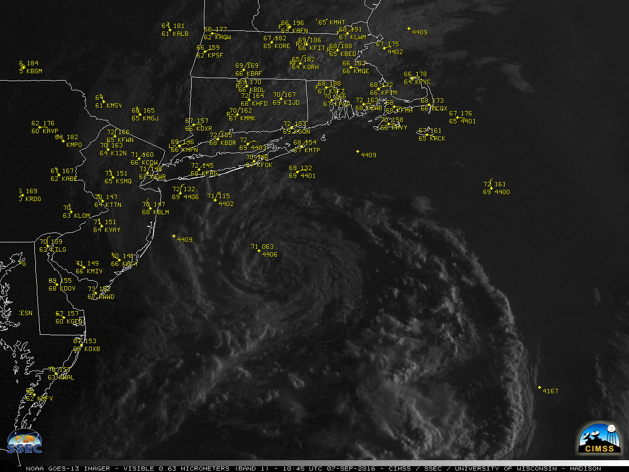
![GOES-13 Visible (0.63 µm) image at 1600 UTC, with ASCAT winds and surface/buoy/ship reports [click to enlarge]](https://cimss.ssec.wisc.edu/satellite-blog/wp-content/uploads/sites/5/2016/09/goes13_visible_ascat-20160906_160000.png)
GOES-13 Visible (0.63 µm) image at 1600 UTC, with ASCAT winds and surface/buoy/ship reports [click to enlarge]
===== 07 September Update =====
![MIMIC Total Precipitable Water product [click to play animation]](https://cimss.ssec.wisc.edu/satellite-blog/wp-content/uploads/sites/5/2016/09/160904-07_mimic_tpw_Hermine_anim.gif)
MIMIC Total Precipitable Water product [click to play animation]