Convective snow squalls in the Upper Midwest
![GOES-13 Visible (0.63 µm) images, with hourly surface weather symbols [click to play animation]](https://cimss.ssec.wisc.edu/satellite-blog/wp-content/uploads/sites/5/2016/04/160402_goes13_visible_surface_weather_Upper_Midwest_anim.gif)
GOES-13 Visible (0.63 µm) images, with hourly surface weather symbols [click to play animation]
![MODIS, VIIRS, and AVHRR visible images [click to enlarge]](https://cimss.ssec.wisc.edu/satellite-blog/wp-content/uploads/sites/5/2016/04/160402_modis_viirs_avhrr_visible_Upper_Midwest_snow_squalls_anim.gif)
MODIS, VIIRS, and AVHRR visible images [click to enlarge]
![GOES-13 Water Vapor (6.5 µm) images with hourly wind gusts in knots [click to play animation]](https://cimss.ssec.wisc.edu/satellite-blog/wp-content/uploads/sites/5/2016/04/160402_goes13_water_vapor_wind_gusts_Upper_Midwest_anim.gif)
GOES-13 Water Vapor (6.5 µm) images with hourly wind gusts in knots [click to play animation]
![GOES-13 Water Vapor (6.5 µm) images with METAR surface reports, surface fronts, and NAM40 500 hPa wind isotachs [click to play animation]](https://cimss.ssec.wisc.edu/satellite-blog/wp-content/uploads/sites/5/2016/04/160402_goes13_water_vapor_metars_Upper_Midwest_snow_squalls_awips_anim.gif)
GOES-13 Water Vapor (6.5 µm) images with METAR surface reports, surface fronts, and NAM40 500 hPa wind isotachs [click to play animation]
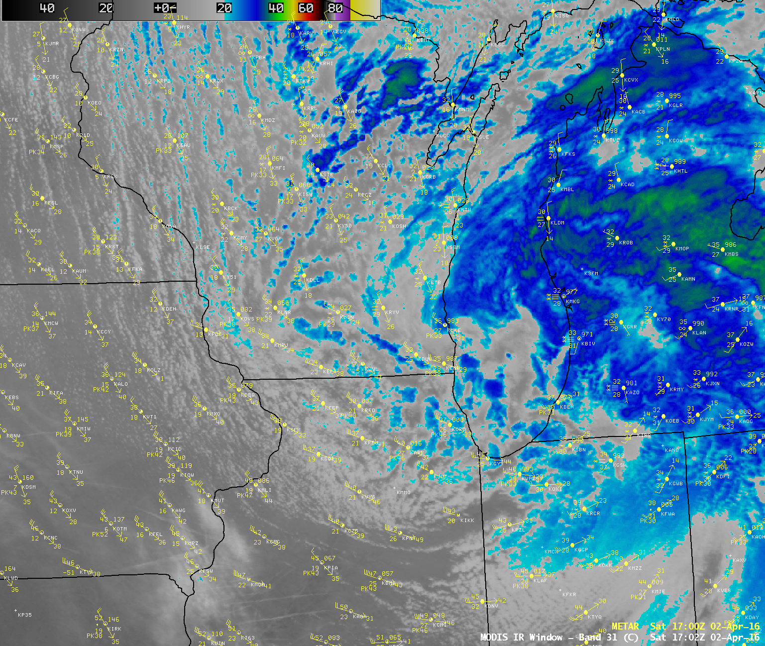
![GOES-13 Infrared Window (10.7 µm) images, with hourly surface weather symbols [click to play animation]](https://cimss.ssec.wisc.edu/satellite-blog/wp-content/uploads/sites/5/2016/04/160402_goes13_infrared_surface_weather_Upper_Midwest_anim.gif)
GOES-13 Infrared Window (10.7 µm) images, with hourly surface weather symbols [click to play animation]
![24-hour snowfall amounts (in inches) ending at 12 UTC on 02 and 03 April [click to enlarge]](https://cimss.ssec.wisc.edu/satellite-blog/wp-content/uploads/sites/5/2016/04/160402-03_24hour_snowfall_anim.gif)
24-hour snowfall amounts (in inches) ending at 12 UTC on 02 and 03 April [click to enlarge]