Mesoscale Convective Vortex moving across Missouri and Illinois
McIDAS images of 1-km resolution GOES-13 0.63 µm visible channel data (above; click image to play animation) showed the well-defined signature of a Mesoscale Convective Vortex (MCV) moving northeastward across Missouri and Illinois during the day on 08 August 2013.
A comparison of 1-km resolution MODIS 0.65 µm visible channel data at 16:16 and 19:35 UTC (below) showed that the MCV was approaching a frontal boundary over southern Illinois.
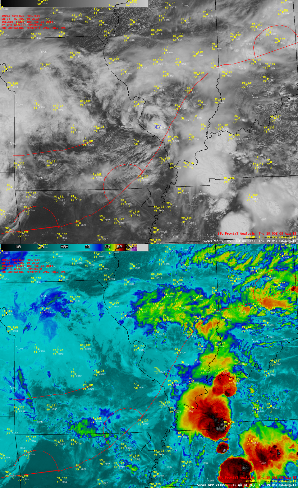
1-km resolution Suomi NPP VIIRS 0.64 µm visible channel and 11.45 µm IR channel images at 19:05 UTC (below) indicated that the clouds associated with the MCV were generally low-level clouds, exhibiting IR brightness temperatures in the +5 to +10º C range (lighter cyan color enhancement).
A comparison of 1-km resolution POES AVHRR 0.86 µm visible channel with the corresponding CLAVR-x Cloud Top Temperature (CTT), Cloud Top Height (CTH), and Cloud Type products (below) indicated the following characteristics of the MCV cloud signature over far southwestern Illinois at 19:44 UTC: CTT values in the -5 to -8 C range (light blue enhancement), CTH values in the 5-6 km range (orange to yellow enhancement), and a Cloud Type consisting of supercooled water droplets (green enhancement).
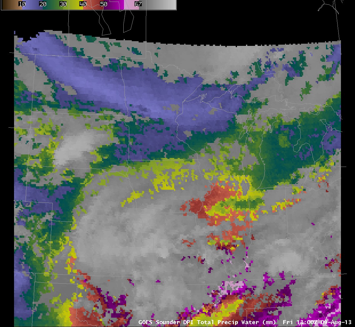
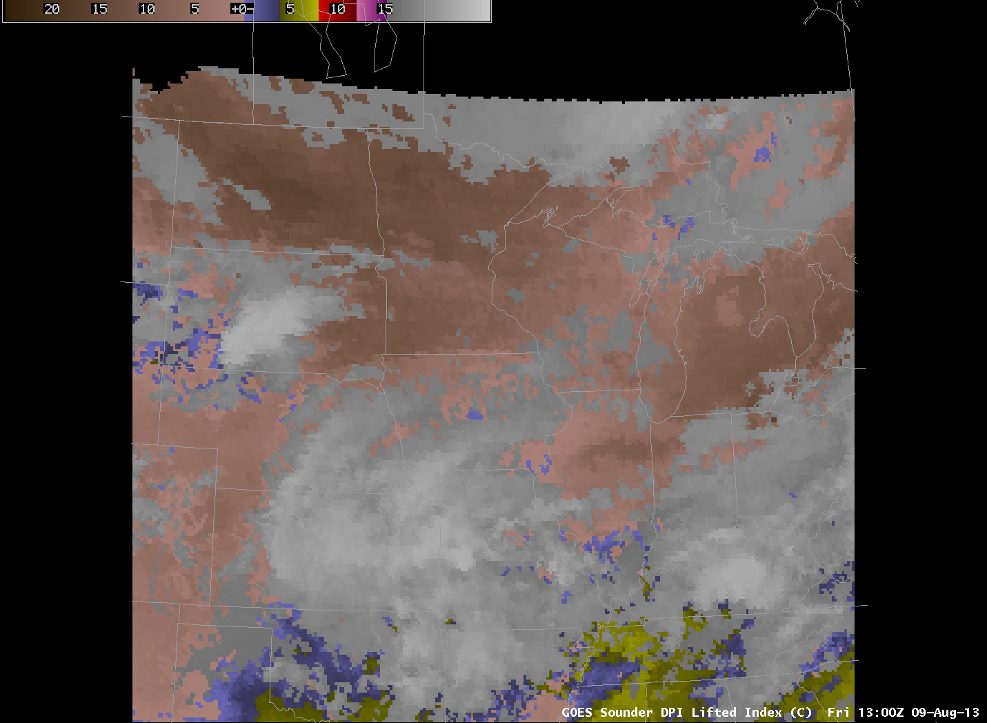
Mesoscale Convective Complexes are most likely to persist in regions of abundant moisture and low shear. GOES Sounder data can give an indication of moisture in regions where clouds do not obscure the view. Clouds were abundant as the MCV formed in this case, but the animation of Total Precipitation Water (above) shows an atmosphere rich in moisture. Sounder estimate of Lifted Index, below, indicate instability. (Both animations stop at 1400 UTC, just as the MCV was seen emerging from the convective complex over southwest Missouri). The ‘blended’ Percent of Normal Total Precipitable Water product, here, shows values exceeding 100% of normal over the mid-Mississippi River Valley.


