Multiple-vehicle accidents caused by snow squalls in the Cincinnati, Ohio area
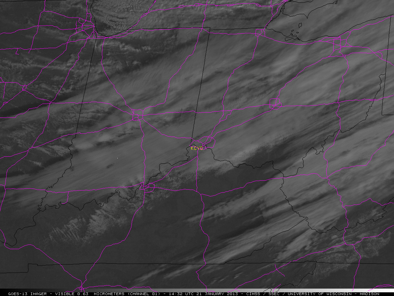
GOES-13 0.63 µm visible channel images (click image to play animation)
A number of multiple-vehicle accidents occurred in the Cincinnati, Ohio area when bands of heavy snow squalls moved through and caused white-out conditions that reduced visibility to near zero at times on 21 January 2012. McIDAS images of 1-km resolution GOES-13 0.63 µm visible channel data (above; click image to play animation) showed the development of widespread convective snow bands as they moved through the Ohio Valley region. KCVG denotes the location of the Cincinnati/Northern Kentucky International Airport, and Interstate highways are plotted in violet. As the clouds cleared to the west, the narrow streaks of snow on the ground seen in northern Illinois and Indiana revealed the mesoscale nature of the heavy snowfall produced by the more intense convective snow bands.
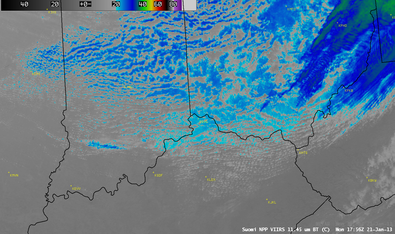
Three comparisons of AWIPS images of 1-km resolution visible and IR data from polar-orbiting satellites (below) — POES AVHRR at 14:47 UTC or 9:47 AM local time; MODIS at 16:10 UTC or 11:40 AM local time; and Suomi NPP VIIRS at 17:56 UTC or 12:56 AM local time — showed that the cloud top IR brightness temperatures of many of the more well-developed convective cloud bands were -20º C and colder (cyan to blue color enhancement), suggesting that those cloud bands had glaciated and were likely producing snowfall.
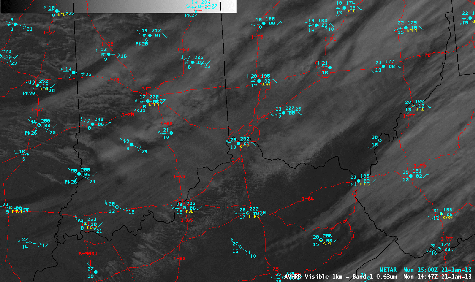
POES AVHRR 0.63 µm visible channel and 10.8 µm IR channel images
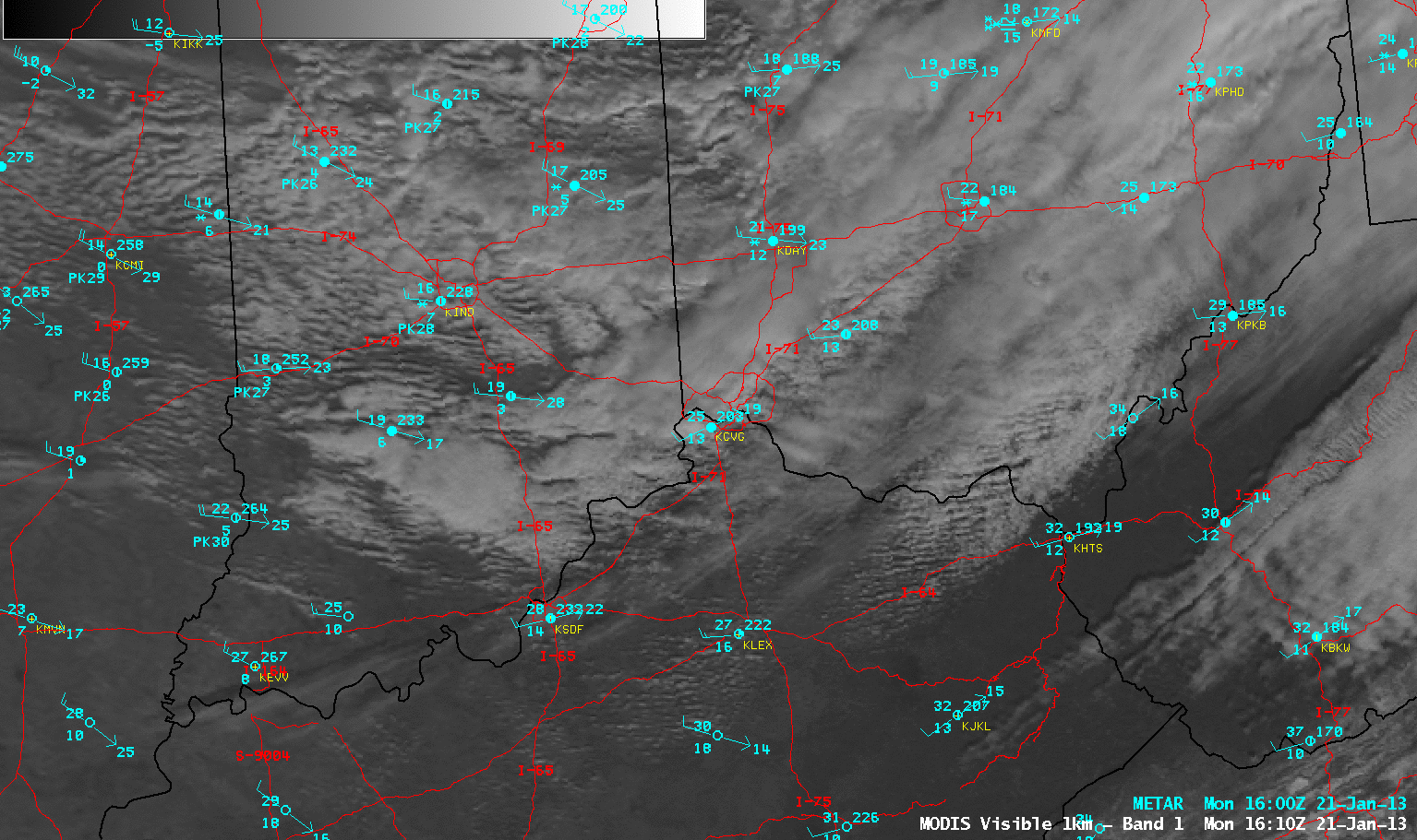
MODIS 0.65 µm visibe channel and 11.0 µm IR channel images
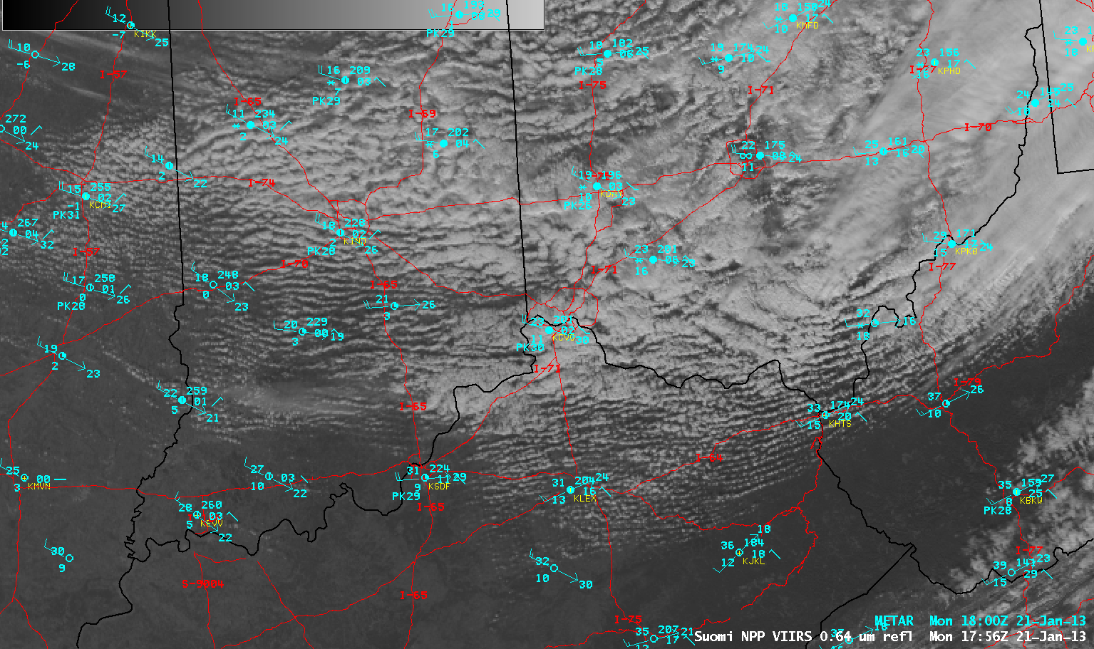
Suomi NPP VIIRS 0.63 µm visible channel and 11.45 µm IR channel images
Finally, a comparison of 1-km resolution Suomi NPP VIIRS 11.45 µm IR and 4-km resolution GOES-13 IR channel images (below) demonstrated the advantage of higher spatial resolution imagery for locating the important cloud band features that were cold enough to be glaciated and were therefore capable of producing snowfall.
Suomi NPP VIIRS 11.45 µm IR and GOES-13 10.7 µm IR images