Hurricane Ernesto
McIDAS images of 4-km resolution GOES-13 10.7 µm IR channel data (above; click image to play animation) showed Category 1 Hurricane Ernesto as it approached the far southeast coast of Mexico during the late afternoon and eary evening hours on 07 August 2012. The GOES-13 satellite had been placed into Rapid Scan Operations mode, providing images as frequently as every 5-10 minutes (vs the standard 15-minute image interval). Cloud top IR brightness temperatures of -80º C and colder were highlighted by the violet color enhancement.
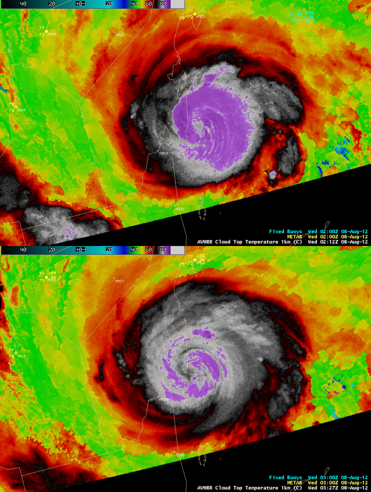
AWIPS images of the 1-km resolution POES AVHRR Cloud Top Temperature (CTT) product indicated that CTT values were as cold as -87º C at 02:12 UTC and -86º C at 03:27 UTC (below).
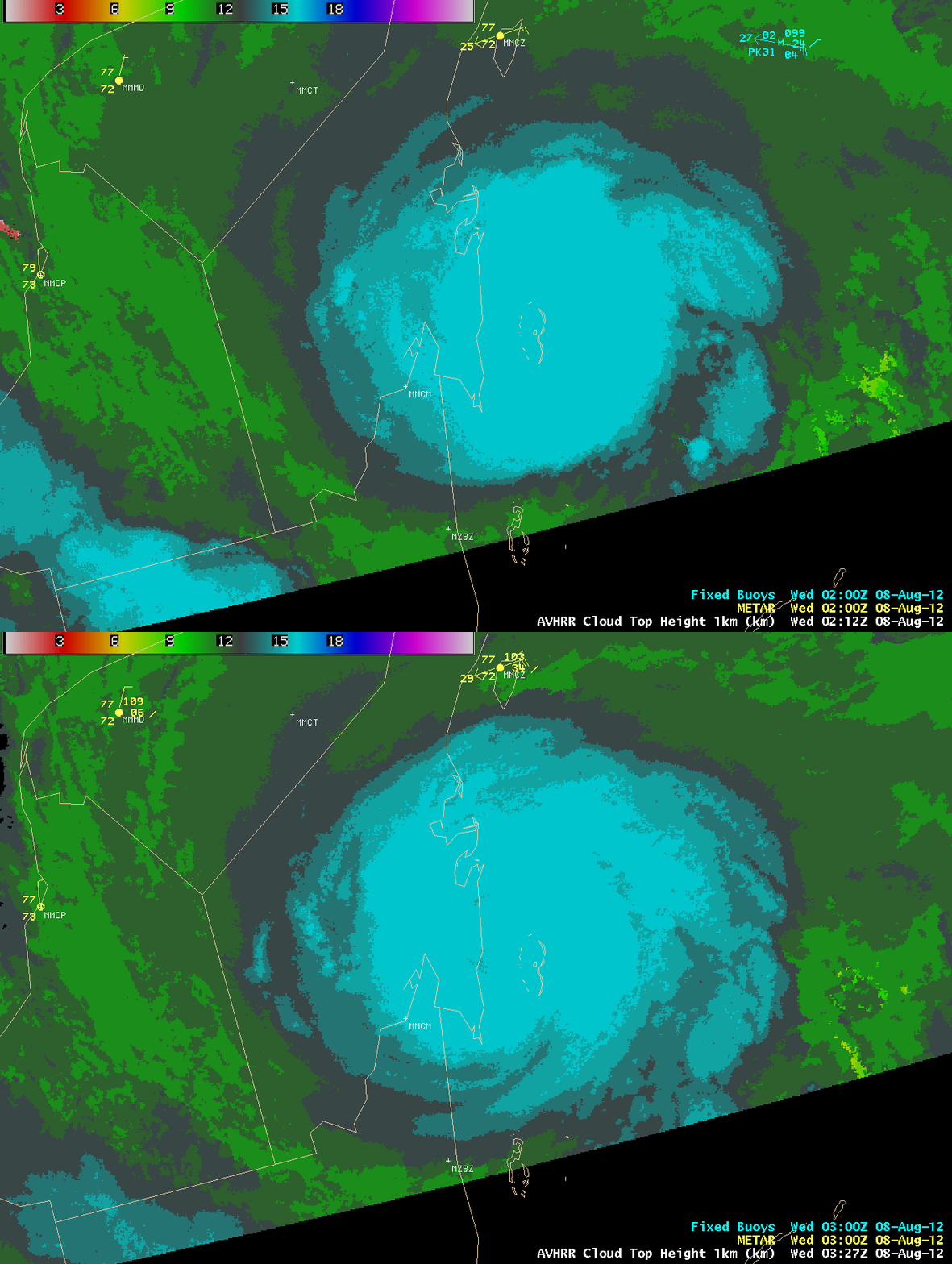
The 1-km resolution POES AVHRR Cloud Top Height (CTH) product showed that the highest cloud tops were around 16 km (below).
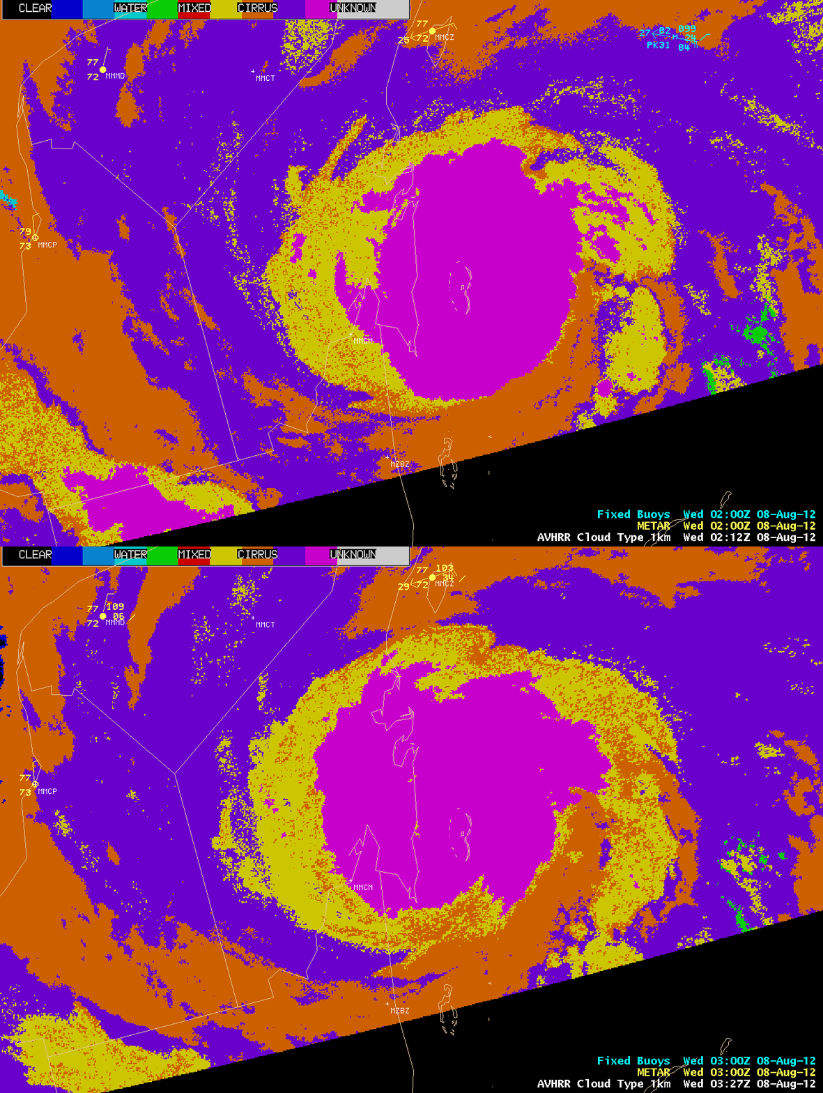
Much of the highest cloud top area was denoted as “overshooting” (violet color enhancement) on the 1-km resolution POES AVHRR Cloud Type product (below).
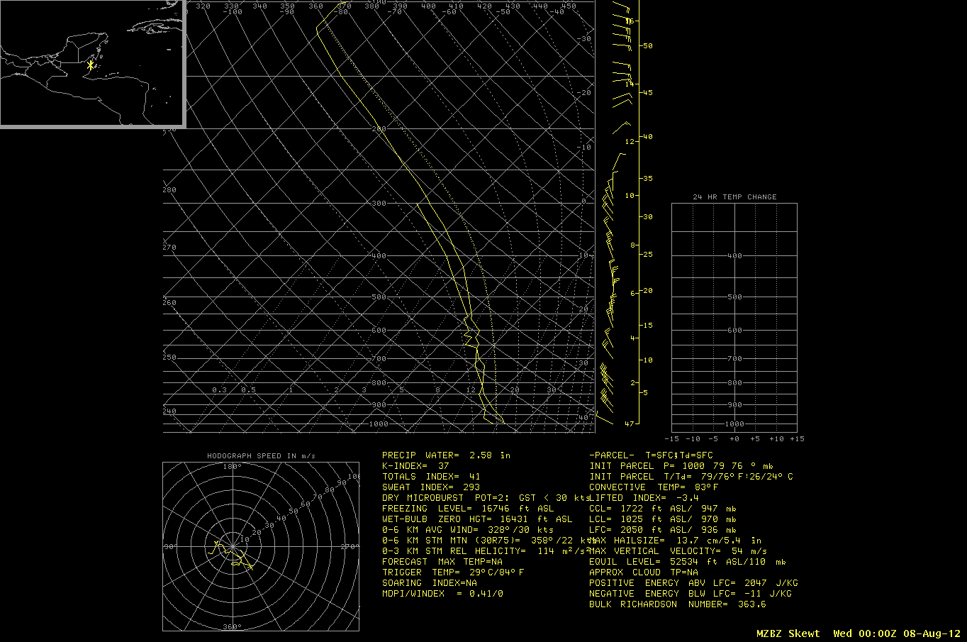
According to the 00:00 UTC / 08 August rawinsonde data from Belize City (below), the height of the tropopause was 15.8 km, with the air temperature at and just above the tropopause around -82º C. Note the nearly saturated profile of the tropical air mass, with a total precipitable water value of 2.58 inches.
===== 08 August Update =====
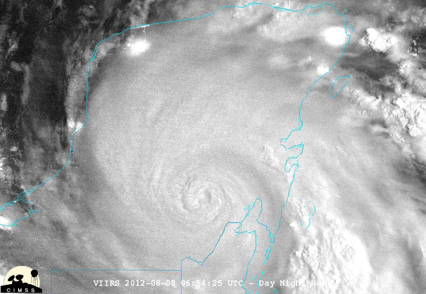
Since the Moon was in the Waning Gibbous phase (61% of full), there was enough reflected moonlight to allow a Suomi NPP VIIRS Day/Night Band image (below) to reveal the well-defined circulation of Ernesto as it was moving inland across the Yucatan Peninsula of Mexico at 06:54 UTC (1:54 am local time). Note the bright areas of city lights along the coastal areas (most notably Campeche, Merida, and Cancun) that could be seen through the relatively thin edges of the cirrus canopy.


