Mesoscale Convective System exhibiting cloud-top gravity waves and transverse banding
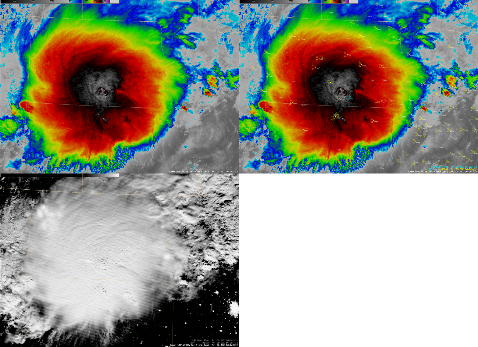
A comparison of AWIPS images of 375-meter resolution (projected onto a 1-km AWIPS grid) Suomi NPP VIIRS 11.45 µm IR channel data with the corresponding 0.7 µm VIIRS Day/Night Band (above) showed a large Mesocale Convective System (MCS) with an expansive cold cloud shield (exihibiting IR brightness temperatures as cold as -84 C) over parts of North Dakota and South Dakota at 08:43 UTC (3:43 AM local time) on 06 July 2012. A number of well-defined cloud-top gravity waves could also be seen propagating northward and northeastward outward away from the core of the storm. There was a damaging wind report at 09:03 UTC in south-central North Dakota:  SW WIND GUST OF 68 MPH AT 403 AM CDT...AND N WIND GUST OF 68 MPH AT 408 AM CDT. Illumination from a full moon made convective overshooting tops and some of these cloud-top gravity waves easy to see on the Day/Night Band image.
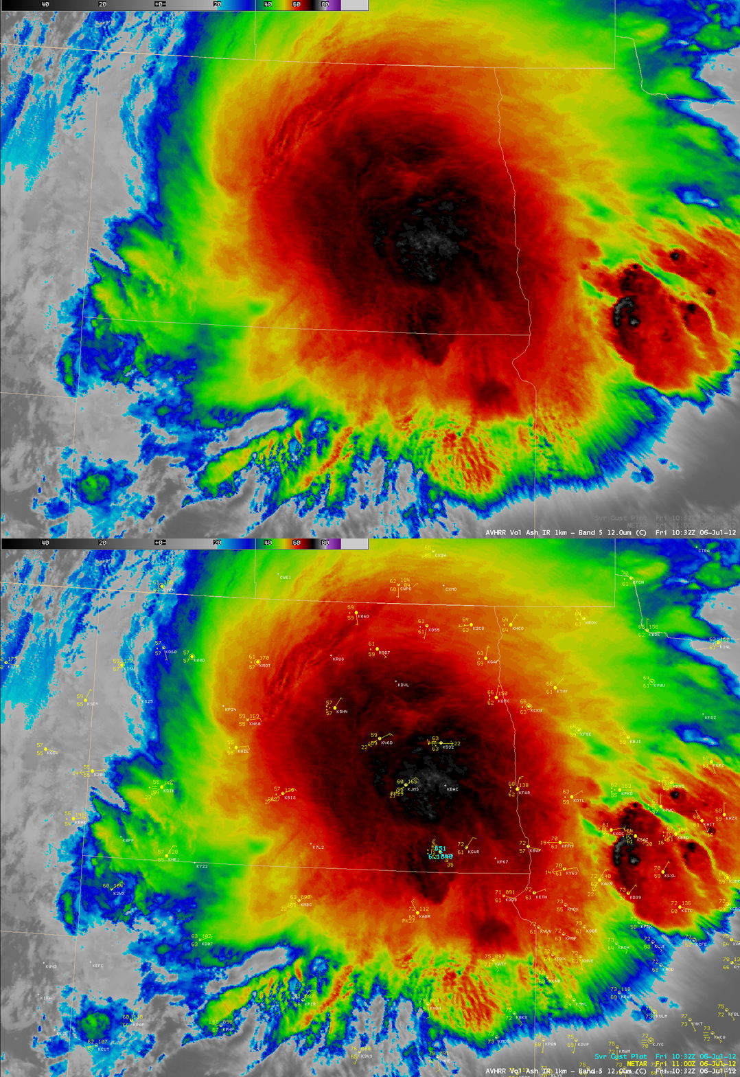
About 2 hours later, these cloud-top gravity waves wee more difficult to identify on a 1-km resolution POES AVHRR 10.8 µm IR image (below) at 10.32 UTC (5:32 AM local time), although a few could still be seen in eastern North Dakota, western Minnesota and southern Manitoba. There was a wind gust to 51 knots (59 mph) reported at 10:40 UTC in southeastern North Dakota.
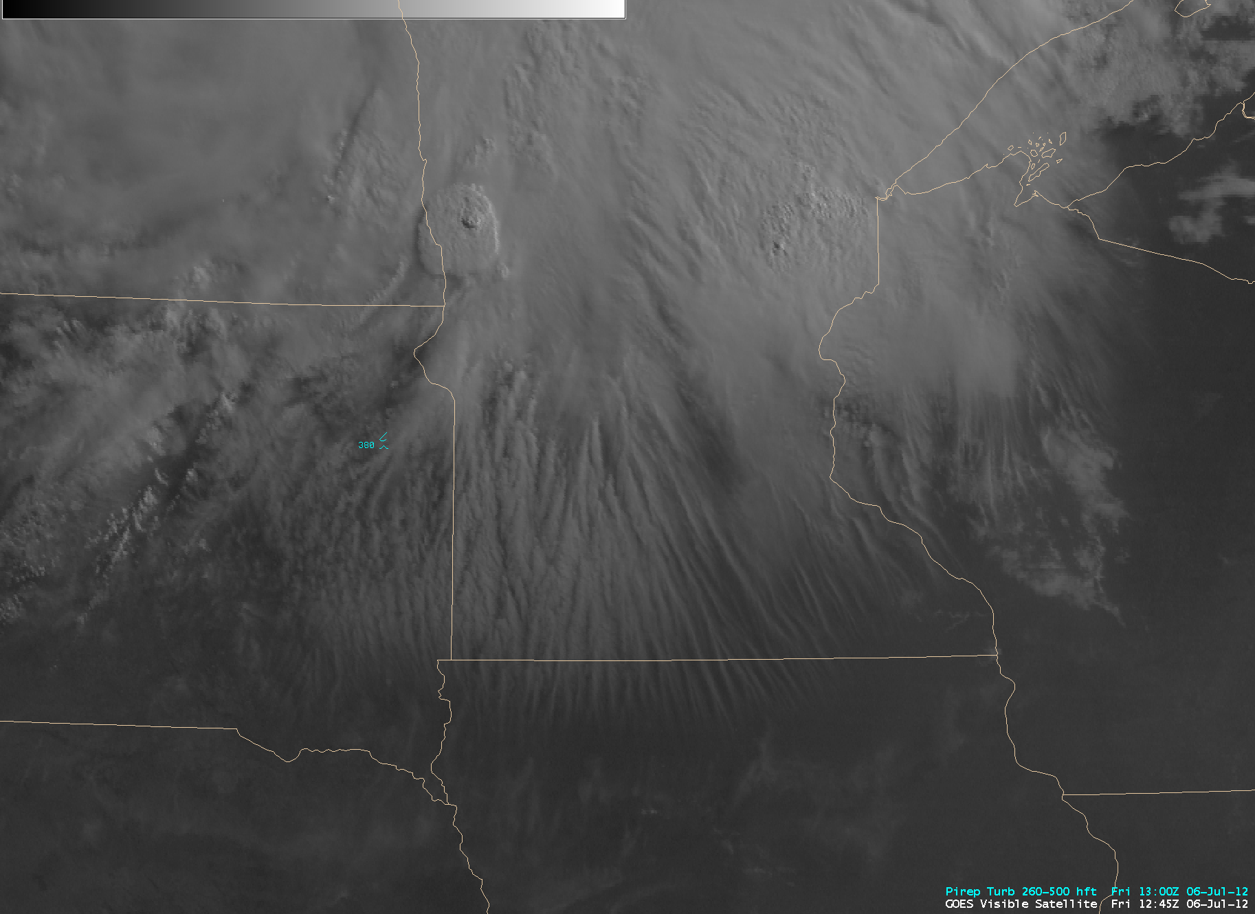
As the MCS began to dissipate around sunrise, a vivid display of transverse banding cirrus filaments could be seen on 1-km resolution GOES-13 0.63 µm visible channel images (below; click image to play animation) forming along the southern periphery of the storm over eastern South Dakota, southern Minnesota, and far northern Iowa. This transverse banding is a satellite signature of potential high-altitude turbulence — and there was one pilot report of moderate turbulence at 38,00 feet in eastern South Dakota.


