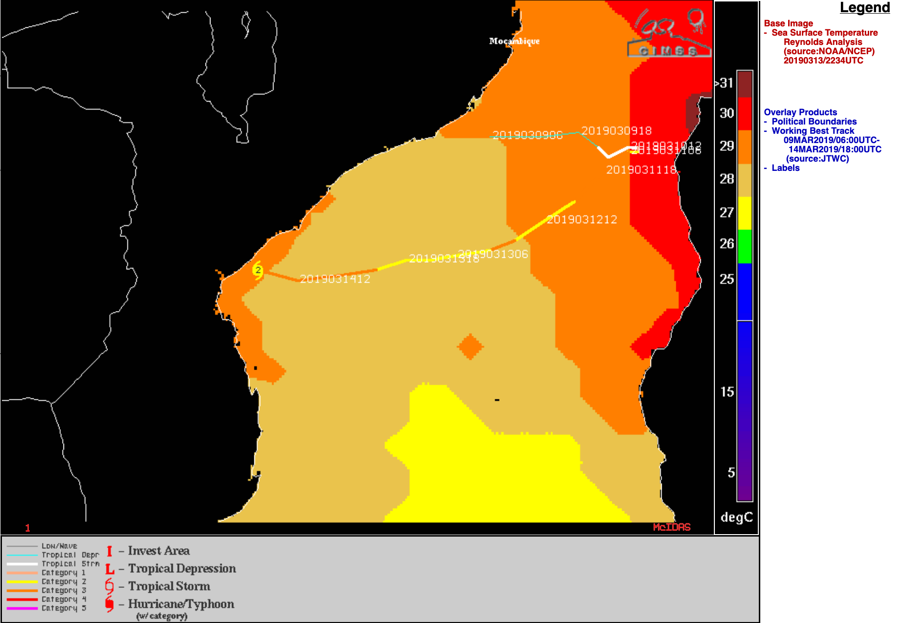
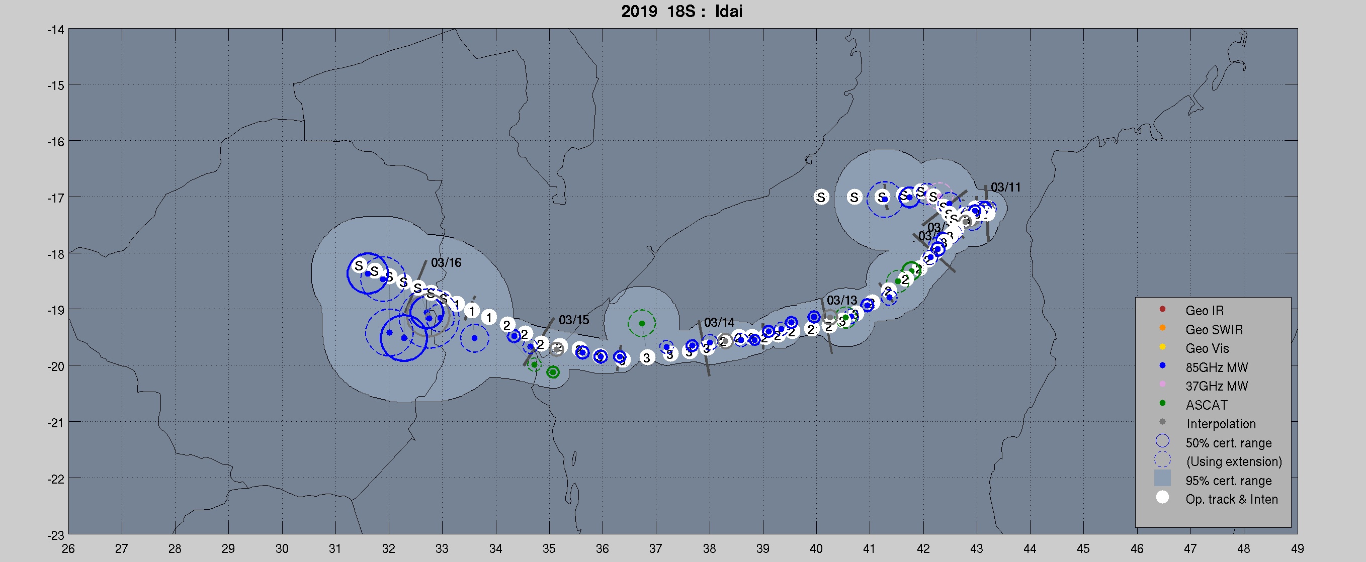
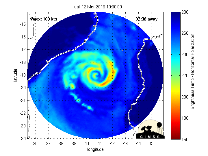
Cyclone Idai makes landfall in Mozambique
![Meteosat-8 Infrared (10.8 µm) and DMSP-17 SSMIS Microwave (85 GHz) images of Cyclone Idai at 1630 UTC [click to enlarge]](https://cimss.ssec.wisc.edu/satellite-blog/wp-content/uploads/sites/5/2019/03/190314_1630utc_meteosat8_infrared_dmsp17__microwave_Idai_anim.gif)
Meteosat-8 Infrared Window (10.8 µm) and DMSP-17 SSMIS Microwave (85 GHz) images of Cyclone Idai at 1630 UTC [click to enlarge]
At 1911 UTC, Metop-A ASCAT winds in excess of 60 knots were sampled just west of the eyewall region (below).
![Meteosat-8 Infrared Window (10.8 µm) image, with plots of Metop-A ASCAT winds at 1911 UTC [click to enlarge]](https://cimss.ssec.wisc.edu/satellite-blog/wp-content/uploads/sites/5/2019/03/190314_1900utc_meteosat8_infrared_metopA_ascat_winds_Idai.png)
Meteosat-8 Infrared Window (10.8 µm) image, with plots of Metop-A ASCAT winds at 1911 UTC [click to enlarge]
![NOAA-20 and Suomi NPP VIIRS True Color RGB and Infrared Window (11.45 µm) images [click to enlarge]](https://cimss.ssec.wisc.edu/satellite-blog/wp-content/uploads/sites/5/2019/03/190314_noaa20_suomiNPP_viirs_truecolor_infrared_Cyclone_Idai_anim.gif)
NOAA-20 and Suomi NPP VIIRS True Color RGB and Infrared Window (11.45 µm) images [click to enlarge]
![Meteosat-8 Infrared Window (10.8 µm) images with contours of satellite-derived Deep-Layer Wind Shear valid at 18 UTC [click to enlarge]](https://cimss.ssec.wisc.edu/satellite-blog/wp-content/uploads/sites/5/2019/03/190314_meteosat8_infrared_Idai_anim.gif)
Meteosat-8 Infrared Window (10.8 µm) images with contours of satellite-derived Deep-Layer Wind Shear valid at 18 UTC [click to enlarge]
![MIMIC TC morphed microwave imagery [click to enlarge]](https://cimss.ssec.wisc.edu/satellite-blog/wp-content/uploads/sites/5/2019/03/190314_mimicTC_Idai_anim.gif)
MIMIC TC morphed microwave image product [click to enlarge]
![Meteosat-8 High Resolution Visible (0.8 µm) images [click to play animation]](https://cimss.ssec.wisc.edu/satellite-blog/wp-content/uploads/sites/5/2019/03/190314_meteosat8_visible_Idai_anim.gif)
Meteosat-8 High Resolution Visible (0.8 µm) images [click to play animation]
![Surface observation data from Beira, Mozambique [click to enlarge]](https://cimss.ssec.wisc.edu/satellite-blog/wp-content/uploads/sites/5/2019/03/190314_FQBR_SFCMG.GIF)
Surface observation data from Beira, Mozambique [click to enlarge]
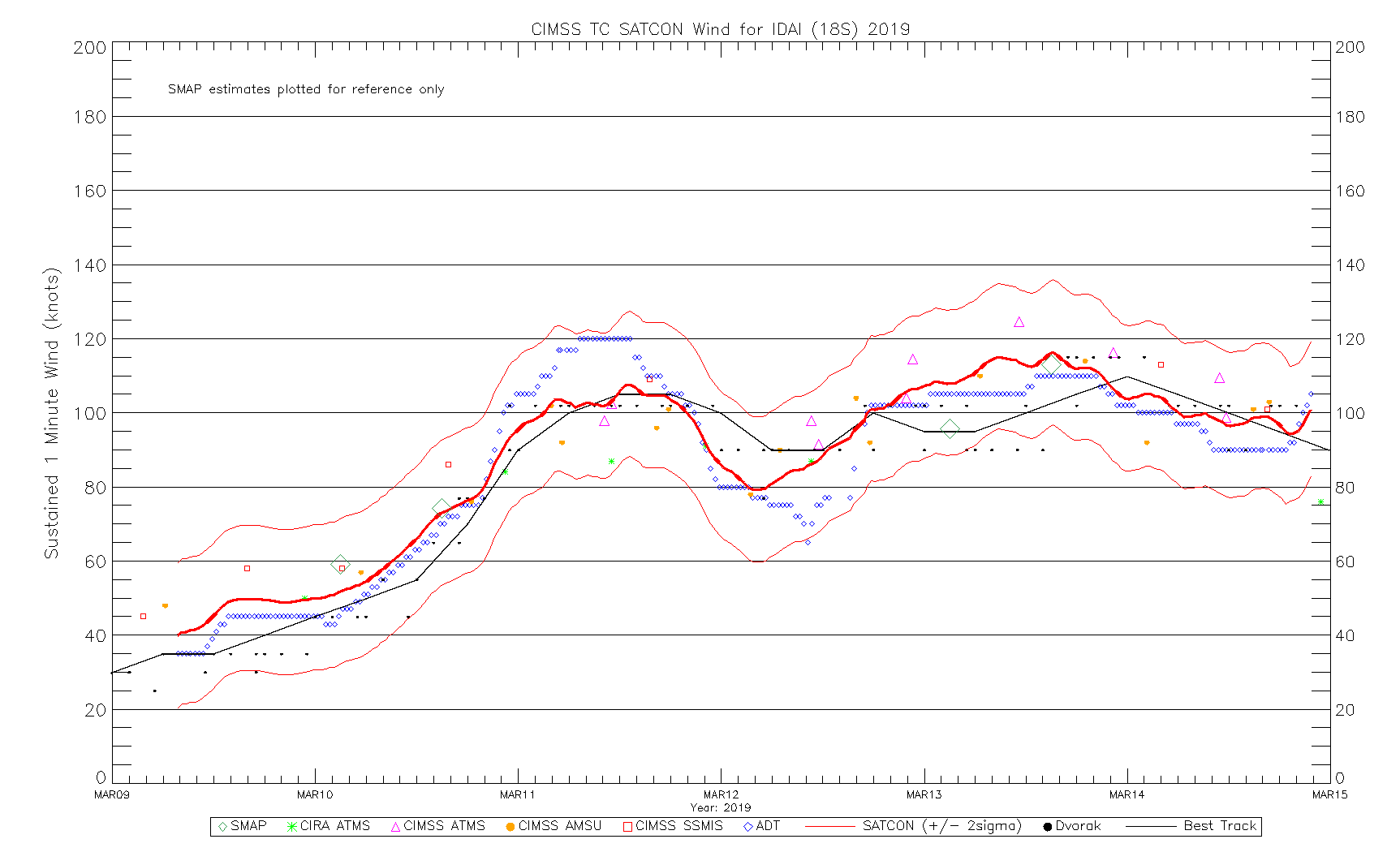
Incidentally, an overpass of the Landsat-8 satellite on 11 March provided a 30-meter resolution view of the eye (below), soon after Idai’s first period of rapid intensification to Category 3 strength (SATCON). Surface mesovortices were apparent within the eye.
![Landsat-8 False Color image of the eye of Idai on 11 March [click to play a zooming animation]](https://cimss.ssec.wisc.edu/satellite-blog/wp-content/uploads/sites/5/2019/03/190311_0710utc_landsat8_falsecolor_Idai_anim.gif)
Landsat-8 False Color image of the eye of Idai on 11 March [click to play a zooming animation]
Flooded areas near Beira on 19 Mar 2019 computed from #Sentinel1 #MozambiqueFloods@CopernicusEMS @CopernicusEU pic.twitter.com/2OdE6Ixzig
— Simon Gascoin (@sgascoin) March 20, 2019