This website works best with a newer web browser such as Chrome, Firefox, Safari or Microsoft Edge. Internet Explorer is not supported by this website.

Category: Severe convection

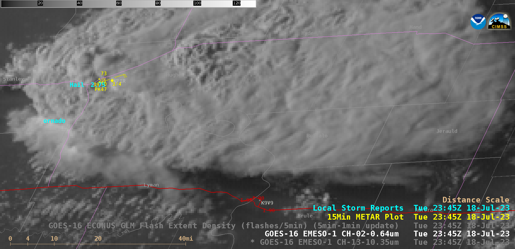
Thunderstorms across Interior Alaska

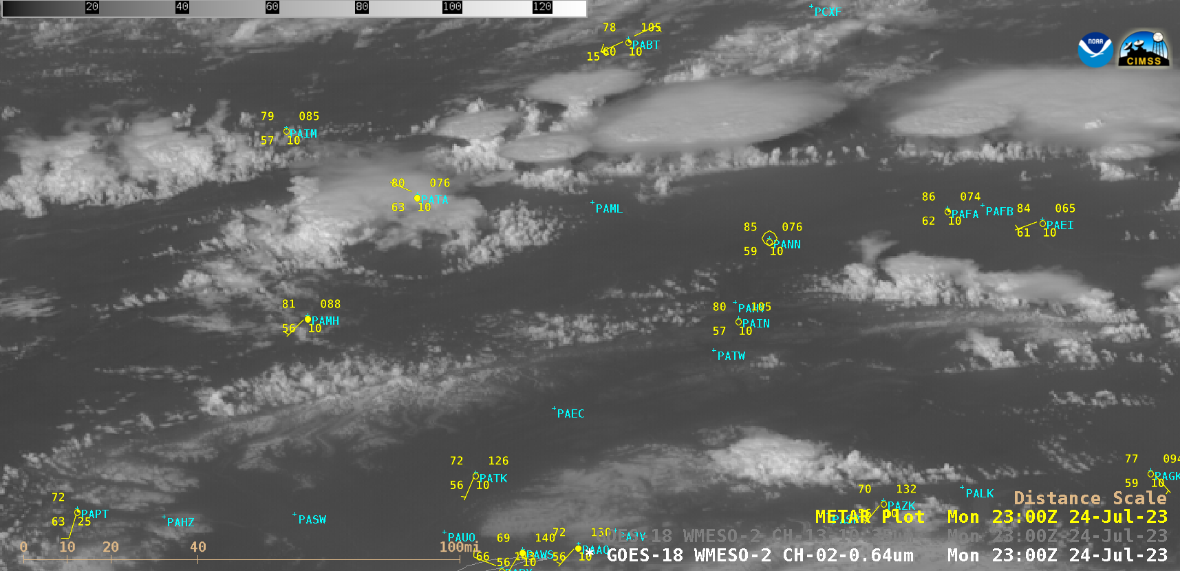
1-minute Mesoscale Domain Sector GOES-18 (GOES-West) “Red” Visible (0.64 µm) images (above) showed the development of thunderstorms across much of the eastern portion of Interior Alaska on 24 July 2023. The large satellite viewing angle — which is 73.5 degrees for Fairbanks (station identifier PAFA) — provided an oblique perspective that nicely displayed the vertical buildup... Read More

Supercell thunderstorm produces giant hail and 100 mph winds in South Dakota

1-minute Mesoscale Domain Sector GOES-16 (GOES-East) “Red” Visible (0.64 µm) images (above) showed a supercell thunderstorm that produced a tornado, hail as large as 5.00 inches in diameter and wind gusts to 100 mph (SPC Storm Reports | NWS Aberdeen summary) in central South Dakota during the late afternoon and early evening hours on 18 July 2023. Several pulses of overshooting tops... Read More