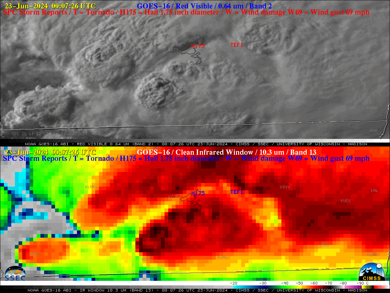
Severe thunderstorm north of the Arctic Circle in Alaska
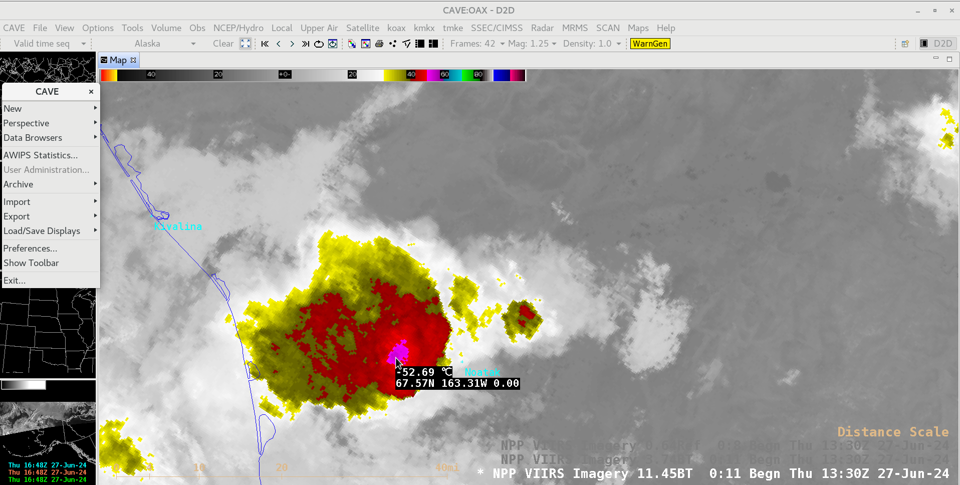
A toggle between Suomi-NPP VIIRS Visible (0.64 µm) and Infrared Window (11.45 µm) images valid at 1335 UTC on 27 June 2024 (above) showed a severe-warned thunderstorm just west of Noatak, Alaska. This thunderstorm — located north of the Arctic Circle — exhibited a cloud-top infrared brightness temperature as cold as... Read More