SAR Data with a severe thunderstorm off the coast of Florida

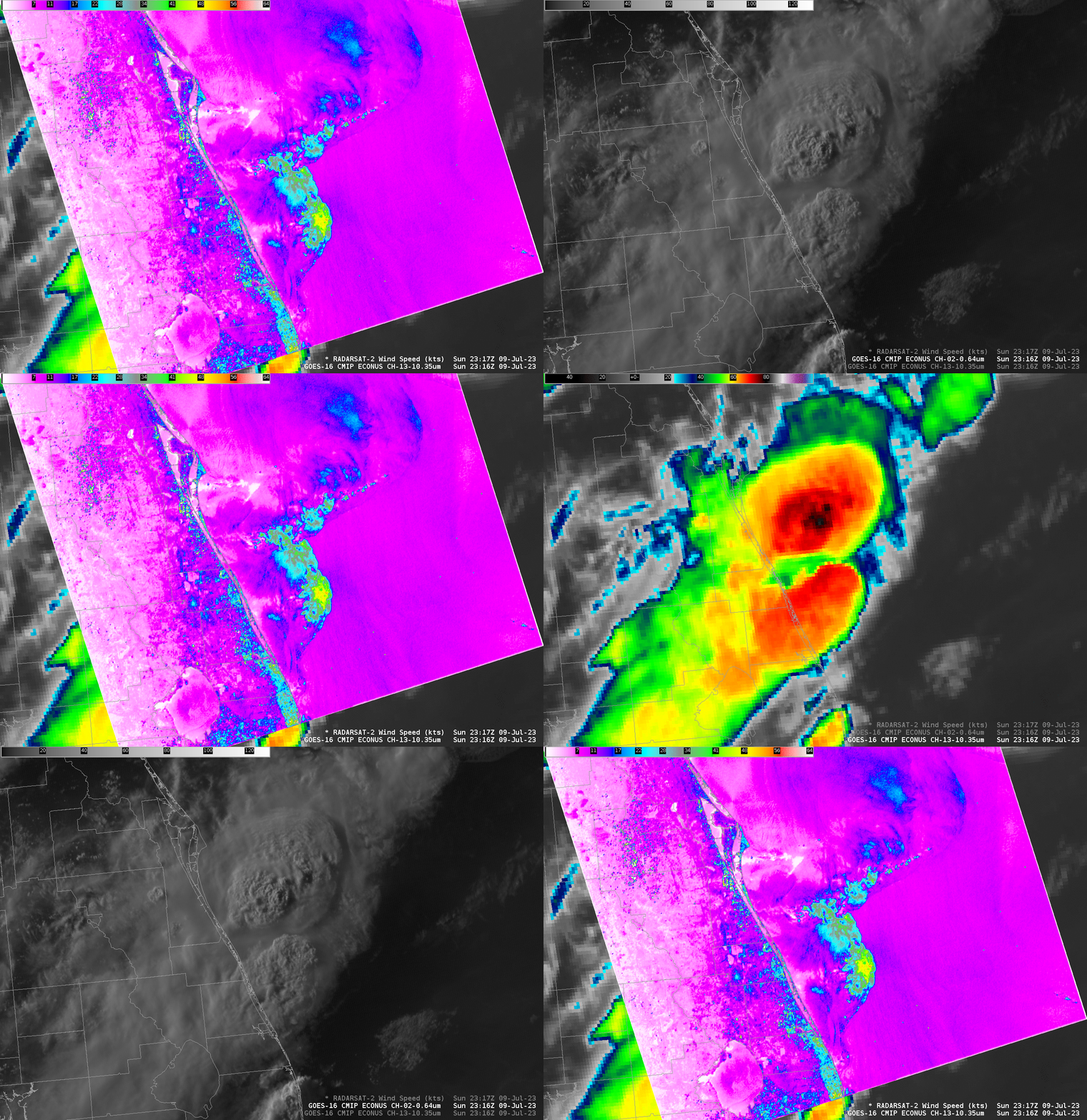
GOES-16 Visible (Band 2, 0.64 µm) and Infrared (Band 13, 10.3 µm) imagery at 2316 UTC on 9 July 2023, above, show cloud-top features commonly associated with intense convection off the east coast of Florida, to the southeast of Cape Canaveral. RADARSAT-2 overflew this region at the same time, and derived SAR wind estimates, toggled above with the ABI data, exceeded 50 knots (the yellow/red enhancement) with the southern convective cell.
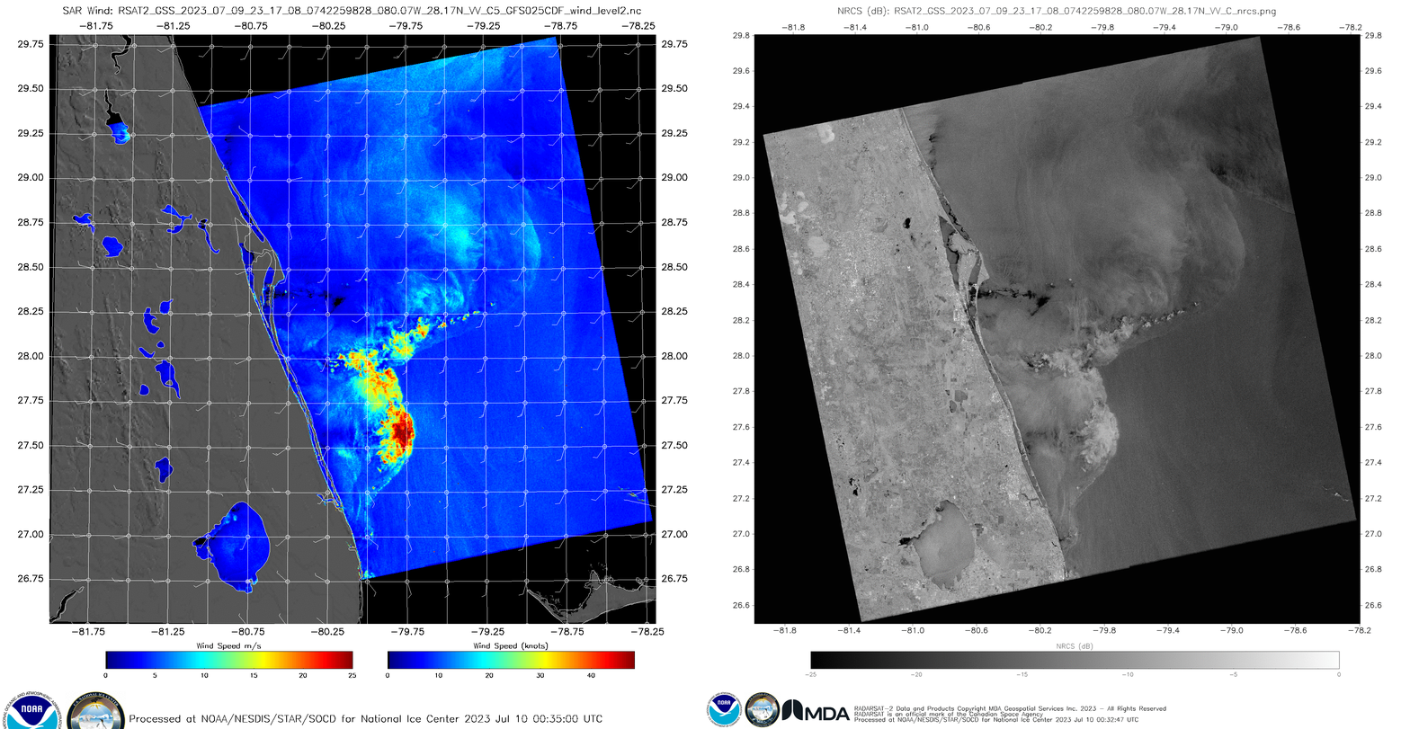
Do you think those SAR wind observations are credible? Sometimes when SAR winds are very strong in regions of convection, the enhanced wind signal occurs because of reflection off ice crystals within the cloud. When that happens, the Normalized Radar Cross Section (NRCS) field will frequently acquire a feathery look. That is not occurring on this day, as shown in the toggle below of derived wind speed and NRCS, at least not in the region of the strong convection just east of the Florida coast. It’s likely that winds over the ocean here were close to 50 knots in strength.

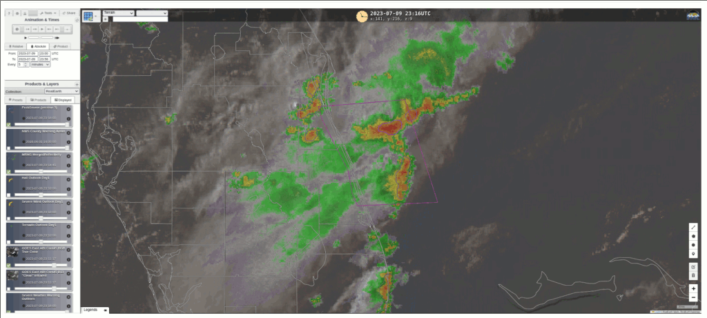
NOAA/CIMSS ProbSevere (version 3) identified the convective cell at 2316 UTC, as shown below. However, probabilities were quite small — less than 10%, albeit with a maximum shortly after 2300 UTC (Click here to see a ProbSevere readout for the Radar Object associated with the southern part of the convection, the one that is oriented north-south). A Special Marine Warning was nevertheless in effect in the region of strong winds. Probabilistic guidance such as ProbSevere should be used in concert with other products to arrive at a warning decision. In this case the other products argued persuasively for warning issuance.


