Intense Bering Sea Extratropical Cyclone
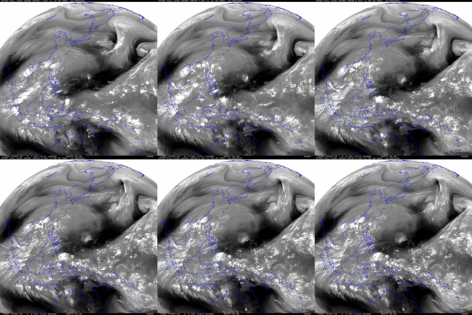
McIDAS images of MTSAT-1R 6.7 µm water vapor channel data (above) showed an intense extratropical cyclone that was moving toward the Bering Sea region during the 07 November – 08 November 2011 time frame. Of particular interest was the presence of a very warm/dry (dark black) circular region within the dry slot sector of the developing cyclone, which could have been associated with a strong potential vorticity anomaly.
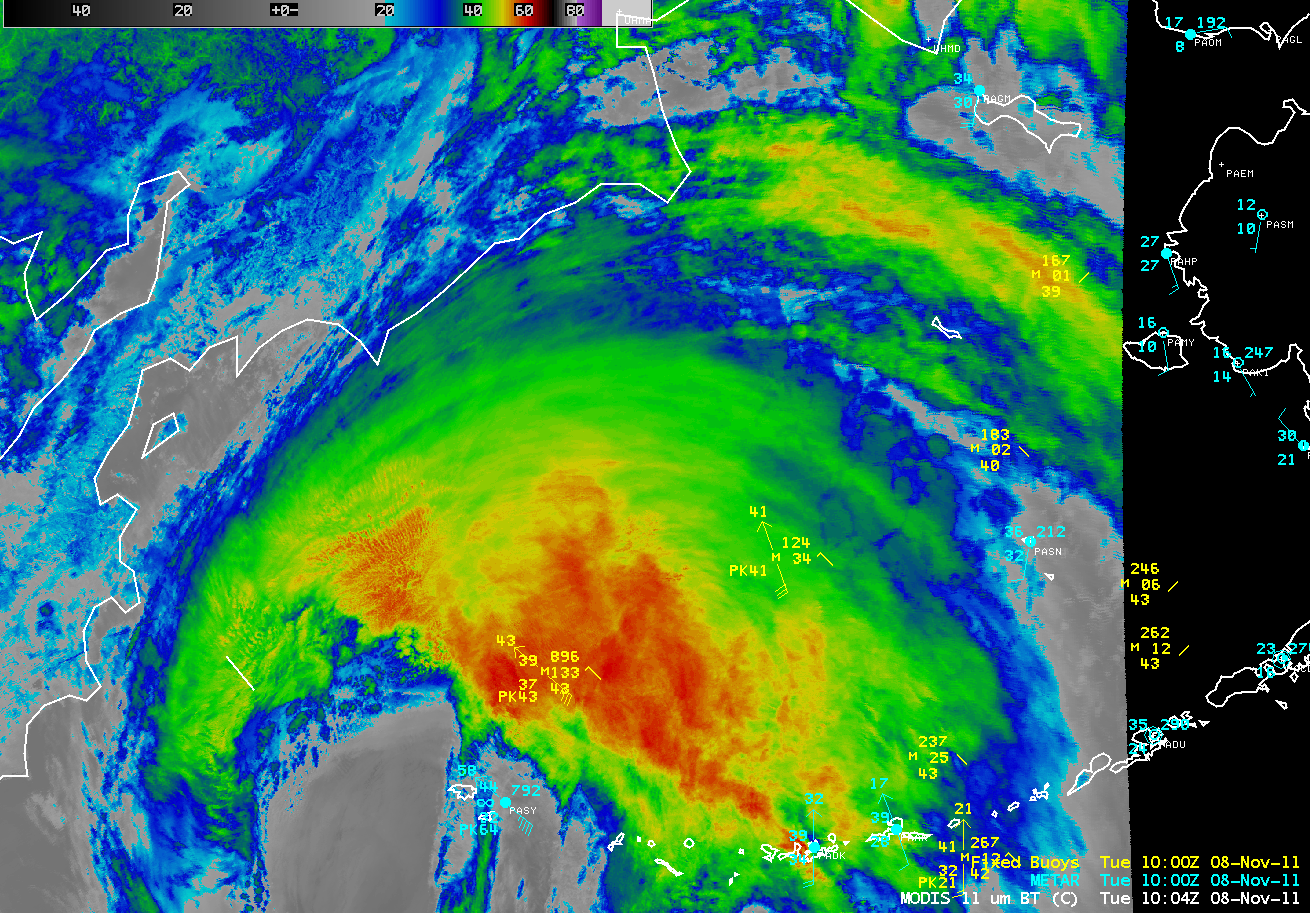
A color-enhanced comparison of MTSAT-1R and GOES-11 6.7 µm water vapor channel data (below; click image to play animation) demonstrated the difference that satellite viewing angle (MTSAT looking from the west; GOES-11 looking from the east) and satellite sensor spatial resolution (the MTSAT-1R water vapor channel is “4 km” at nadir, while the GOES-11 water vapor channel is “8 km” at nadir) play in the ability to resolve such potentially important dynamical features. The core of the aforementioned MTSAT-1R dry feature moved directly over Shemya Island around 12:00 UTC on 08 November (MODIS IR image with surface analysis), where a surface wind gust of 83 mph was recorded at Shemya Air Force Base. Then, once the storm began to move northward over the Bering Sea, a more “curved banding” structure was seen on water vapor imagery as the cyclone began to wrap filaments of dry air around the deepening storm center. Although the sun angle was low, some of the “banding structure” could be seen in GOES-11 0.65 µm visible channel images.
MTSAT-1R (left) and GOES-11 (right) 6.7 µm water vapor channel images (click image to play animation)
While the dry slot features began to lose their definition in the geostationary MTSAT-1R and GOES-11 water vapor images (in part due to the upward shift in the peak of the water vapor channel weighting function with increasing satellite viewing angle), a direct overpass of the Aqua satellite around 23:45 UTC on 08 November provided a nice view using the 6.7 µm water vapor channel on the MODIS instrument (below). Using the MODIS imagery, good dry slot structure could be seen, even after the storm had moved northward over the Bering Sea.
A sequence of AWIPS images of 1-km resolution MODIS 11.0 µm and POES AVHRR 12.0 µm InfraRed data (below; click image to play animation) showed the storm at various phases as it was rapidly deeping during its northward trek over the Bering Sea.
This ended up being one of the strongest Bering Sea storms on record — the winds exceeded hurricane force across a very expansive area, producing high seas and major coastal flooding and beach erosion along parts of western Alaska. At the Tin City Airways Facility Sector (located near the western tip of the Seward Peninsula), they reported sustained winds of 72 mph with gusts to 85 mph — and the minimum altimeter air pressure was 28.46 inches. A peak gust of 89 mph was reported nearby at Wales. As the storm moved over St, Lawrence Island, minimum altimeter air pressure readings were 28.21 inches and 28.28 inches at Gambell and Savoonga, respectively.
The entire evolution of the storm during the 08-09 November time period can be seen on an animation of 15-minute interval GOES-11 10.7 µm IR images (below; click image to play animation).


