Lake Michigan lake-effect snow band enhanced with a mesoscale vortex
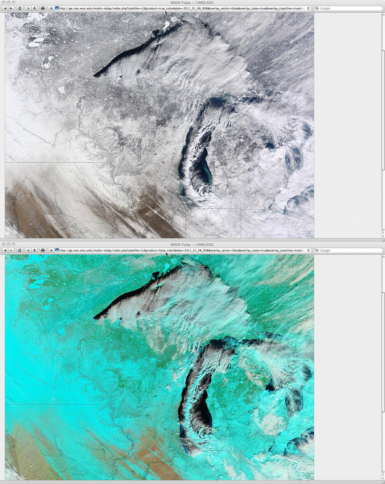
A comparison of MODIS Red/Green/Blue (RGB) “true color” (created using Bands 1/4/3) and “false color” (created using Bands 7/2/1) images from the SSEC MODIS Today site (above) showed a well-defined single lake-effect snow (LES) band running down the length of Lake Michigan on 08 January 2011. On the false color image, snow cover, ice, and glaciated clouds appeared as cyan-colored features, in contrast to the brighter white supercooled water droplet cloud features.
A mesoscale vortex formed during the day along the southern end of the Lake Michigan LES band, which helped to enhance snowfall rates as the band moved inland across southwestern Lower Michigan and northern Indiana. With the heavy snow from this LES band and mesoscale vortex, South Bend, Indiana (station identifier KSBN) set a new record for both 1-day and 2-day snowfall — 26.0 inches and 36.6 inches, respectively. With the MODIS Sea Surface Temperature (SST) product showing mid-lake SST values over 40º F (+10º C) and the 12 UTC 850 hPa air temperatures at Green Bay WI and Gaylord MI around +4º F (-16º C), the delta-T values were certainly large enough to support the formation of intense LES bands.
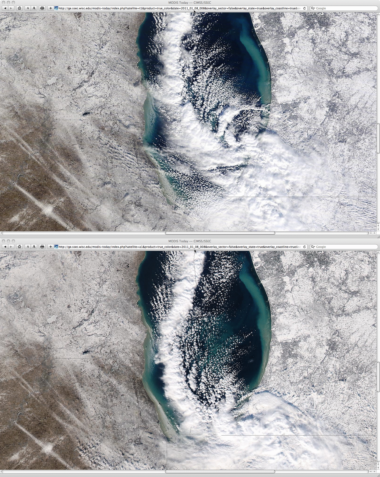
A closer view of the southern end of the LES band and the mesoscale vortex using 250-meter resolution MODIS true color RGB images at 17:04 UTC and 18:46 UTC (below) also revealed the movement of small ice floes in the nearshore waters of Lake Michigan.
The evolution of the mesoscale vortex was evident on McIDAS images of 15-minute interval GOES-13 0.65 µm visible channel data (below; click image to play animation). Also note the numerous long, narrow streaks of snow on the ground across parts of northern Illinois into northern Indiana, left behind from previous events.
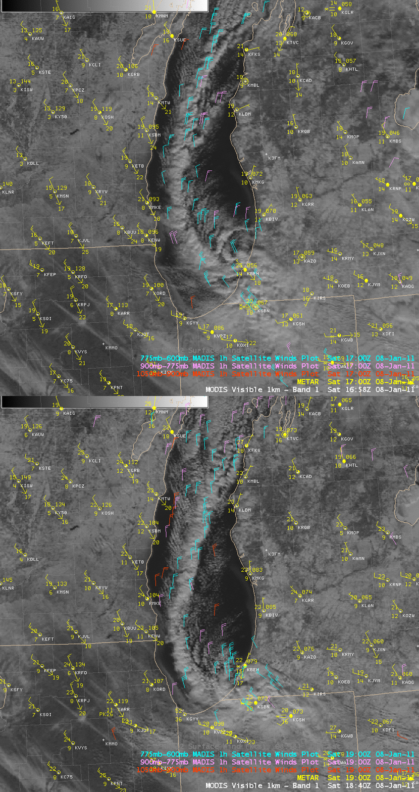
AWIPS images of MODIS 0.65 µm visible channel data with overlays of MADIS 1-hour interval satellite winds (below) indicated that the LES band features were generally propagating southward at speeds of 20-30 knots.
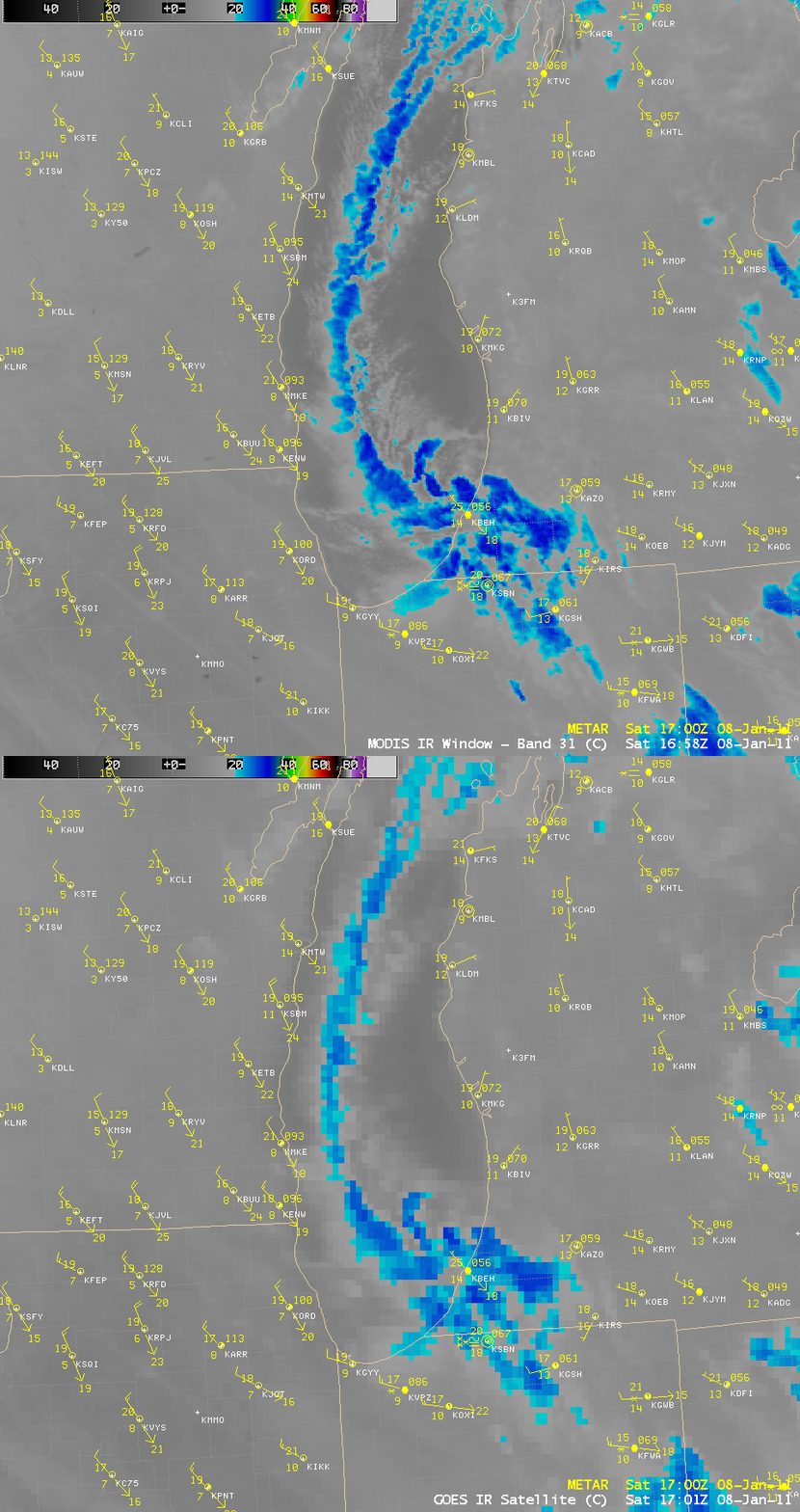
A comparison of a 1-km resolution MODIS 11.0 µm IR image with the corresponding 4-km resolution GOES-13 10.7 µm IR image (below) showed that IR brightness temperatures within parts of the LES band feature were as cold as -25 to -30º C (cyan to darker blue color enhancement).
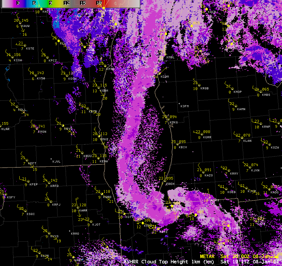
The 1-km resolution POES AVHRR Cloud Top Height (CTH) product (below) indicated that the LES feature exhibited CTH values which were generally in the 2-3 km range (darker violet color enhancement).
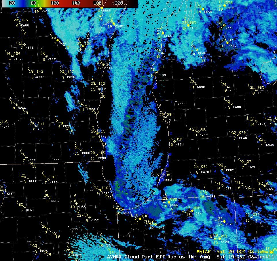
The POES AVHRR Cloud Particle Effective Radius product (below) helped to highlight the glaciated portions of the LES band, where the radius of the larger ice crystals was in the 50-60 µm range (green color enhancement), compared to the supercooled water droplet clouds consisting of smaller particles in the 15-25 µm range (cyan color enhancement).


