The first US tornado of 2010: in southern California, of all places
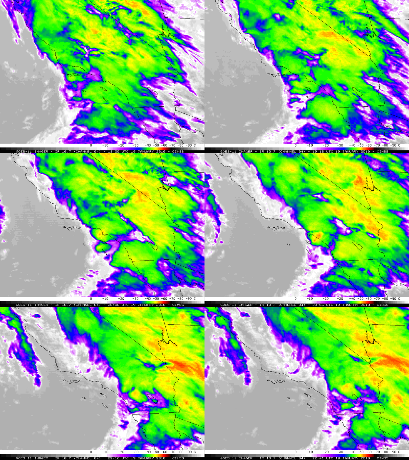
McIDAS images of the 4-km resolution GOES-11 10.7 µm IR channel data (above) showed the development of convection that moved onshore across southern California during the afternoon hours on 19 January 2010. Of particular interest is the strong convective cluster that developed just offshore over the Santa Catalina and San Clemente Island area — the GOES-11 IR brightness temperatures of this feature cooled to -53º C (darker orange color enhancement) as it was moving inland around 20:46 UTC (12:46 pm local time).
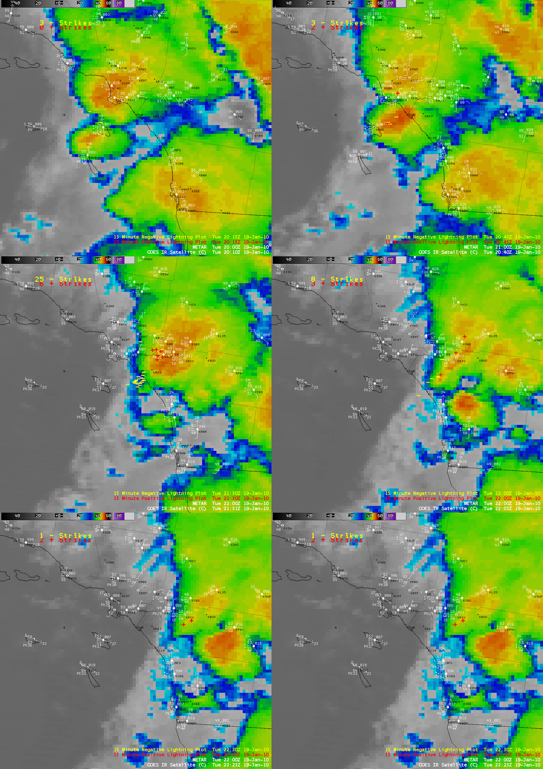
A closer view using AWIPS images of the GOES-11 IR channel with overlays of surface METAR reports and cloud-to-ground lightning strikes (below) revealed that this convective cell with the coldest cloud tops exhibited a number of lightning strikes (as many as 31 for the 15-minute period ending at 21:30 UTC). These storms were developing in the vicinity of a surface wave that had formed along a strong cold frontal boundary — and according to SPC Storm Reports (overlaid on a MODIS 11.0 µm IR image) there were two reports of a tornado in the Huntington Beach area and a number of high wind gusts (including 93 mph at Newport Beach, and 92 mph at Huntington Beach) as the severe thunderstorm moved onshore. For radar images and additional information, see the WeatherMatrix blog.
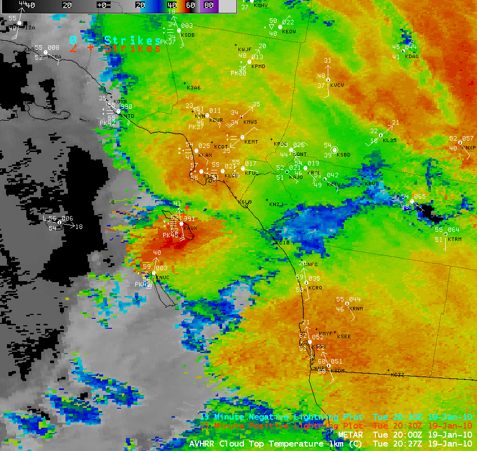
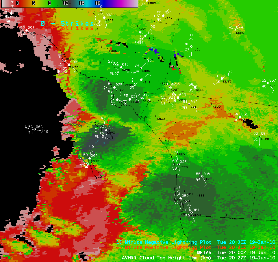
The 1-km resolution POES AVHRR Cloud Top Temperature (CTT) product (above) indicated that the coldest CTT value with this storm was -56º C, with the Cloud Top Height product (below) showing the maximum cloud tops at a height of 14 km.
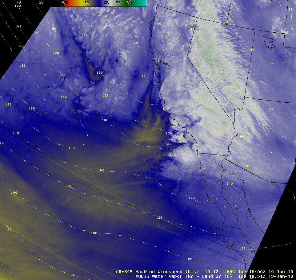
A MODIS 6.7 µm water vapor image with an overlay of CRAS model Level of Maximum Wind isotachs (below) showed that southern California was located beneath the left exit region of a strong upper level jet stream, which likely contributed to strong deep layer wind shear and ageostrophic forcing to aid in the development of the severe thunderstorms.
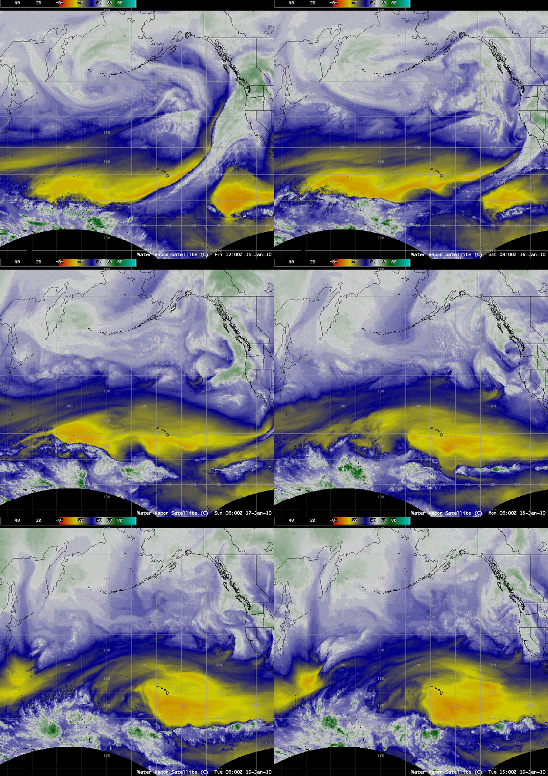
A sequence of water vapor images from 15 January to 19 January (below) showed that this particular storm was one of a series of strong disturbances that was moving across the Pacific Ocean along a very strong zonal (west to east) jet stream.
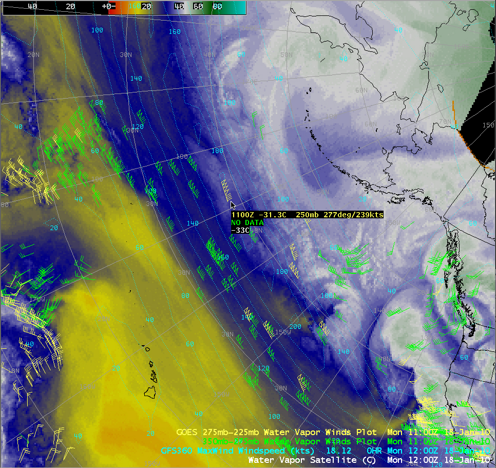
On 18 January, The GFS360 model Level of Maximum Wind isotach field indicated that winds just exceeded 200 knots within the core of the jet stream; however, GOES-11 satellite-derived water vapor winds (below) suggested that speeds were as high as 239 knots along the jet stream axis.


