Super Typhoon Nida (26W) in the West Pacific Ocean
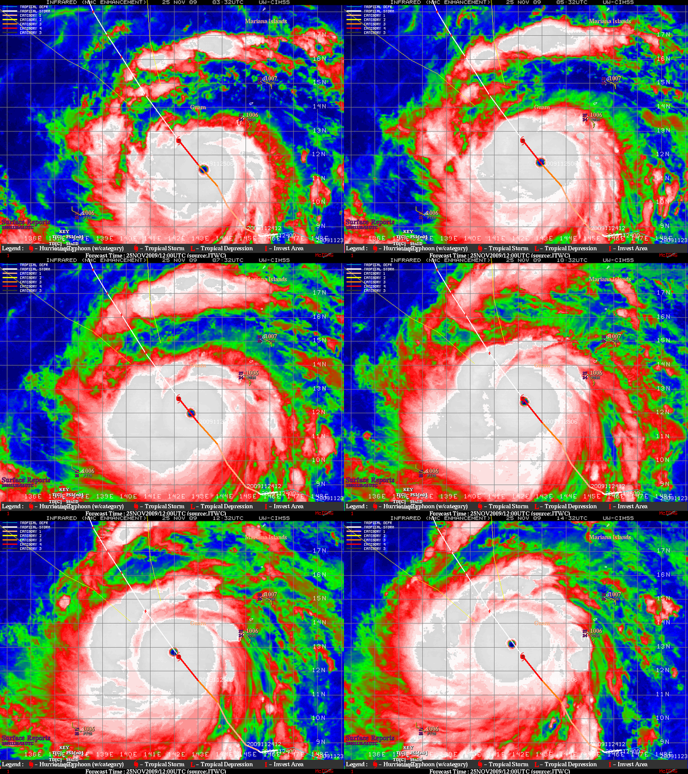
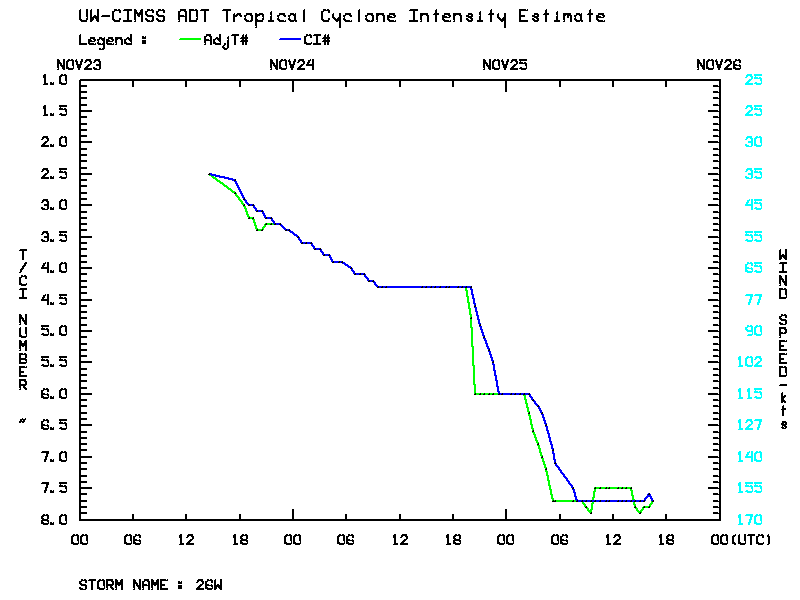
MTSAT-2 IR images from the CIMSS Tropical Cyclones site (above) revealed a well-defined eye associated with Super Typhoon Nida on 25 November 2009. Typhoon Nida underwent a period of very rapid intensification — increasing by 50 knots of speed in 12 hours — as seen on the CIMSS Automated Dvorak Technique plot (below). Low values of deep layer wind shear and warm sea surface temperatures were favorable factors aiding further intensification.
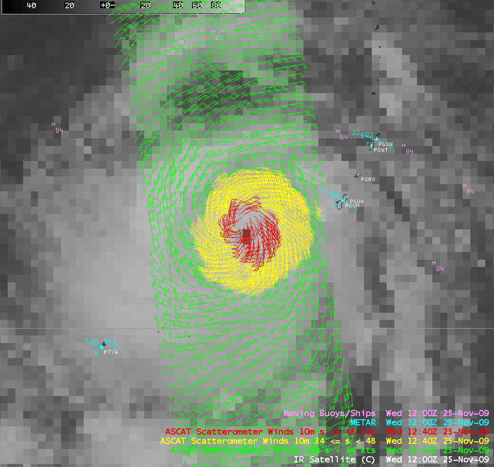
An AWIPS image of the MTSAT-2 IR channel with an overlay of ASCAT scatterometer winds (below) showed a core of strong winds (greater than 48 knots, red wind vectors) surrounding the eye of Nida; the maximum ASCAT wind speed at that time was only 62 knots in the northern quadrant (but ASCAT wind speeds in excess of 34 knots tend to be underestimated).
A MODIS 11.0 µm IR image (below) depicted the very cold cloud tops within the eyewall region, with a minimum value of -87º C (black to gray color enhancement). However, there were some incredibly cold cloud tops of -97º C (violet color enhancement) in one of the outer bands in the northwest quadrant of Nida.
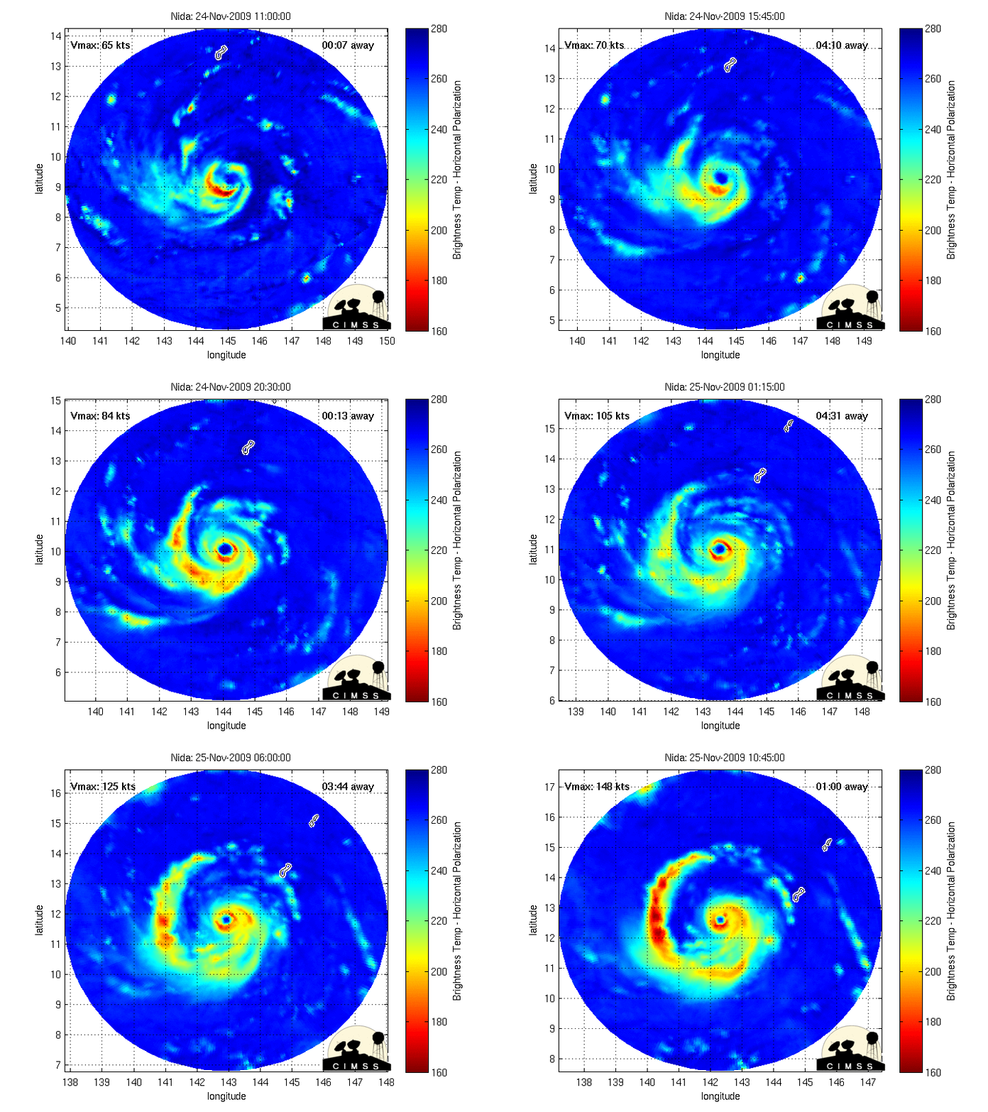
An animation of the MIMIC morphed POES microwave images (below) showed a contracting eyewall as the typhoon was experiencing rapid intensification just southwest of the island of Guam.
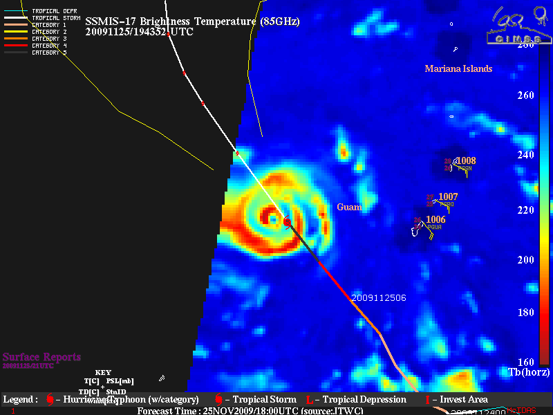
UPDATE: A microwave image from the DMSP SSM/IS instrument (below) revealed a concentric eyewall structure at 19:43 UTC. A couple of hours later, the 21:00 UTC advisory from the Joint Typhoon Warning Center listed the winds of Super Typhoon Nida at 160 knots with gusts to 195 knots!


