Fires continue in the southeast United States
![Terra MODIS (1650 UTC), Aqua MODIS (1829 UTC) and Suomi NPP VIIRS (1913 UTC) true-color images [click to enlarge]](https://cimss.ssec.wisc.edu/satellite-blog/wp-content/uploads/sites/5/2016/11/161114_modis_viirs_truecolor_Southeast_US_fires_anim.gif)
Terra MODIS (1650 UTC), Aqua MODIS (1829 UTC) and Suomi NPP VIIRS (1913 UTC) true-color images [click to enlarge]
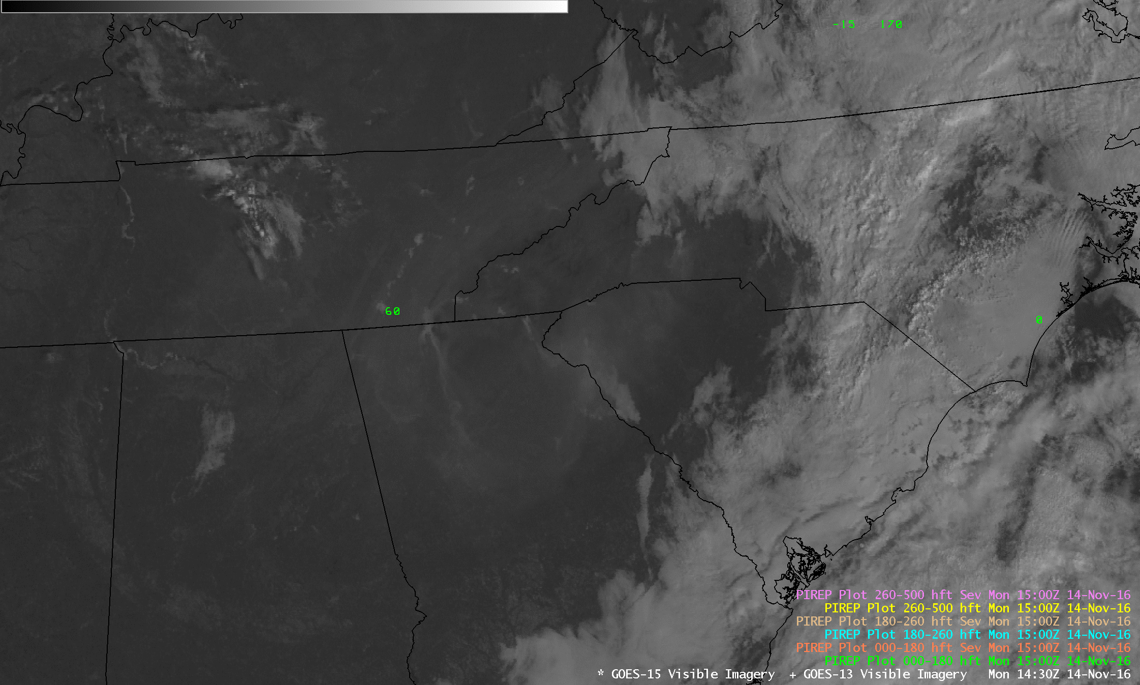
GOES-13 (GOES-East) Visible (0.63 µm) images with plots of surface weather and visibility (below; also available as an MP4 animation) revealed that visibility was restricted to 3 miles or less at one or more sites in all of the aforementioned states. A pair of pilot reports in eastern Tennessee indicated that he top of the smoke layer was at 6000 feet above ground level.
![GOES-13 Visible (0.63 µm) images, with hourly plots of surface weather (yellow) and visibility (statute miles, in cyan) [click to animate]](https://cimss.ssec.wisc.edu/satellite-blog/wp-content/uploads/sites/5/2016/11/161114_goes13_visible_surface_weather_and_visibility_Southeast_US_fires_anim.gif)
GOES-13 Visible (0.63 µm) images, with hourly plots of surface weather (yellow) and visibility (statute miles, in cyan) [click to animate]
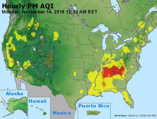
Hourly AIRNow Particulate Matter (PM) Air Quality Index (AQI)
===== 15 November Update =====
![Suomi NPP VIIRS Shortwave Infrared (3.74 um) and Day/Night Band (0.7 um) images, plus METAR surface reports [click to enlarge]](https://cimss.ssec.wisc.edu/satellite-blog/wp-content/uploads/sites/5/2016/11/161115_0735utc_suomi_npp_viirs_shortwaveIR_DayNightBand_Southeast_US_fires_anim.gif)
Suomi NPP VIIRS Shortwave Infrared (3.74 um) and Day/Night Band (0.7 um) images, plus METAR surface reports [click to enlarge]
During the subsequent daytime hours, Terra MODIS and Suomi NPP VIIRS true-color RGB images (below) again revealed the vast coverage of the thick smoke — and VIIRS Aerosol Optical Depth values were quite high over South Carolina. Unhealthy AQI values persisted during much of the day across parts of Tennessee, Georgia and South Carolina.
![Terra MODIS and Suomi NPP VIIRS true-color images, with VIIRS Aerosol Optical Depth (click to enlarge]](https://cimss.ssec.wisc.edu/satellite-blog/wp-content/uploads/sites/5/2016/11/161115_terra_modis_truecolor_suomi_npp_viirs_truecolor_aod_Southeast_US_fires_anim.gif)
Terra MODIS and Suomi NPP VIIRS true-color images, with VIIRS Aerosol Optical Depth (click to enlarge]
A sampling of pilot reports (PIREPS) showed some of the impacts that the smoke was having on aviation (below).
![Suomi NPP VIIRS Visible (0.64 µm) image with a PIREP over South Carolina [click to enlarge]](https://cimss.ssec.wisc.edu/satellite-blog/wp-content/uploads/sites/5/2016/11/161115_1859utc_viirs_visible_pirep_SC.jpg)
Suomi NPP VIIRS Visible (0.64 µm) image with a PIREP over South Carolina [click to enlarge]
![Aqua MODIS Visible (0.65 µm) image with a PIREP over Georgia [click to enlarge]](https://cimss.ssec.wisc.edu/satellite-blog/wp-content/uploads/sites/5/2016/11/161115_1912utc_modis_visible_pirep_GA.jpg)
Aqua MODIS Visible (0.65 µm) image with a PIREP over Georgia [click to enlarge]
![GOES-13 Visible (0.63 µm) image with a PIREP over North Carolina [click to enlarge]](https://cimss.ssec.wisc.edu/satellite-blog/wp-content/uploads/sites/5/2016/11/161115_2115utc_goes13_visible_pirep_NC.jpg)
GOES-13 Visible (0.63 µm) image with a PIREP over North Carolina [click to enlarge]
===== 16 November Update =====
![Terra/Aqua MODIS and Suomi NPP VIIRS true- color images [click to enlarge]](https://cimss.ssec.wisc.edu/satellite-blog/wp-content/uploads/sites/5/2016/11/161116_1637utc_terra_modis_1818utc_aqua_modis_1840utc_suomi_npp_viirs_truecolor_anim.gif)
Terra/Aqua MODIS and Suomi NPP VIIRS true- color images [click to enlarge]