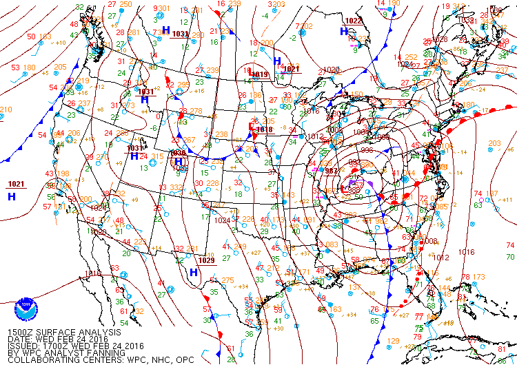
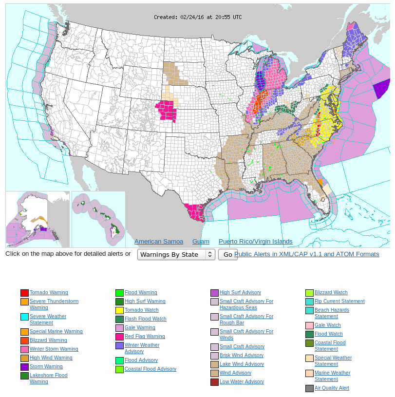
Strong Winter Storm over the upper Ohio River Valley with severe weather in the Mid-Atlantic
![GOES-14 Water Vapor Infrared (6.5 µm) images [click to play mp4 animation]](https://cimss.ssec.wisc.edu/satellite-blog/wp-content/uploads/sites/5/2016/02/1400x1210_GOES14_B3_Storm_24FEB_2016055_180000_0001PANEL.GIF)
GOES-14 Water Vapor Infrared (6.5 µm) images [click to play animation]
A strong winter storm produced a swath of winter weather from Arkansas through lower Michigan on 23-24 February. GOES-14 SRSO-R Imagery was centered on the occluded storm on 24 February, and the water vapor animation, above (available here as an animated gif image), shows strong flow north-northwest from the Mid-Atlantic states into the Upper Midwest, where Winter Storm and Blizzard Warnings were widespread. The end of the animation shows strong convection developing over the Mid-Altantic states where multiple reports of Severe Weather occurred. (A water vapor animation with weather symbols included is available here as an mp4 and here as an animated gif).
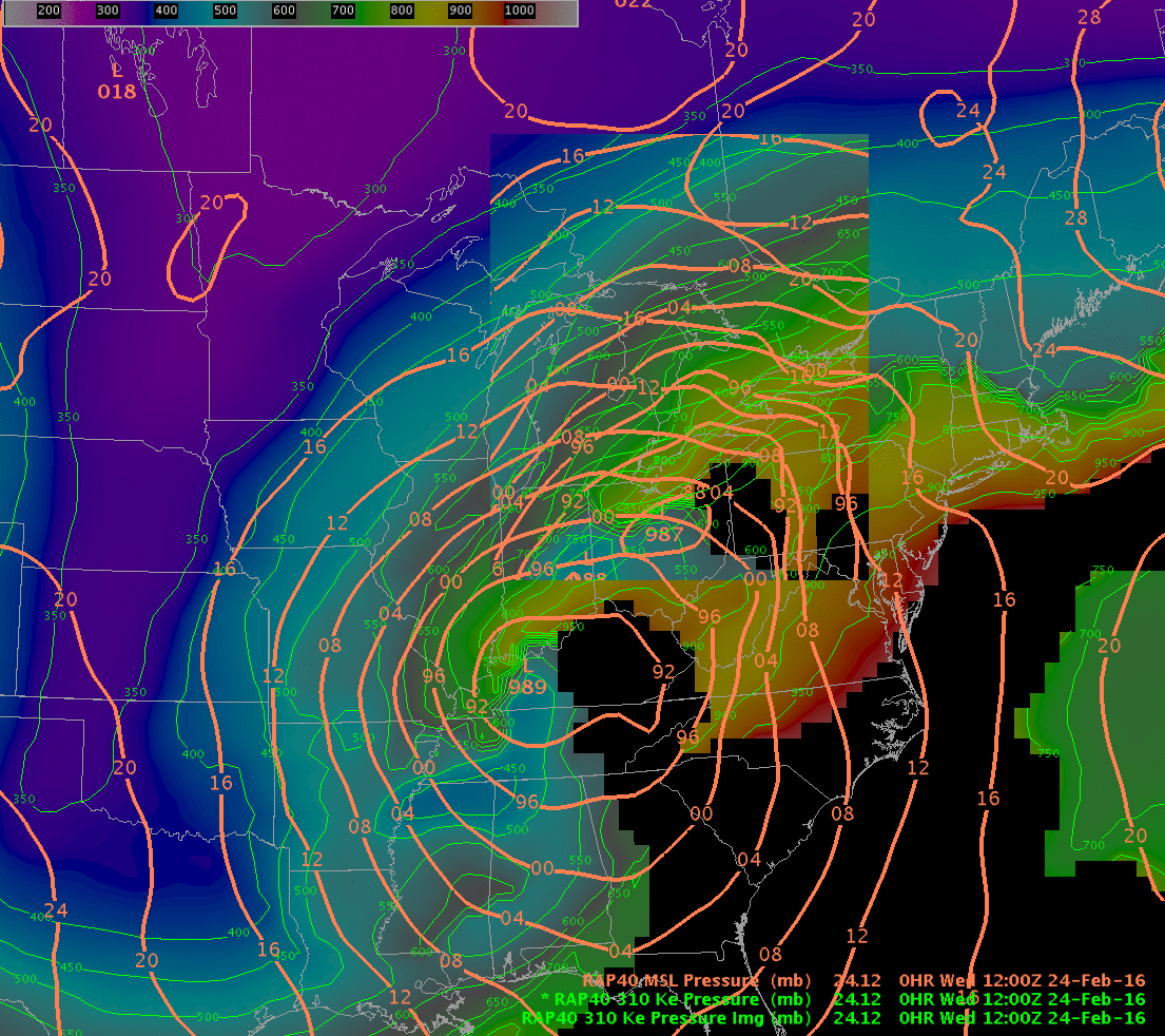
![Rapid Refresh Model Simulation of 310 K Equivalent Potential Temperature Surface [click to play animation]](https://cimss.ssec.wisc.edu/satellite-blog/wp-content/uploads/sites/5/2016/02/RAP40Thetae_310Kanim.gif)
Rapid Refresh Model Simulation of 310 K Equivalent Potential Temperature Surface [click to play animation]
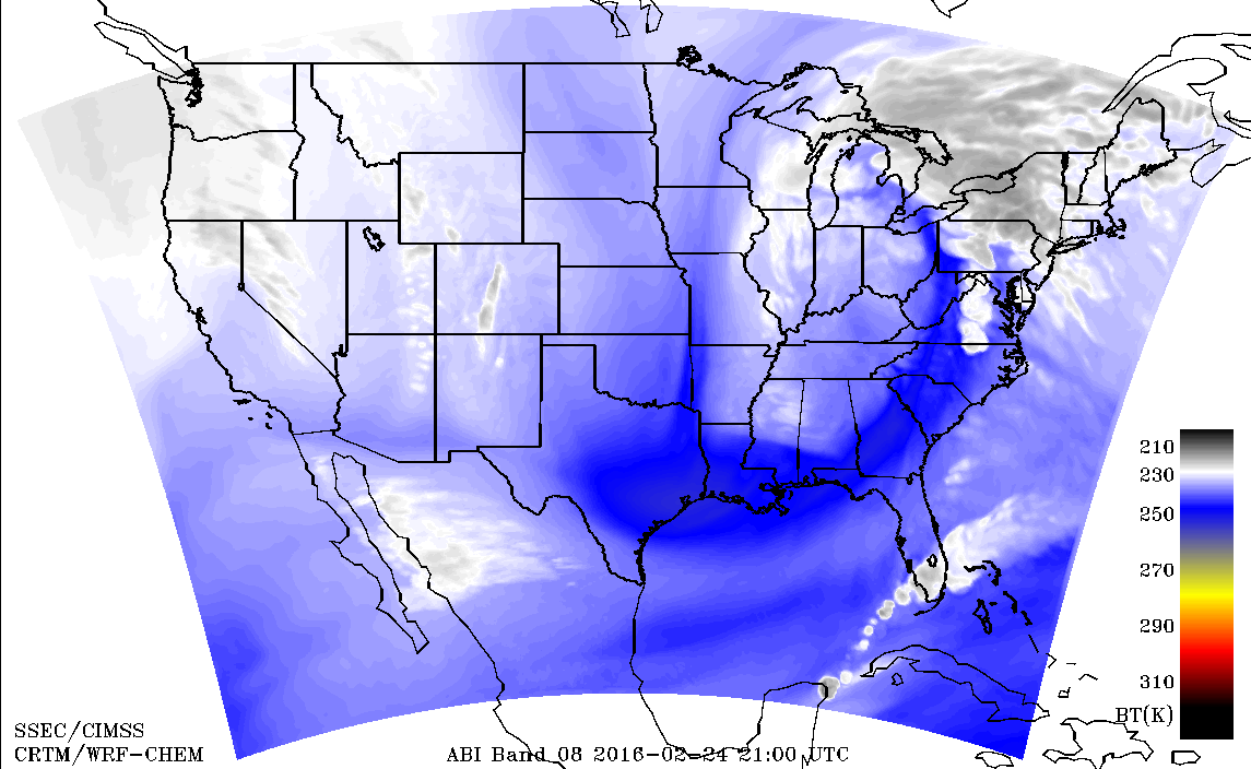
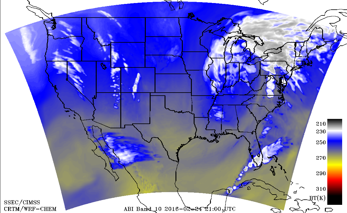
![Simulated ABI 7.3 µm Water Vapor Channel Imagery, hourly from 16-22 UTC on 24 February 2016 [click to play animation]](https://cimss.ssec.wisc.edu/satellite-blog/wp-content/uploads/sites/5/2016/02/SimuABI_10_16_22UTC_24Feb2016anim.gif)
Simulated ABI 7.3 µm Water Vapor Channel Imagery, hourly from 16-22 UTC on 24 February 2016 [click to play animation]
![GOES-13 Visible (0.65 µm) images [click to play animation]](https://cimss.ssec.wisc.edu/satellite-blog/wp-content/uploads/sites/5/2016/02/GOES13VIS_24FEB2016_1415_2145anim.gif)
GOES-13 Visible (0.65 µm) images [click to play animation]
![GOES-14 Visible (0.65 µm) images [click to play animation]](https://cimss.ssec.wisc.edu/satellite-blog/wp-content/uploads/sites/5/2016/02/800x600_GOES14_ALL_B1_VISStorm_24FEB_animated_2016055_200100_182_2016055_225900_182_GRAY.gif)
GOES-14 Visible (0.65 µm) images [click to play animation]
====================================================
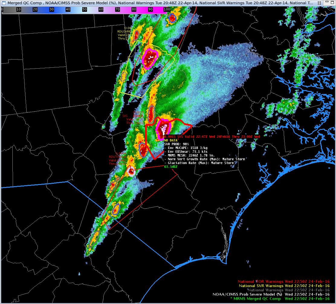
![NOAA/CIMSS ProbSevere output superimposed on MRMS Merged QC Composite Reflectivity, times as Indicated [click to play animation]](https://cimss.ssec.wisc.edu/satellite-blog/wp-content/uploads/sites/5/2016/02/ProbSevere_2134_2250_24Feb2016anim.gif)
NOAA/CIMSS ProbSevere output superimposed on MRMS Merged QC Composite Reflectivity, times as Indicated [click to play animation]