Unusual Double Eyewall structure in Himawari-8 Infrared Imagery of Typhoon Nangka
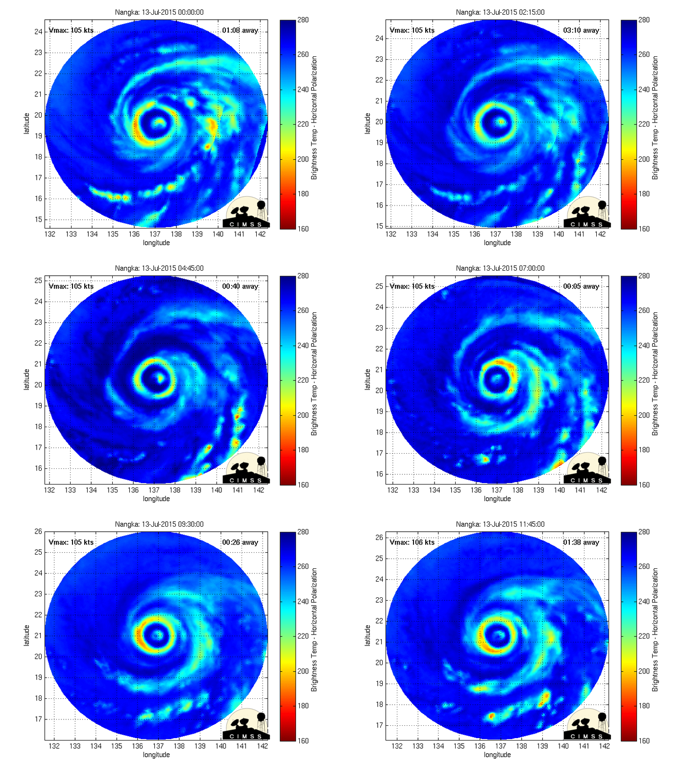
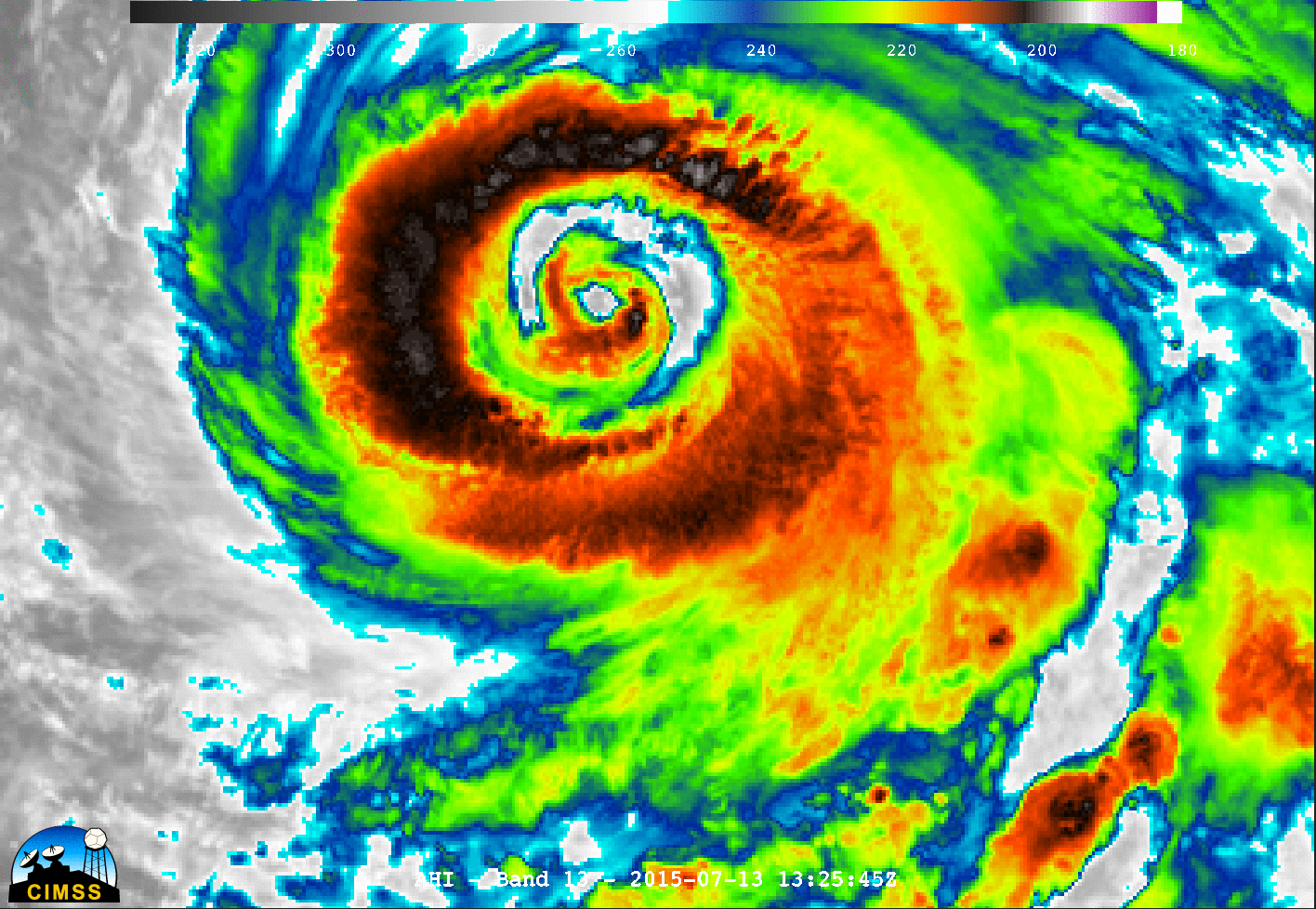
Himawari-8 10.35 µm infrared imagery showed an unusual (for infrared imagery) double-eyewall structure in Typhoon Nangka over the western Pacific Ocean on 13 July 2015. For such a feature to appear in infrared imagery, the secondary circulations of both the inner and outer eyewall need to be intense enough to support the downdraft/cloud-clearing necessary to create the “moats” between them. Microwave imagery of the storm, below, viewed via MIMIC (from this site), also showed the double eyewall structure quite well. This double-eyewall signature typically indicates that a tropical cyclone is experiencing an eyewall replacement cycle (ERC), which signals that a (temporary) decrease in intensity is soon to follow.
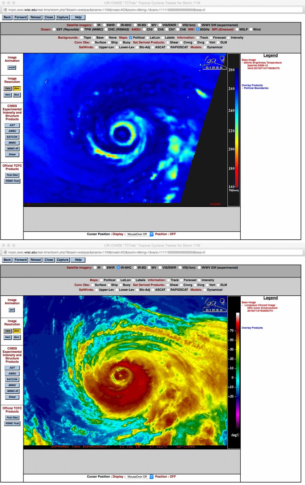
Several hours later, a DMSP SSMIS 85 GHz microwave image at 1756 UTC, below, indicated that the ERC was essentially complete. Subsequently, the Joint Typhoon Warning Center slightly downgraded the intensity of Typhoon Nangka for their 21 UTC advisory. While not as well-defined as in the Himawari-8 imagery, the double-eyewall signature was still evident in the lower-resolution (4-km, vs 2-km) MTSAT-2 IR imagery (animation).
The Himawari-8 Target Sector was centered over Typhoon Nangka during this time; an IR image animation with a 2.5-minute timestep, below (courtesy of William Straka, SSEC), showed the evolution of the double eyewall signature, along with 2 pulses of storm-top gravity waves which propagated radially outward away from the center in the northern semicircle of the typhoon.


