GOES-14 SRSOR: severe thunderstorms over the central Plains
The GOES-14 satellite continued to be in Super Rapid Scan Operations for GOES-R (SRSOR) mode on 11 May 2014, capturing the development of thunderstorms along a dryline that stretched from the Texas Panhandle into far southwestern Kansas. As a southward-moving cold front intersected this dryline, McIDAS images of 1-minute interval GOES-14 0.63 µm visible channel data (above; click image to play animation; also available as an MP4 movie file) showed that the narrow line of storms later developed into large discrete supercell thunderstorms over Kansas, with widespread reports of tornadoes, large hail, and damaging winds (SPC storm reports).
Farther to the northeast, other large supercell thunderstorms could be seen growing over eastern Nebraska along a warm frontal boundary — these storms exhibited numerous signatures of vigorous overshooting tops. Near the end of the animation, winds gusted to 82 mph at Omaha, Nebraska at 00:51 UTC.

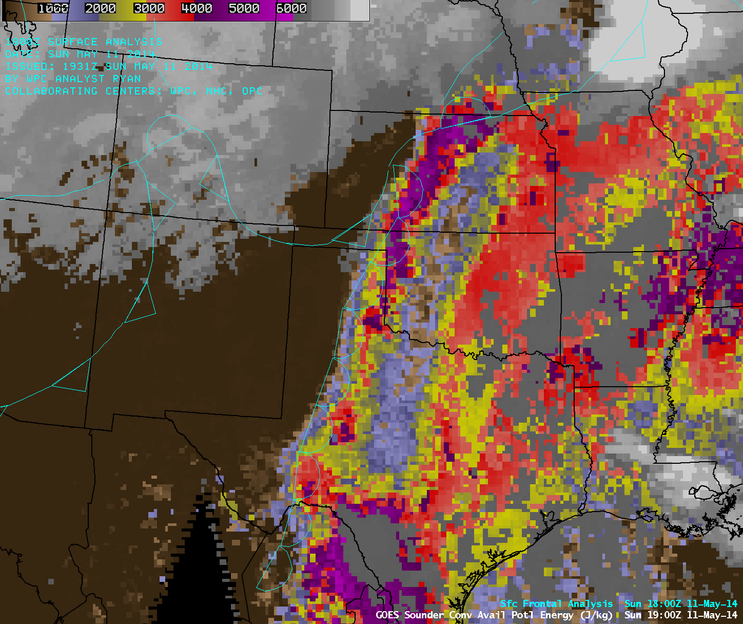
GOES-13 sounder Convective Available Potential Energy (CAPE) derived product imagery (click to play animation)
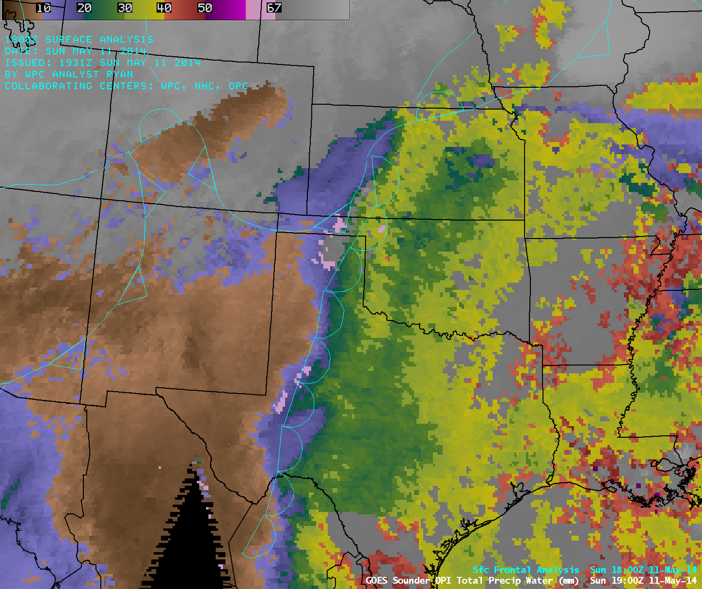
AWIPS images of GOES-13 sounder Convective Available Potential Energy or CAPE (above; click image to play animation) and Total Precipitable Water or TPW (below; click image to play animation) with surface frontal analyses revealed the sharp gradient of both instability and moisture across the dryline — just to the east of the dryline, CAPE values exceeded 4000 J per kg (darker purple color enhancement), while TPW values were generally in the 30-40 mm or 1.2-1.6 inch range (shades of yellow). In addition, GOES-13 sounder Lifted Index values were in the -8 to -10º C range across parts of Kansas into southeastern Nebraska prior to convective initiation.
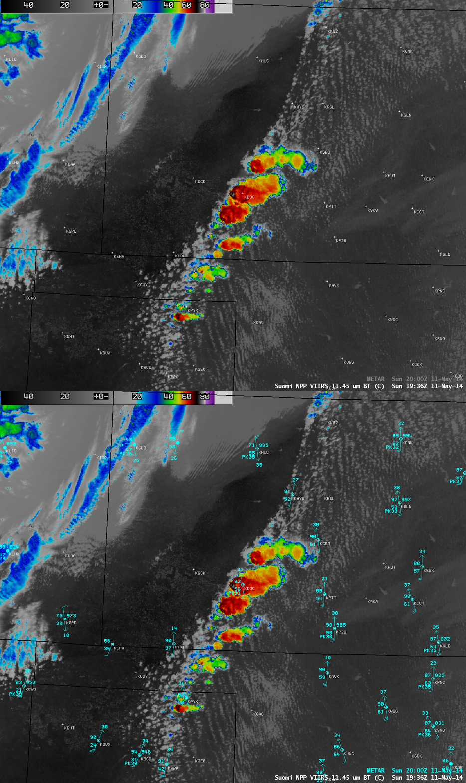
A 19:36 UTC Suomi NPP VIIRS 11.45 µm IR channel image (below) showed the early stages of convective development along the dryline in far southwestern Kansas; the coldest cloud-top IR brightness temperature value at that time was -80º C, just west of Dodge City, Kansas KDDC (corresponding GOES-14 visible image).
A comparison of POES AVHRRR 12.0 µm IR channel images (below) showed the explosive convective growth over Kansas and Nebraska in the 3-hour period between 19:56 UTC and 22:53 UTC.
Additional details on this event can be found on the RAMMB GOES-R Proving Ground Blog.


